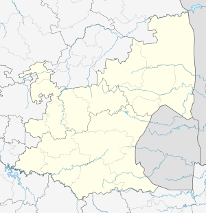
Breyten
| Breyten | |
|---|---|
|
SAR Class 19 no. 1369, plinthed in Breyten | |
 Breyten  Breyten  Breyten
| |
| Coordinates: 26°18′S 29°59′E / 26.300°S 29.983°ECoordinates: 26°18′S 29°59′E / 26.300°S 29.983°E | |
| Country | South Africa |
| Province | Mpumalanga |
| District | Gert Sibande |
| Municipality | Msukaligwa |
| Area[1] | |
| • Total | 4.52 km2 (1.75 sq mi) |
| Population (2011)[1] | |
| • Total | 14,347 |
| • Density | 3,200/km2 (8,200/sq mi) |
| Racial makeup (2011)[1] | |
| • Black African | 94.4% |
| • Coloured | 0.8% |
| • Indian/Asian | 0.6% |
| • White | 4.0% |
| • Other | 0.2% |
| First languages (2011)[1] | |
| • Zulu | 81.4% |
| • Swazi | 4.5% |
| • Afrikaans | 4.3% |
| • English | 2.9% |
| • Other | 6.8% |
| Postal code (street) | 2330 |
| PO box | 2330 |
| Area code | 017 |
Breyten is a small farming town in Mpumalanga, South Africa and is situated at the foot of Klipstapel, the highest point on the watershed between the westward flowing Vaal River system and the eastward flowing Olifants and Komati River systems. The original farm, Bothasrus on which the town is built was given to Lukas Potgieter as compensation for losing a leg during the first Boer War. He later sold the farm to field-cornet Nicolaas Breytenbach, who formed the village in his own name.
Tselentis, Spitzkop and other mines in the area employ the majority of the people of Breyten. There is also a leather factory in Breyten called JCB Leather Works. Breyten has also a college called Xtensive ICT Academy, a private company that deals with information technology training and private classes
The main spoken languages are i-SiSwati, Zulu and Ndebele.
Breyten was once a vibrant and well established rail stop. Passenger and freight trains departed and or connected in Breyten to Johannesburg, Nelspruit, Witbank, Pretoria and other areas of South Africa. Common freight transported was agricultural produce, livestock and most predominantly coal from the local and adjacent coal mines. To this day, coal is still the most transported goods. Due to changing economic times, the town has become depressed with high unemployment.
Breyten is a stopover for tourists en route to various holidays destination in the lowveld and the highveld. There is a Hotel and a few guest houses.
Lake Chrissie is 20 kilometres (12 mi) east of Breyten.
The nearest towns are Ermelo. from the N17, Hendrina from the Middelburg/Witbank N4 and Carolina on the N11 or R36.
References
- 1 2 3 4 "Main Place Breyten". Census 2011.
.svg.png)