Kyustendil Ridge
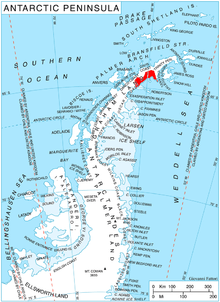
Kyustendil Ridge (Bulgarian: Кюстендилски хребет, ‘Kyustendilski Hrebet’ \kyu-sten-'dil-ski 'hre-bet\) is a partly ice-free ridge rising to 1,700 m (5,600 ft) on Nordenskjöld Coast in Graham Land, Antarctica. It extends 23 km (14 mi) in a west-east direction between Foster Plateau and Weddell Sea, and is 10 km (6.2 mi) wide. The ridge is bounded by Drygalski Glacier to the north, and Rogosh Glacier and Zlokuchene Glacier to the south. It is linked by Mrahori Saddle to Lovech Heights to the south.
The feature is named after the city of Kyustendil in western Bulgaria.
Location
Kyustendil Ridge is centred at 64°49′00″S 61°06′00″W / 64.81667°S 61.10000°WCoordinates: 64°49′00″S 61°06′00″W / 64.81667°S 61.10000°W, mapped by the British in 1978.
References
External links
- Antarctic Digital Database (ADD). Scale 1:250000 topographic map of Antarctica. Scientific Committee on Antarctic Research (SCAR), 1993–2016.
This article includes information from the Antarctic Place-names Commission of Bulgaria which is used with permission.