La Mesa, Cundinamarca
| La Mesa | |||
|---|---|---|---|
|
Church of La Mesa | |||
| |||
| Nickname(s): La Mesa de Juan Díaz | |||
 Localization in Cundinamarca, in Colombia | |||
| Coordinates: 4°37′49″N 74°27′45″W / 4.63028°N 74.46250°WCoordinates: 4°37′49″N 74°27′45″W / 4.63028°N 74.46250°W | |||
| Country | Colombia | ||
| Department |
| ||
| Province | Tequendama Province | ||
| Founded | 12 March 1777 | ||
| Founded by | Ramón Ibáñez, Laureano de Rojas & Joaquín de Lis | ||
| Government | |||
| • Mayor |
Mercedes Rodríguez González (2016-2019) | ||
| Area | |||
| • City | 148 km2 (57 sq mi) | ||
| • Urban | 2.75 km2 (1.06 sq mi) | ||
| Elevation | 1,200 m (3,900 ft) | ||
| Population (2015) | |||
| • City | 31,350 | ||
| • Density | 210/km2 (550/sq mi) | ||
| • Urban | 17,521 | ||
| Time zone | Colombia Standard Time (UTC-5) | ||
| Website | Official website | ||

.svg.png)
.svg.png)
La Mesa (Spanish pronunciation: [la ˈmesa]) is a municipality and town of Colombia in the Tequendama Province of the department of Cundinamarca. The urban centre is located 65 kilometres (40 mi) from Bogotá.[1]
Geography
Its name ("The Table" in Spanish) comes from its geographical position, located on the top of a plateau with an area of 14 km2 (2.5 sq mi) in the centre of the Eastern Ranges of the Colombian Andes.
History
Before the Spanish conquest of the Muisca, the area was inhabited by the Panche who were notable warriors and defeated by an alliance of the Spanish conquistadors and the zipa Sagipa in the Battle of Tocarema on August 20, 1538.
This town is famed for the Botanical Expedition on the New Kingdom of Granada which commenced from there in 1783 led by the biologist José Celestino Mutis. The expedition researched local fauna and flora. It was also an important trade centre during the 19th and part of the 20th century.
Originally La Mesa was located a short distance from its present location and was known as Guayabal. But because of lack of water and too much mud, it was moved in 1777 by order of Pedro Messia de la Zerda, Manuel Guirior and Manuel Antonio Flórez, Spanish Viceroys. The town centre was located the Main Plaza (Downtown), next to the Carbonera river, today an underground river. The original location had 98 houses and nowadays is now known by the name of Dos Caminos, (Two Roads in Spanish).
The population of La Mesa was part of the Independence from Spain movement. From there started the first military campaign of July 20 of 1810 independence revolution. Approximately 50 men and later 300 more went to Bogotá on the day after the declaration of independence to be part of the disposition of the Supreme Board of the independence. La Mesa became a training centre for army soldiers who fought for the independence cause. At La Mesa many heroes were trained, who later were killed defending their ideals by the Spanish troops, some were killed in the middle of the Main Plaza.
Four times, the liberator Simón Bolivar passed by, in the years of 1821, 1826, 1828 and 1830. Antonio Nariño transited in September 1813 commanding the Cundinamarca army of the South campaign of the Independence cause.[1]
Climate
Its position over the East Mountain Range produces an unusual meteorological phenomenon which consists of a dense fog.
This fog is the product of the low and heavy cloud movements, that in the Magdalena Valley, They are caused by warm air forced to rise by the cooler air around Bogotá. On clear days is possible to see the snow-covered Nevado del Tolima and Ruiz volcanoes. The Santa Isabel snow hills, located to the west and the Magdalena River opposite the Central Mountain Range can also be seen.
The year round average temperature is 24 °C (75 °F)
Paleontology
Fossil remains of Eonatator coellensis were found in La Mesa and described in 2013.[2]
Born in La Mesa
- Karen Castiblanco, professional tennis player
Gallery
 Street in front of the stadium and the Francisco Julian Olaya school
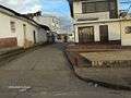 7th street
 7th street
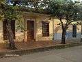 Beautiful house on the 7th street
 Other streets
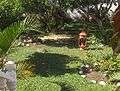 Typical backyard
References
- 1 2 (Spanish) Official website La Mesa
- ↑ Eonatator coellensis in the Paleobiology Database
External links
| Wikimedia Commons has media related to La Mesa, Cundinamarca. |
- (Spanish) Government of Cundinamarca - La Mesa