Tibiritá
| Tibiritá | ||
|---|---|---|
| Municipality and town | ||
| ||
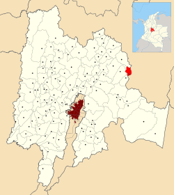 Location of Tibiritá inside Cundinamarca Department of Colombia | ||
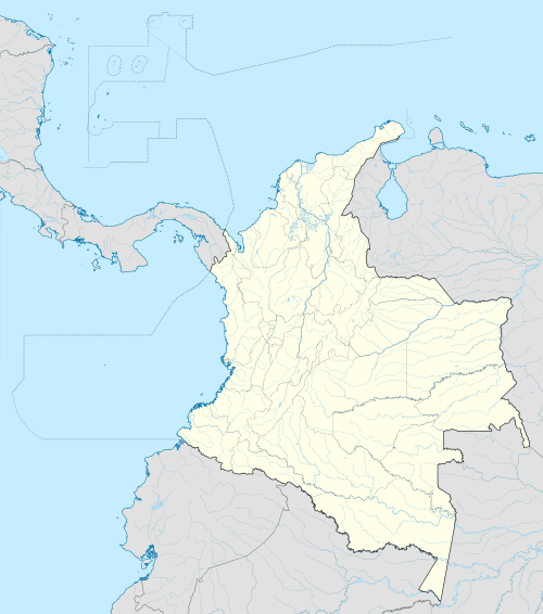 Tibiritá Location in Colombia | ||
| Coordinates: 5°3′4″N 73°30′15″W / 5.05111°N 73.50417°WCoordinates: 5°3′4″N 73°30′15″W / 5.05111°N 73.50417°W | ||
| Country |
| |
| Department |
| |
| Province | Almeidas Province | |
| Founded | 9 July 1593 | |
| Founded by | Miguel de Ibarra | |
| Government | ||
| • Mayor |
María Patricia Vaca Castillo (2016-2019) | |
| Area | ||
| • Municipality and town | 57.2 km2 (22.1 sq mi) | |
| • Urban | 0.26 km2 (0.10 sq mi) | |
| Elevation | 1,980 m (6,500 ft) | |
| Time zone | Colombia Standard Time (UTC-5) | |
| Website | Official website | |

Tibiritá is a municipality and town of Colombia in the department of Cundinamarca. Tibiritá is situated on the Altiplano Cundiboyacense at a distance of 125 kilometres (78 mi) from the capital Bogotá. It borders Villapinzón in the north, in the east La Capilla (Boyacá), in the south Guateque (Boyacá) and in the west Manta, Machetá and Chocontá.[1]
History
The area of Tibiritá was populated by the Muisca before the Spanish conquest of the Muisca in the 1530s. The village was ruled by the zaque of Hunza, present day capital of Boyacá Tunja. Modern Tibiritá was founded on July 9th, 1553 by Miguel de Ibarra.[1] The name Tibiritá is Chibcha.
Economy
Main economical activity of Tibiritá is dairy farming.[1]
Born in Tibiritá
- Rufino Cuervo Barreto, 4 months president of the Republic of New Granada
References
- 1 2 3 (Spanish) Official website Tibiritá - accessed 07-05-2016
5°03′04″N 73°30′15″W / 5.05111°N 73.50417°W