Lac-Bouchette, Quebec
| Lac-Bouchette | |
|---|---|
| Municipality | |
 | |
 | |
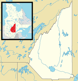 Lac-Bouchette Location in Saguenay–Lac-Saint-Jean Quebec. | |
| Coordinates: 48°15′N 72°11′W / 48.250°N 72.183°WCoordinates: 48°15′N 72°11′W / 48.250°N 72.183°W[1] | |
| Country |
|
| Province |
|
| Region | Saguenay–Lac-Saint-Jean |
| RCM | Le Domaine-du-Roy |
| Settled | 1882 |
| Constituted | September 25, 1971 |
| Government[2] | |
| • Mayor | Benoît Gélinas |
| • Federal riding | Roberval—Lac-Saint-Jean |
| • Prov. riding | Roberval |
| Area[2][3] | |
| • Total | 972.20 km2 (375.37 sq mi) |
| • Land | 908.63 km2 (350.82 sq mi) |
| Population (2011)[3] | |
| • Total | 1,174 |
| • Density | 1.3/km2 (3/sq mi) |
| • Pop (2006–11) |
|
| • Dwellings | 1,120 |
| Time zone | EST (UTC−5) |
| • Summer (DST) | EDT (UTC−4) |
| Postal code(s) | G0W 1V0 |
| Area code(s) | 418 and 581 |
Lac-Bouchette is a municipality in Quebec, Canada. The town is located on the eastern shore of the eponymous Lake Bouchette, along Quebec Route 155 and the Canadian National Railway.
In addition to Lac-Bouchette itself, the municipality also includes the population centres of Lac-des-Commissaires and Lizote.
Municipality and lake were named in honour of Surveyor General of Lower Canada Joseph Bouchette (1774-1841).
Demographics
Population trend:[4]
- Population in 2011: 1174 (2006 to 2011 population change: -10.5 %)
- Population in 2006: 1311
- Population in 2001: 1370
- Population in 1996: 1445
- Population in 1991: 1485
Private dwellings occupied by usual residents: 565 (total dwellings: 1120)
Mother tongue:[5]
- English as first language: 0%
- French as first language: 99.2%
- English and French as first language: 0%
- Other as first language: 0.8%
References
- ↑ Reference number 32983 of the Commission de toponymie du Québec (French)
- 1 2 Ministère des Affaires municipales, des Régions et de l'Occupation du territoire - Répertoire des municipalités: Lac-Bouchette
- 1 2 "Lac-Bouchette census profile". 2011 Census data. Statistics Canada. Retrieved 2010-12-06.
- ↑ Statistics Canada: 1996, 2001, 2006, 2011 census
- ↑ "Lac-Bouchette community profile". 2006 Census data. Statistics Canada. Retrieved 2010-12-06.
 |
Saint-François-de-Sales | Saint-André-du-Lac-Saint-Jean | | |
| Lac-Ashuapmushuan | |
Belle-Rivière | ||
| ||||
| | ||||
| La Tuque | Lac-Moncouche |
| Cities & Towns | |
|---|---|
| Municipalities | |
| Parishes | |
| Villages | |
| Unorganized territories | |
| |
This article is issued from Wikipedia - version of the 1/25/2014. The text is available under the Creative Commons Attribution/Share Alike but additional terms may apply for the media files.