Lake Topozero
| Lake Topozero | |
|---|---|
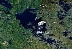 from space | |
| Location | Republic of Karelia |
| Coordinates | 65°40′N 32°00′E / 65.66°N 32°ECoordinates: 65°40′N 32°00′E / 65.66°N 32°E |
| Basin countries | Russia |
| Max. length | 75.3 km (46.8 mi) |
| Max. width | 30.3 km (18.8 mi) |
| Surface area | 986 km2 (381 sq mi) |
| Max. depth | 50 m (160 ft) |
| Islands | 100+ |
Lake Topozero (Russian: Топозеро, Finnish: Tuoppajärvi) is a large freshwater lake in the Republic of Karelia, northwestern part of Russia. It is located at around 65°40′N 32°00′E / 65.66°N 32°E and has an area of 986 km², it's 75.3 km long and 30.3 km wide. Maximum depth is about 50 m. There are more than 100 islands on the lake. Topozero is used for fishery and timber rafting. From Lake Topozero the waters flow north into the Lake Pyaozero and from there to the White Sea through the Kovda River.
This article is issued from Wikipedia - version of the 9/4/2015. The text is available under the Creative Commons Attribution/Share Alike but additional terms may apply for the media files.