Lalibela Airport
| Lalibela Airport | |||||||||||
|---|---|---|---|---|---|---|---|---|---|---|---|
|
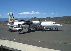
An Ethiopian Airlines Fokker 50 at Lalibela Airport. | |||||||||||
| IATA: LLI – ICAO: HALL | |||||||||||
| Summary | |||||||||||
| Airport type | Public | ||||||||||
| Operator | Ethiopian Airports Enterprise | ||||||||||
| Serves | Lalibela, Ethiopia | ||||||||||
| Elevation AMSL | 1,958 m / 6,424 ft | ||||||||||
| Coordinates | 11°58′26″N 038°59′28″E / 11.97389°N 38.99111°ECoordinates: 11°58′26″N 038°59′28″E / 11.97389°N 38.99111°E | ||||||||||
| Map | |||||||||||
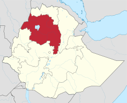 HALL Location in Ethiopia (Amhara region in red) | |||||||||||
| Runways | |||||||||||
| |||||||||||
Lalibela Airport (IATA: LLI, ICAO: HALL) is an airport serving Lalibela,[2] a city in the Amhara Region of Ethiopia. The name of the city and airport may also be transliterated as Lalibella.[3] The airport is located 23 km (14 miles) southwest of the city.[1]
Facilities
The Lalibela Airport resides at an elevation of 1,958 metres (6,424 ft) above mean sea level.[2] It has one runway designated 10/28, with an asphalt surface measuring 2,400 by 53 metres (7,874 ft × 174 ft).[1][2]
The main runway was rebuilt in 1997, at a cost of 53 million birr.[4]
Airlines and destinations
The following airlines offer scheduled passenger service at the Lalibela Airport:
| Airlines | Destinations |
|---|---|
| Ethiopian Airlines[5] | Addis Ababa, Axum, Bahir Dar, Gondar |
Airports and incidents
On 14 March 1975, Douglas C-47 ET-ABR of Ethiopian Airlines was destroyed on the ground during a clash with rebels.[6]
References
- 1 2 3 "Lalibela Airport". Ethiopian Airports Enterprise. Archived from the original on 8 August 2012.
- 1 2 3 4 Airport information for HALL from DAFIF (effective October 2006)
- 1 2 Airport information for LLI at Great Circle Mapper. Source: DAFIF (effective October 2006).
- ↑ "Monthly Situation Report for Ethiopia". UNDP Emergencies Unit for Ethiopia (UNDP-EUE). August 1997. Retrieved 20 January 2009.
- ↑ "Domestic Route Map". Ethiopian Airlines.
- ↑ "ET-ABR Accident description". Aviation Safety Network. Retrieved 20 August 2010.