Lanaken
| Lanaken | |||
|---|---|---|---|
| Municipality | |||
|
Zuid-Willemsvaart at Smeermaas | |||
| |||
 Lanaken Location in Belgium | |||
|
Location of Lanaken in Limburg 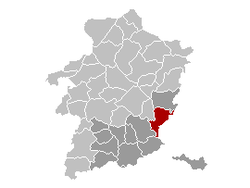 | |||
| Coordinates: 50°53′N 05°39′E / 50.883°N 5.650°ECoordinates: 50°53′N 05°39′E / 50.883°N 5.650°E | |||
| Country | Belgium | ||
| Community | Flemish Community | ||
| Region | Flemish Region | ||
| Province | Limburg | ||
| Arrondissement | Tongeren | ||
| Government | |||
| • Mayor | Guido Willen (Open VLD) | ||
| • Governing party/ies | Open VLD, sp.a | ||
| Area | |||
| • Total | 59.00 km2 (22.78 sq mi) | ||
| Population (1 January 2016)[1] | |||
| • Total | 25,793 | ||
| • Density | 440/km2 (1,100/sq mi) | ||
| Postal codes | 3620-3621 | ||
| Area codes | 089 | ||
| Website | www.lanaken.be | ||


Lanaken is a municipality located in the Belgian province of Limburg. On January 1, 2007, the municipality of Lanaken had a total population of 24,724. Its area is 59.00 km² which gives a population density of 415 inhabitants per km².
Lanaken is located on the Dutch border, bordering Maastricht directly. In the 2006 census, some 20 percent of the inhabitants turned out to have the Dutch nationality. A number of neighbourhoods in Lanaken is characterized by these immigrant's numerous villas and exclusive landhouses.
Lanaken consists of the following villages: Lanaken proper, Rekem, Neerharen, Gellik, Veldwezelt, Smeermaas and Kesselt.
The South African pulp and paper company Sappi operates a large mill on the outskirts of the town. In 2006, four 100 meter high wind turbines were built to provide electricity to the Celanese factory. Later on 8 more have been built.
The reactivation of the railway Maastricht-Lanaken-Hasselt will possibly be started in 2014.
The Veldwezelt-Hezerwater Palaeolithic archaeological site is located in the municipality.
Born in Lanaken
Eric Gerets (1954) Former professional football (soccer) player for Belgium, born in Rekem
Gallery
 Hocht Abbey at Lanaken |
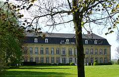
.JPG) d'Aspremont-Lynden castle at Rekem |
References
- ↑ Population per municipality as of 1 January 2016 (XLS; 397 KB)
External links
-
 Media related to Lanaken at Wikimedia Commons
 - Official website - Available only in Dutch
 |
Maasmechelen | Meerssen (NL-LI) | | |
| Zutendaal Bilzen |
|
Maastricht (NL-LI) | ||
| ||||
| | ||||
| Riemst |