Larissos
| Larissos Λαρίσσος | |
|---|---|
 Larissos | |
|
Location within the regional unit 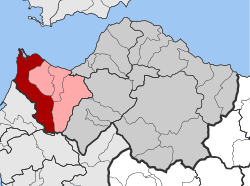 | |
| Coordinates: 38°6′N 21°25′E / 38.100°N 21.417°ECoordinates: 38°6′N 21°25′E / 38.100°N 21.417°E | |
| Country | Greece |
| Administrative region | West Greece |
| Regional unit | Achaea |
| Municipality | West Achaea |
| • Municipal unit | 225.73 km2 (87.15 sq mi) |
| Elevation | 98 m (322 ft) |
| Population (2011)[1] | |
| • Municipal unit | 5,650 |
| • Municipal unit density | 25/km2 (65/sq mi) |
| Time zone | EET (UTC+2) |
| • Summer (DST) | EEST (UTC+3) |
| Postal code | 270 52 |
| Area code(s) | 26930 |
| Vehicle registration | ΑΧ |
| Website |
www |
Larissos (Greek: Λαρίσσος) is a former municipality in Achaea, West Greece, Greece. Since the 2011 local government reform it is part of the municipality West Achaea, of which it is a municipal unit.[2] The municipal unit has an area of 225.729 km2.[3] Its seat of administration was in the village Lappas, part of the community Metochi. The municipal unit was named after the river Larissos, which flows through it. It is the westernmost municipal unit of Achaea, stretching along the Ionian Sea coast and the border with Elis to the southern part of the Movri hills. It is about 32 km southwest of Patras is 37and 50 km north of Pyrgos.
The area is mostly flat, except the Movri hills in the southeast and the lower Mavra Vouna hills in the northwest, near Cape Araxos. Araxos Airport (GPA). The archaeological site of the ancient town of Dyme is located 1 km south.
Subdivisions
The municipal unit Larissos is subdivided into the following communities (constituent villages in brackets):
- Agios Nikolaos Spaton (Agios Nikolaos, Agios Konstantinos)
- Apideonas
- Araxos (Araxos, Kalogria, Paralimni)
- Kagkadi
- Lakkopetra (Lakkopetra, Ioniki Akti, Karnari, Limanaki)
- Mataragka (Mataragka, Kafalaiika)
- Metochi (Metochi, Lappas, Neo Vouprasio, Vouprasio)
- Michoi (Michoi, Kandalos, Tsamaiika, Psefteika)
- Petas
- Riolos (Riolos, Mazaiika)
- Velitses (Ano Velitses, Kato Velitses)
Population history
| Year | Population |
|---|---|
| 1991 | 7,414 |
| 2001 | 8,858 |
| 2011 | 5,650 |
Football (soccer) clubs
- Akadimos Larissou
- Atromitos Lappa, a football (soccer) club currently playing in the Fourth Division
- Ikaros Lakkopetra
- Metochi FC
See also
References
- ↑ "Απογραφή Πληθυσμού - Κατοικιών 2011. ΜΟΝΙΜΟΣ Πληθυσμός" (in Greek). Hellenic Statistical Authority.
- ↑ Kallikratis law Greece Ministry of Interior (Greek)
- ↑ "Population & housing census 2001 (incl. area and average elevation)" (PDF) (in Greek). National Statistical Service of Greece.
External links
 |
Gulf of Patras | Movri | | |
| Ionian Sea | |
Dymi | ||
| ||||
| | ||||
| Vouprasia | Vouprasia | Olenia |