Le Lamentin
| Le Lamentin | ||
|---|---|---|
|
Aimé-Césaire International Airport in Le Lamentin | ||
| ||
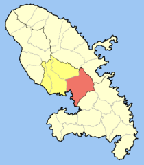 Location of the commune (in red) within Martinique | ||
| Coordinates: 14°36′N 61°00′W / 14.60°N 61.00°WCoordinates: 14°36′N 61°00′W / 14.60°N 61.00°W | ||
| Country | France | |
| Overseas region and department | Martinique | |
| Arrondissement | Fort-de-France | |
| Canton | Le Lamentin 1st Canton through Le Lamentin 3rd Canton | |
| Intercommunality | Centre de la Martinique | |
| Government | ||
| • Mayor (2008–2014) | Pierre-Jean Samot | |
| Area1 | 62.32 km2 (24.06 sq mi) | |
| Population (2013)2 | 40,841 | |
| • Density | 660/km2 (1,700/sq mi) | |
| INSEE/Postal code | 97213 / 97232 | |
| Elevation | −10–363 m (−33–1,191 ft) | |
|
1 French Land Register data, which excludes lakes, ponds, glaciers > 1 km² (0.386 sq mi or 247 acres) and river estuaries. 2 Population without double counting: residents of multiple communes (e.g., students and military personnel) only counted once. | ||

.svg.png)
Le Lamentin is a French town, located in the Outre-Mer department of Martinique, in the French West Indies. With its 62,32 km², it is the town with the largest area of Martinique. Le Lamentin, with near to 40 000 inhabitants, is the second most populated town of Martinique, after Fort-de-France. It is also the first industrial town and the heart of the island's economy.
Location
The town, incorporated in the region of Fort-de-France, is located in the center of the island of Martinique. Originally a giant swamp land and mangrove region, it is now a riparian town, located by the sea in the Bay of Fort-de-France and crossed by the island's longest river (35 km): La Lézarde.
History
This low region of Martinique, with its mangroves and flooded lands, keeps in its name the memory of the pacific manatees, hunted for their meat by the island's first inhabitants. The river La Lézarde was frequently visited by Manatees, now extinct in the Lesser Antilles. The legend says that, once upon a time, a manatee was found dead on the river banks and since then, the town has adopted the name Le Lamentin. Nowadays, a symbolic statue of a manatee rests in front of city hall.
Economy
Le Lamentin is Martinique's economical and industrial center. Specialized mainly in tertiary industries, it is home to five industrial zones and two joint development zones (La Lézarde, La Jambette, Les Mangles Acajou, Les hauts de Californie, Place d'Armes, Lareinty and Manhity), an oil refinery named La Sara and the two largest shopping centers of the island (La Galleria and Place d'Armes). On the administrative aspect, Le Lamentin is home to large groups such as the Caisse Générale de Sécurité Sociale, the Caisse d'Allocations Familiales and the Chambers of Agriculture. It also houses the headquarters of various groups such as Société Martiniquaise des Eaux (the island's water company) and banks such as Crédit Agricole. The town of Le Lamentin is also home to the island's only international airport named after local author and politician Aimé Césaire. The airport had, in 2011, a total passenger Traffic of 1,729,711 people and represents the 12th busiest airport in the Caribbean, just behind Guadeloupe and Curaçao.
Climate
| Climate data for Le Lamentin (1981–2010 averages) | |||||||||||||
|---|---|---|---|---|---|---|---|---|---|---|---|---|---|
| Month | Jan | Feb | Mar | Apr | May | Jun | Jul | Aug | Sep | Oct | Nov | Dec | Year |
| Record high °C (°F) | 32.1 (89.8) |
32.9 (91.2) |
34.4 (93.9) |
34.1 (93.4) |
33.6 (92.5) |
33.7 (92.7) |
32.8 (91) |
34.2 (93.6) |
34.6 (94.3) |
35.4 (95.7) |
33.9 (93) |
32.1 (89.8) |
35.4 (95.7) |
| Average high °C (°F) | 28.8 (83.8) |
28.9 (84) |
29.4 (84.9) |
30.2 (86.4) |
30.7 (87.3) |
30.7 (87.3) |
30.7 (87.3) |
31.2 (88.2) |
31.4 (88.5) |
31.1 (88) |
30.3 (86.5) |
29.5 (85.1) |
30.2 (86.4) |
| Average low °C (°F) | 22.1 (71.8) |
21.8 (71.2) |
22.1 (71.8) |
22.9 (73.2) |
24.0 (75.2) |
24.8 (76.6) |
24.8 (76.6) |
24.4 (75.9) |
23.9 (75) |
23.5 (74.3) |
23.2 (73.8) |
22.6 (72.7) |
23.3 (73.9) |
| Record low °C (°F) | 14.2 (57.6) |
14.6 (58.3) |
16.1 (61) |
16.6 (61.9) |
18.7 (65.7) |
20.2 (68.4) |
20.1 (68.2) |
19.9 (67.8) |
19.0 (66.2) |
19.1 (66.4) |
17.2 (63) |
14.1 (57.4) |
14.1 (57.4) |
| Average precipitation mm (inches) | 120.6 (4.748) |
83.1 (3.272) |
83.2 (3.276) |
105.9 (4.169) |
134.5 (5.295) |
174.5 (6.87) |
206.9 (8.146) |
258.0 (10.157) |
225.4 (8.874) |
279.3 (10.996) |
278.8 (10.976) |
144.7 (5.697) |
2,094.9 (82.476) |
| Average precipitation days | 18.80 | 14.10 | 13.70 | 12.17 | 13.17 | 17.77 | 20.53 | 20.43 | 19.20 | 19.57 | 19.73 | 18.60 | 207.77 |
| Mean monthly sunshine hours | 181.4 | 196.7 | 229.5 | 212.2 | 203.5 | 192.1 | 202.3 | 224.3 | 210.3 | 191.0 | 178.9 | 178.5 | 2,400.6 |
| Source: Meteo France[1][2] | |||||||||||||
Twin towns
See also
References
- ↑ "Données climatiques de la station de Lamentin" (in French). Meteo France. Retrieved January 31, 2016.
- ↑ "Climat Martinique". Meteo France. Retrieved January 31, 2016.
External links
- Official website (in French)
- Martinique Aimé Césaire International Airport (in French)
- Mérimée database - Cultural heritage (French)
| Wikimedia Commons has media related to Le Lamentin. |