Le Perchay
| Le Perchay | ||
|---|---|---|
|
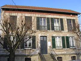
The town hall of Le Perchay | ||
| ||
 Le Perchay | ||
|
Location within Île-de-France region  Le Perchay | ||
| Coordinates: 49°06′42″N 1°56′01″E / 49.1117°N 1.9336°ECoordinates: 49°06′42″N 1°56′01″E / 49.1117°N 1.9336°E | ||
| Country | France | |
| Region | Île-de-France | |
| Department | Val-d'Oise | |
| Arrondissement | Pontoise | |
| Canton | Vigny | |
| Intercommunality | Plateau du Vexin | |
| Government | ||
| • Mayor (2001–2008) | Antoine Casset | |
| Area1 | 5.46 km2 (2.11 sq mi) | |
| Population (2006)2 | 512 | |
| • Density | 94/km2 (240/sq mi) | |
| Time zone | CET (UTC+1) | |
| • Summer (DST) | CEST (UTC+2) | |
| INSEE/Postal code | 95483 / 95450 | |
| Elevation | 52–117 m (171–384 ft) | |
|
1 French Land Register data, which excludes lakes, ponds, glaciers > 1 km² (0.386 sq mi or 247 acres) and river estuaries. 2 Population without double counting: residents of multiple communes (e.g., students and military personnel) only counted once. | ||
.svg.png)
Le Perchay is a commune in the Val-d'Oise department in Île-de-France in northern France.
See also
References
External links
| Wikimedia Commons has media related to Le Perchay. |
- Official website (French)
- Mérimée database - Cultural heritage (French)
- Land use (IAURIF) (English)
This article is issued from Wikipedia - version of the 2/1/2015. The text is available under the Creative Commons Attribution/Share Alike but additional terms may apply for the media files.