Lezíria do Tejo
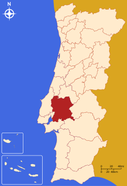
Map showing Lezíria do Tejo subregion.
The Comunidade Intermunicipal da Lezíria do Tejo (English: Tagus Floodplain) is an administrative division in Portugal. It was established as an Associação de Municípios in 1987, converted into a Comunidade Urbana in 2003, and converted into a Comunidade Intermunicipal in November 2008.[1] It is also a NUTS3 subregion of the Alentejo Region. The seat of the intermunicipal community is the city of Santarém. Lezíria do Tejo comprises municipalities of the former districts of Santarém and Lisbon. Lezíria do Tejo belongs to the Lisboa e Vale do Tejo Region for planning. The population in 2011 was 247,453,[2] in an area of 4,275 km².[3]
Municipalities
It is composed of 11 municipalities:[4]
| Municipality | Population (2011)[2] | Area (km²)[3] |
| Almeirim | 23,376 | 222.12 |
| Alpiarça | 7,702 | 95.36 |
| Azambuja | 21,814 | 262.66 |
| Benavente | 29,019 | 521.38 |
| Cartaxo | 24,462 | 158.17 |
| Chamusca | 10,120 | 746.01 |
| Coruche | 19,944 | 1115.72 |
| Golegã[5] | 5,913 | 84.32 |
| Rio Maior | 21,192 | 272.76 |
| Salvaterra de Magos | 22,159 | 243.93 |
| Santarém[6] | 61,752 | 552.54 |
| Total | 247,453 | 4,274.98 |
References
External links
Coordinates: 39°14′N 8°41′W / 39.23°N 8.68°W / 39.23; -8.68