Lima Puluh Kota Regency
| Lima Puluh Kota ٥٠ كوتو | ||
|---|---|---|
| Regency | ||
| ||
 | ||
| Country | Indonesia | |
| Province | West Sumatra | |
| Capital | Sarilamak | |
| Government | ||
| • Regent | dr. Alis Marajo DT. Sorimarajo | |
| Area | ||
| • Total | 3,354.53 km2 (1,295.19 sq mi) | |
| Population (2014) | ||
| • Total | 366,668 | |
| • Density | 110/km2 (280/sq mi) | |
| Time zone | WIB (UTC+7) | |
| Area code(s) | +62 752 | |
| Website | www.limapuluhkota.go.id | |

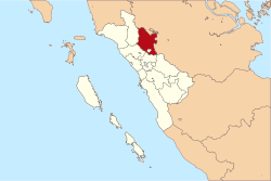
Lima Puluh Kota, or Limapuluh Koto (meaning fifty states or fifty towns in Minangkabau language), is a regency (kabupaten) of West Sumatra, Indonesia. It has an area of 3,354.53 km² and a population of 348,249 at the 2010 Census; the latest official estimate (for January 2014) is 366,668. The capital is Sarilamak.
Administration
Lima Puluh Kota is divided into 13 districts (kecamatan):
- Akabiluru
- Bukik Barisan (meaning row of hills in Minangkabau language)
- Guguak
- Gunuang Omeh (meaning golden mountain in Minangkabau language)
- Harau
- Kapur IX
- Luak
- Lareh Sago Halaban
- Mungka
- Pangkalan Koto Baru
- Payakumbuh (meaning grassy swamp in Minangkabau language)
- Suliki
- Situjuah Limo Nagari
Harau Canyon
Harau Canyon is called as Indonesian Yosemite. There are 4 waterfalls here with height among 50–90 meters. The cliffs are around 80 to 300 meters and (rope) climbing guides are available.[1]
Butterfly Park
Since January 1, 2012 Aka Barayun Butterfly Park near Harau Canyon has opened for free. Butterfly breeding cages are still in preparation and also some animals as mini zoo.[2]
Kelok Sembilan Bridge
Kelok Sembilan Bridge which connecting West Sumatra Province and Riau Province in kilometer 143-148 has been officially opened on October 31, 2013. Kelok Sembilan Bridge is also called as Kelok Sembilan Overpass, because it is over the old Kelok 44. The first stage of the bridge is 720 meters with 4 kilometer access road, the second stage is 250 meters bridge and 1 kilometer access road. The bridge will cut time and the most important is make drivers safer compare with through the beautiful scenery, but dangerous Kelok 44 traditional route which will still operates for tourism purposes.[3] The bridge is predicted can save vehicles and passengers cost up to Rp134.5 billion per year.[4] The bridge cost itself was Rp550 billion ($49.5 million).[5]
References
- ↑ Indonesian Yosemite
- ↑ "Taman Kupu-Kupu Dikembangkan di Lima Puluh Kota". March 31, 2012.
- ↑ "Lebaran Jalur Kelok Sembilan Belum Selesai". July 2, 2012.
- ↑ "Arus Mudik, Jalan Layang Kelok Sembilan Difungsikan Sementara". August 2, 2013.
- ↑ "Islands in focus: Kelok 9 overpass ready to be opened". Retrieved November 1, 2013.
External links
| Wikimedia Commons has media related to Limapuluh Koto Regency. |
- (Indonesian) Official website

Coordinates: 0°14′00″S 100°37′59″E / 0.233333°S 100.633°E