Lindi Region
| Lindi Region Mkoa wa Lindi (Swahili) | |
|---|---|
| Region | |
|
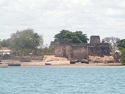
Fort on the banks of Kilwa Kisiwani | |
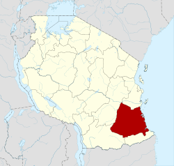 Location in Tanzania | |
| Country | Tanzania |
| Zone | Coastal |
| Capital | Lindi |
| Government | |
| • Regional Commissioner | Hon. Mwantumu Mahiza |
| Area | |
| • Total | 66,040 km2 (25,500 sq mi) |
| Population (2012) | |
| • Total | 864,652 |
| • Density | 13/km2 (34/sq mi) |
| Time zone | EAT (UTC+3) |
| Postcode | 65xxx |
| Area code(s) | 023 |
| Website |
lindi |
Lindi Region is one of Tanzania's 30 administrative regions. The regional capital is the municipality of Lindi. According to the 2012 national census, the region had a population of 864,652, which was lower than the pre-census projection of 960,236.[1]:page 2 For 2002-2012, the region's 0.9 percent average annual population growth rate was the 29th highest in the country.[1]:page 4 It was also the least densely populated region with 13 people per square kilometer.[1]:page 6
The Lindi Region borders on Pwani Region, Morogoro Region, Ruvuma Region, and Mtwara Region. Much of the western part of the Lindi Region is in the Selous Game Reserve.
The regional commissioner of the Lindi Region is Mwantumu Mahiza.[2]
Districts
The region is administratively divided into five districts:
| Districts of Lindi Region | ||||||
|---|---|---|---|---|---|---|
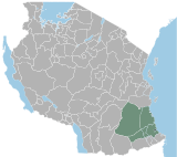
| Map | District | Population (2012) | ||||
 |
Kilwa | 190,744 | ||||
| Lindi | 272,984 | |||||
| Liwale | 91,380 | |||||
| Nachingwea | 178,464 | |||||
| Ruangwa | 131,080 | |||||
| Total | 864,652 | |||||
References
| Mainland | ||
|---|---|---|
| Zanzibar | ||
Coordinates: 9°30′S 38°30′E / 9.500°S 38.500°E