Linga, Muckle Roe
| Norse name | lyngey |
|---|---|
| Meaning of name | "heather island" |
| Location | |
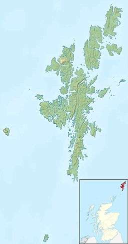 Linga Linga shown within Shetland | |
| OS grid reference | HU354639 |
| Physical geography | |
| Island group | Shetland |
| Area | 70 hectares (0.27 sq mi) |
| Area rank | 171= [1] |
| Highest elevation | 69 metres (226 ft) |
| Administration | |
| Sovereign state | United Kingdom |
| Country | Scotland |
| Council area | Shetland Islands |
| Demographics | |
| Population | 0 |
| Largest settlement | Roesound |
| References | [2][3][4] |
Linga is a small, uninhabited island, 1 km east of Muckle Roe in the Shetland Islands. The island is roughly circular in shape and its highest elevation is 69 metres (226 ft). Its area is 70 hectares (0.27 sq mi).
Geography and geology
Linga is almost completely round, with a central peak. It lies between the mouths of Olna Firth and Gon Firth on the west coast of the Shetland Mainland.[5] To the north is Delting on the Mainland, and the Mainland is also to the south and east. Papa Little is to the south west, and Mavis Grind to the north.
There is a submerged rock, known as Groin Baa to the north.
The island is composed of gneiss and schist, with some quartzite and pelite while its landscape is one of rough grass and heather.[3]
Footnotes
- ↑ Area and population ranks: there are c. 300 islands over 20 ha in extent and 93 permanently inhabited islands were listed in the 2011 census.
- ↑ 2001 UK Census per List of islands of Scotland
- 1 2 Haswell-Smith, Hamish (2004). The Scottish Islands. Edinburgh: Canongate. ISBN 978-1-84195-454-7.
- ↑ Get-a-map (Map). Ordnance Survey.
- ↑ "Overview of Linga". Gazetteer for Scotland. Retrieved 2008-01-06.
Coordinates: 60°21′31″N 1°21′27″W / 60.35861°N 1.35750°W