Linwood, Utah
| Linwood, Utah | |
|---|---|
| Ghost town | |
 Linwood  Linwood Location of Linwood in Utah | |
| Coordinates: 40°59′41″N 109°38′46″W / 40.99472°N 109.64611°WCoordinates: 40°59′41″N 109°38′46″W / 40.99472°N 109.64611°W | |
| Country | United States |
| State | Utah |
| County | Daggett |
| Founded | 1890s |
| Abandoned | 1950s |
| Elevation[1] | 6,043 ft (1,842 m) |
| GNIS feature ID | 1448598[1] |
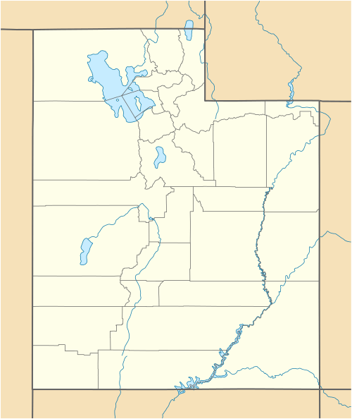
Linwood was a small, unincorporated village in north-central Daggett County, Utah, USA, near the Wyoming state line. The town, located along Henrys Fork of the Green River about 5 miles east of the county seat of Manila, was first settled in the 1890s. The nearby bottomland was used for irrigated agriculture, and sheep ranches operated in the more arid lands to the north.
The town of Linwood was in decline by the 1920s, due to farm consolidation and road improvements, which made larger communities more easily accessible to local residents. In the late 1950s the Linwood area was purchased by the federal government as part of its land acquisition for the Flaming Gorge Reservoir project. The remaining buildings in Linwood were razed or moved, and the townsite is now inundated; no trace of the former community remains.[2]
A United States post office operated at Linwood from 1903 to 1958.[3]
References
- 1 2 U.S. Geological Survey Geographic Names Information System: Linwood
- ↑ Carr, Stephen L. (1974). The Historical Guide to Utah Ghost Towns. Salt Lake City, Utah: Western Epics. p. 64. ISBN 978-0-914740-30-8.
- ↑ http://www.postalhistory.com/postoffices.asp?task=display&state=UT&county=Daggett
Municipalities and communities of Daggett County, Utah, United States | ||
|---|---|---|
| Town | 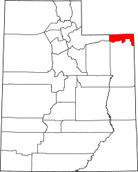 | |
| CDPs | ||
| Ghost towns | ||