Christmas Island Airport
| Christmas Island Airport | |||||||||||
|---|---|---|---|---|---|---|---|---|---|---|---|
 | |||||||||||
| IATA: XCH – ICAO: YPXM | |||||||||||
| Summary | |||||||||||
| Airport type | Public | ||||||||||
| Operator | Toll Remote Logistics | ||||||||||
| Location | Christmas Island | ||||||||||
| Elevation AMSL | 916 ft / 279 m | ||||||||||
| Coordinates | 10°27′02″S 105°41′25″E / 10.45056°S 105.69028°ECoordinates: 10°27′02″S 105°41′25″E / 10.45056°S 105.69028°E | ||||||||||
| Map | |||||||||||
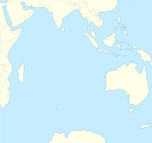 XCH Location on a map of the Indian Ocean | |||||||||||
| Runways | |||||||||||
| |||||||||||
| Statistics (2010/11[1]) | |||||||||||
| |||||||||||
Christmas Island Airport (IATA: XCH, ICAO: YPXM) is an airport located on Christmas Island,[2] a territory of Australia in the Indian Ocean. The island is located 2,600 km (1,600 mi) northwest of the Western Australian city of Perth, 500 km (310 mi) south of the Indonesian capital, Jakarta, and 975 km (606 mi) east-northeast of the Cocos (Keeling) Islands.
Although located on Australian territory, the airport is classified as a Category 2 international airport for all arrivals, including those from Australia. It is owned by the Commonwealth through the Department of Infrastructure and Regional Development and is operated under contract by Toll Remote Logistics.
History
From the late 1940s, when the island was still a British colony administered by Singapore and the Straits Settlements Administration, it was serviced occasionally by Royal Air Force (RAF) Short Sunderland flying boats before the construction of the airport.
Tampa crisis
A brief revival of the "old days" happened in 2001 during the Tampa crisis when the heightened Royal Australian Air Force (RAAF) traffic was complemented by a large number of Department of Immigration and Citizenship (DIAC) and media charters. During this incident, traffic at the airport is said to have been "near-continuous".
Satellite launch facility
After the closure of the casino, the resort was taken over by the Asia Pacific Space Centre, which developed plans for a satellite launch facility on Christmas Island. The company, with solid financial participation from the Australian Government, had planned to start satellite launches in 2004. Technical staff was to include 350-400 Russian rocket scientists and engineers, and componentry was to be flown in on Antonov An-124 and Boeing 747 freighters. To achieve this, the airport would need major extensions, and the Government allocated around A$55m to the task. This included a 600 m (1,969 ft) runway extension, plus additional taxiways, apron space, and other infrastructure, and resulted in a major review of the airport master plan, which is still current today.
Facilities
The airport resides at an elevation of 916 ft (279 m) above sea level. It has one runway designated 18/36 with an asphalt surface measuring 2,103 m × 45 m (6,900 ft × 148 ft).[2]
The airport's location at the top of a hill, with a 2% mid-runway gradient, makes it a challenging landing for pilots.
Airlines and destinations
| Airlines | Destinations |
|---|---|
| Garuda Indonesia | Charter: Jakarta-Soekarno-Hatta |
| Malindo Air | Kuala Lumpur–International[4] |
| Virgin Australia | Cocos (Keeling) Islands, Perth |
Traffic to and from the airport varies greatly. Along with regular flights to the Australian mainland, the airport receives open charter flights from Jakarta with Garuda Indonesia. Historically airlines such as AirAsia Indonesia, Malaysia Airlines and SilkAir travelled to the island. Tourist attractions such as the migration of the Christmas Island red crab and the island's Christmas Island Resort have caused spikes in traffic levels. The construction of an immigration detention centre on the island resulted in a temporary increase in RAAF and DIMIA arrivals..
Statistics
Christmas Island Airport is a quiet airport and served 27,286 revenue passengers during financial year 2010-2011.[1][3]
| Year[1] | Revenue passengers | Aircraft movements |
|---|---|---|
| 2001-02 | 6,515 | 229 |
| 2002-03 | 8,778 | 303 |
| 2003-04 | 7,504 | 249 |
| 2004-05 | 8,125 | 255 |
| 2005-06 | 8,093 | 256 |
| 2006-07 | 8,072 | 262 |
| 2007-08 | 8,594 | 412 |
| 2008-09 | 6,665 | 246 |
| 2009-10 | 14,287 | 395 |
| 2010-11 | 27,286 | 428 |
See also
References
- 1 2 3 Fiscal year 1 July - 30 June
- 1 2 3 YPXM – Christmas Island (PDF). AIP En Route Supplement from Airservices Australia, effective 10 November 2016, Aeronautical Chart
- 1 2 3 "Airport Traffic Data 1985-86 to 2010-11". Bureau of Infrastructure, Transport and Regional Economics (BITRE). May 2012. Archived from the original on 24 March 2012. Retrieved 27 June 2012. Refers to "Regular Public Transport (RPT) operations only"
- ↑ https://twitter.com/Airlineroute/status/805396417078562816?lang=en
External links
| Wikimedia Commons has media related to Christmas Island Airport. |