List of baseball parks in Chicago
West Side Park (II)
South Side Park (III)
Comiskey Park
Wrigley Field
U.S. Cellular Field
This is a list of venues used for professional baseball in Chicago. The information is a synthesis of the information contained in the references listed.
- Dexter Park
- Occupant: Chicago White Stockings, independent professional club (1870)
- Location: Halsted Street (east), between 47th Street (south) and the imaginary line of 42nd Street (north). Adjacent to Union Stock Yards.
- Later: site of International Amphitheatre
- Currently: Uniform services plant
- Ogden Park
- Occupant: Chicago White Stockings (1870) – some games
- Location: East of where Ontario Street (at that time) T-ed into Michigan Avenue.
- Currently: hotels and other businesses
- Union Base-Ball Grounds a.k.a. White Stocking Park
- Occupant: Chicago White Stockings – National Association (1871)
- Location: Randolph (north), Michigan Avenue (west)
- Currently: Northwest corner of Lake Park (now known as Grant Park) – diamond roughly in southwest corner of field
- 23rd Street Grounds
- Occupants: Neutral site for some out-of-town clubs' games (1872–1873); Chicago White Stockings – NA (1874–1875), National League (1876–1877)
- Location: 23rd Street (north, home plate), State Street (east, left field), 22nd Street (now Cermak Road) (south, center field) and what is now Federal Street (west, right field)
- Currently: National Teachers Academy
- Lake Park a.k.a. Lake-Shore Park
- Occupant: Chicago White Stockings – NL (1878–1884)
- Location: Same as 1871 site – diamond roughly in south part of field
- South Side Park (I)
- Occupant: Chicago – Union Association (1884)
- Location: near 39th Street (now Pershing Road) and South Wabash Avenue – a few blocks southeast of the later south side ballparks
- West Side Park (I)
- Occupant: Chicago White Stockings – NL (1885–1891)
- Location: Congress Street (north, left field); Loomis Street (west, home plate); Harrison Street (south, right field); Throop Street (east, center field)
- Currently: Andrew Jackson Language Academy (1340 West Harrison Street)
- South Side Park (II)
- Occupants:
- Chicago Pirates – PL (1890)
- Chicago White Stockings – NL (1891 – mid-1893)
- Notes: Split schedule with West Side Park (I) in 1891 and West Side Park (II) in 1893
- Location: 35th Street and South Wentworth Avenue, just east of eventual Comiskey Park site
- Currently: Parking lot and/or Dan Ryan Expressway
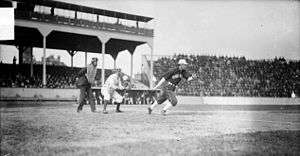
- West Side Park (II)
- Occupant: Chicago White Stockings – NL (mid-1893–1915)
- Location: Polk Street (north, third base); Lincoln (now Wolcott) Street (west, first base); Wood Street (east, left field); flats and Taylor Street (south, right field)
- Currently: University of Illinois College of Medicine
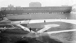
- South Side Park (III) renamed Schorling's Park
- Occupants: Chicago White Sox – American League (1900 – mid-1910); Chicago American Giants – Negro Leagues (1911–1940)
- Location: 39th Street (now called Pershing Road) (south, first base); South Wentworth Avenue (east, right field); South Princeton Avenue (west, third base); line of 38th Street (north, left field) – a couple of blocks south of the Comiskey Park sites
- Currently: Wentworth Gardens housing project
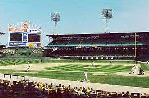
- Comiskey Park a.k.a. White Sox Park (1960s-1970s)
- Occupants: Chicago White Sox – AL (mid-1910 – 1990); Chicago American Giants – Negro Leagues (1941-ca.1950)
- Location: 324 West 35th Street – 35th Street (south, first base); Shields Street (west); 34th Street (north, left field); Wentworth Avenue (east, right field) and Dan Ryan Expressway (farther east)
- Currently: Parking lot
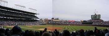
- Wrigley Field previously Weeghman Park, then Cubs Park
- Occupants: Chicago Chi-Feds/Whales – Federal League (1914–1915); Chicago Cubs – NL (1916–present)
- Location: 1060 West Addison Street – Addison Street (south, first base), Clark Street (southwest and west, home plate), Waveland Avenue (north, left field), Sheffield Avenue (east, right field)
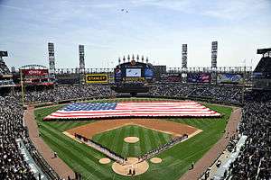
- Guaranteed Rate Field initially "New Comiskey Park", then U.S. Cellular Field
- Occupant: Chicago White Sox – AL (1991–present)
- Location: 333 West 35th Street, across the street to the south from "Old" Comiskey Park – 35th Street (north, third base); site of Shields Street (west, first base); Wentworth Avenue (east, left field) and Dan Ryan Expressway (farther east); parking and Wells Street (south, right field)
See also
References
- Benson, Michael (1989). Ballparks of North America: A Comprehensive Historical Reference to Baseball Grounds, Yards, and Stadiums, 1845 to Present. Jefferson, N.C.: McFarland. ISBN 978-0-89950-367-7. OCLC 19630055.
- Lowry, Philip J. (2006). Green Cathedrals: The Ultimate Celebration of Major League and Negro League Ballparks. New York: Walker Co. ISBN 978-0-8027-1608-8. OCLC 74491309.
- Baseball Memories, by Marc Okkonen, Sterling Publishing, 1992.
This article is issued from Wikipedia - version of the 10/27/2016. The text is available under the Creative Commons Attribution/Share Alike but additional terms may apply for the media files.