List of hills of Gloucestershire
This is a list of hills in Gloucestershire. Many of these hills are important historical, archaeological and nature conservation sites, as well as popular hiking and tourist destinations in the county of Gloucestershire in southern England.
Colour key
| Class | Prominence |
|---|---|
| Marilyns | 150 – 599 m |
| HuMPs | 100 – 149 m |
The table is colour-coded based on the classification or "listing" of the hill. The types that occur in Gloucestershire are Marilyns, HuMPs and Tumps, listings based on topographical prominence. "Prominence" correlates strongly with the subjective significance of a summit. Peaks with low prominences are either subsidiary tops of a higher summit or relatively insignificant independent summits. Peaks with high prominences tend to be the highest points around and likely to have extraordinary views. A Marilyn is a hill with a prominence of at least 150 metres or about 500 feet.[1] A "HuMP" (the acronym comes from "Hundred Metre Prominence) is a hill with a prominence of at least 100 but less than 150 metres.[2] In this table Marilyns are in beige and HuMPs in lilac. A "Tump" is a hill with a prominence of at least 30 but less than 100 metres. The term "sub-Marilyn" or "sub-HuMP" is used, e.g. in the online Database of British and Irish Hills to indicate hills that fall just below the threshold. To qualify for inclusion, hills must either be 250 metres or higher with a prominence of at least 30 metres, below 250 metres with a prominence of at least 90 metres (the threshold for a sub-HuMP) or be in some other way notable. For further information see the Lists of mountains and hills in the British Isles and the individual articles on Marilyns, HuMPs and Tumps.
List of hills
| Hill | Height (m) | Prom. (m) | Grid ref. | Class | Parent | Range/Region | Remarks | Image |
|---|---|---|---|---|---|---|---|---|
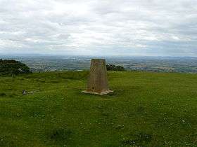
| Cleeve Hill[3] | 330 | 234 | SO996246 | Marilyn, HuMP, Tump, Gloucestershire county top (historical and current) | The Wrekin[2] | Cotswolds | Gloucestershire's county top. Highest point of the Cotswolds. |
 |
| Seven Wells Hill[3] | 319 | 121 | SP115348 | HuMP, Tump | Cleeve Hill | Cotswolds | Gloucestershire's second highest hill. Summit at base of wall on S side. |
|
| Cutsdean Hill[3] | 305 | 26 | SP104302 | Unclassified | Cleeve Hill | Cotswolds | Summit is verge by trig point beside minor road. | 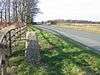 |
| Shenbarrow Hill[3] | 304 | 52 | SP083333 | Tump | Cleeve Hill | Cotswolds | Summit in field; no feature. |  |
| Roel Hill[3] | 301 | 67 | SP054253 | Tump | Cleeve Hill | Cotswolds | Ground at SW corner of covered reservoir compound. |  |
| Birdlip Hill[3] | 299 | 116 | SO924141 | HuMP, Tump | Cleeve Hill | Cotswolds | Fields in Birdlip close to B4070 and reservoir. On a raised mound. |  |
| Wistley Hill[3] | 298 | 74 | SO983180 | Tump | Cleeve Hill | Cotswolds | Open featureless summit. |  |
| May Hill[3] | 296 | 217 | SO695212 | Marilyn, HuMP, Tump | Cleeve Hill | Over Severn | Summit on small knoll in trees, 15m from trig point and 12m S of Jubilee Plaque. Stunning views from top. National Trust property. |
 |
| Leckhampton Hill[3] | 295 | 71 | SO948183 | Tump | Cleeve Hill | Cotswolds | Summit at trig point on hillfort ramparts. Just S of Cheltenham. |
 |
| Ruardean Hill[3] | 290 | 174 | SO634169 | Marilyn, HuMP, Tump | Cleeve Hill | Forest of Dean | Highest point in the Forest of Dean. Summit at site of original flagpole, about 5m from present one. Trig point nearby. |
 |
| Upper Coscombe Hill[3] | 290 | 42 | SP071296 | Tump | Cleeve Hill | Cotswolds | Summit at junction of field boundaries. |  |
| Painswick Beacon[3] | 283 | 76 | SO868120 | Tump | Cleeve Hill | Cotswolds | Summit 25m S of trig point. Hillfort |
|
| High Brotheridge[3] | 282 | 49 | SO891138 | Tump | Cleeve Hill | Cotswolds | Open flat summit surrounded by woodland. Site of ancient settlement. |
|
| Nottingham Hill[3] | 280 | 41 | SO980283 | Tump | Cleeve Hill | Cotswolds | No summit feature | .jpg) |
| Buck Stone[3] | 279 | 145 | SO541122 | Sub-Marilyn, HuMP, Tump | Cleeve Hill | Cotswolds |  | |
| Edge Hills[3] | 279 | 32 | SO662159 | Tump | Ruardean Hill | Forest of Dean | Wooded summit by track NE of compound. Three masts along track. |
 |
| Temple Guiting Hill[3] | 279 | 31 | SP082287 | Tump | Cleeve Hill | Cotswolds | Open summit. |  |
| Wigpool Common[3] | 279 | 46 | SO655192 | Tump | Ruardean Hill | Forest of Dean | Wooded summit and trig point by minor road. |  |
| Langley Hill[3] | 274 | 102 | SP008290 | HuMP, Tump | Cleeve Hill | Cotswolds | Obvious summit within 2m of trig point. |  |
| Crickley Hill[3] | 273 | 41 | SO930164 | Tump | Cleeve Hill | Cotswolds | Embankment at summit. Location of Crickley Hill Country Park (NT) |  |
| Pen Hill[3] | 267 | 30 | SO995124 | Tump | Cleeve Hill | Cotswolds | Trig point on open summit. Nr Colesbourne Park |  |
| Hart Hill[3] | 263 | 84 | SO541031 | Tump | Ruardean Hill | Wye Valley | No summit feature. Gd on N side of Windward Ho. |  |
| Scottsquar Hill[3] | 256 | 72 | SO837085 | Tump | Cleeve Hill | Cotswolds | No summit feature. Very flat summit area. |  |
| Crawley Hill[3] |
251 | 98 | SO789000 | Tump, Sub-HuMP. | Cleeve Hill | Cotswolds | Mound on summit. |  |
| Wyck Beacon[3] | 250 | 96 | SP201207 | Tump, Sub-HuMP. | Cleeve Hill | Cotswolds | Summit on tumulus 7m from trig point. | |
| Oxenton Hill[3] | 223 | 126 | SO973314 | Tump, HuMP. | Cleeve Hill | Cotswolds | No summit feature. 19 m SE of trig point. |  |
| Alderton Hill[3] | 223 | 126 | SP009345 | Tump, HuMP, subMarilyn. | Cleeve Hill | Cotswolds | No summit feature. |  |
| Robins Wood Hill[3] | 198 | 142 | SO840150 | Tump, HuMP, subMarilyn. | Cleeve Hill | Cotswolds | No summit feature. Viewing point above Gloucester. |  |
| Churchdown Hill Chosen Hill, Tinker's Hill[3] |
155 | 102 | SO880188 | Tump, HuMP | Cleeve Hill | Cotswolds | No summit feature. Gd by fence. | .jpg) |
See also
References and footnotes
- ↑ Dawson, Alan (1992). The Relative Hills of Britain. Milnthorpe: Cicerone Press. ISBN 1-85284-068-4.
- 1 2 Jackson, Mark (2009). More Relative Hills of Britain, Marilyn News Centre, UK.
- 1 2 3 4 5 6 7 8 9 10 11 12 13 14 15 16 17 18 19 20 21 22 23 24 25 26 27 28 29 Name, height, prominence, grid and class data from Database of British and Irish Hills at www.hill-bagging.co.uk, retrieved 9-10 Jul 2016. Also parent data unless otherwise stated.
- ↑ OS map sheet no 162, 1:50,000 series.
Lists of hills of Southern England | ||
|---|---|---|
 | ||