List of historic places in Saskatchewan
See also: List of historic places in rural municipalities of Saskatchewan, List of historic places in Battleford, List of historic places in Moose Jaw, List of historic places in Prince Albert, List of historic places in Regina, and List of historic places in Saskatoon
This article is a list of historic places in the province of Saskatchewan entered on the Canadian Register of Historic Places, whether they are federal, provincial, or municipal.
List of historic places
| Name | Address | Municipality | PC | Coordinates | IDF | IDP | IDM | |
Image |
|---|---|---|---|---|---|---|---|---|---|
| Abbey Fire Hall | 322 Cathedral Avenue | Abbey | S0N | 50°44′05″N 108°45′25″W / 50.7348°N 108.757°W | 6152 |  | |||
| Abernethy and District Memorial Hall | Main Street | Abernethy | S0A | 50°44′43″N 103°25′05″W / 50.7453°N 103.418°W | 5516 | | |||
| Barn | Abernethy | 50°43′13″N 103°25′30″W / 50.7202°N 103.425°W | 3341 | 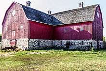 More images | |||||
| Christ Anglican Church | Abernethy | S0A | 50°44′51″N 103°25′12″W / 50.7474°N 103.42°W | 1981 | | ||||
| Motherwell Homestead National Historic Site of Canada | Highway 22 | Abernethy | S0A | 50°43′13″N 103°25′30″W / 50.7202°N 103.425°W | 1209 | 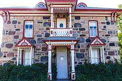 More images | |||
| Stone House Classified Federal Heritage Building | Abernethy | 50°43′13″N 103°25′30″W / 50.7202°N 103.425°W | 9951 | 9960 | | ||||
| Wood/Gibson Residence | Main Street | Alameda | S0C | 49°15′57″N 102°16′48″W / 49.2659°N 102.28°W | 4079 | | |||
| Paroisse St. Jacques D’Albertville | Albertville | S0J | 53°30′35″N 105°33′50″W / 53.5098°N 105.564°W | 11486 | | ||||
| The Alsask School | Alsask | S0L | 51°22′33″N 109°59′31″W / 51.3757°N 109.992°W | 3783 | | ||||
| Aneroid United Church | Aneroid | S0N | 49°43′06″N 107°17′53″W / 49.7182°N 107.298°W | 8360 | | ||||
| Arcola Court House on Souris Avenue | 619 Souris Avenue | Arcola | S0C | 49°38′14″N 102°29′02″W / 49.6373°N 102.484°W | 7504 | | |||
| Arcola Town Hall | 21 Main Street | Arcola | S0C | 49°38′05″N 102°29′31″W / 49.6348°N 102.492°W | 1309 | | |||
| Land Titles Office | 301 Main Street | Arcola | S0C | 49°38′11″N 102°29′31″W / 49.6363°N 102.492°W | 1303 | | |||
| Law Office Building | 114 Main Street | Arcola | S0C | 49°39′06″N 103°21′54″W / 49.6518°N 103.365°W | 1308 | | |||
| Pharmacy Building | 107 Main Street | Arcola | S0C | 49°38′02″N 102°29′31″W / 49.6339°N 102.492°W | 10447 | | |||
| Assiniboia Court House | 700 Centre Street | Assiniboia | S0H | 49°37′42″N 105°59′35″W / 49.6283°N 105.993°W | 3100 | | |||
| Kristiania Lutheran Church | Atwater | S0A | 50°46′42″N 102°13′34″W / 50.7783°N 102.226°W | 6611 | | ||||
| Balgonie United Church | 137 Lewis Street | Balgonie | S0G | 50°29′26″N 104°15′58″W / 50.4905°N 104.266°W | 1983 | | |||
| Batoche National Historic Site of Canada | PO Box 999 | Batoche | S0K | 52°45′14″N 106°06′58″W / 52.7539°N 106.116°W | 14598 |  More images | |||
| Former Jean Caron Sr. House | Batoche | 52°45′14″N 106°07′01″W / 52.754°N 106.117°W | 4684 |  | |||||
| St. Antoine de Padoue Rectory | Batoche National Historic Site of Canada | Batoche | 52°45′14″N 106°07′01″W / 52.754°N 106.117°W | 4762 | | ||||
| Jax Theatre | 141 First Avenue West | Bengough | S0G | 51°11′43″N 105°08′02″W / 51.1954°N 105.134°W | 6626 | | |||
| Gillis Blakley Bethune and District Heritage Museum | 519 East Street | Bethune | S0G | 50°42′44″N 105°12′18″W / 50.7121°N 105.205°W | 5824 | | |||
| Train/Caboose Lot | Railway Ave | Bienfait | S0C | 49°08′40″N 102°48′29″W / 49.1445°N 102.808°W | 2569 | | |||
| Biggar Railway Station (Grand Trunk Pacific) National Historic Site of Canada | Biggar | S0K | 52°04′00″N 108°00′00″W / 52.0667°N 108°W | 13347 | | ||||
| Doukhobor Prayer Home | 318 Main Street | Blaine Lake | 52°49′46″N 106°52′48″W / 52.8295°N 106.88°W | 16285 | | ||||
| St. Andrew's Roman Catholic Church | 102 2nd Avenue E | Blaine Lake | S0K | 52°35′41″N 109°16′52″W / 52.5948°N 109.281°W | 11692 | | |||
| Turtle Lake School | 202 Main Street | Borden | S0K | 52°24′18″N 107°14′24″W / 52.4049°N 107.24°W | 9244 | | |||
| Peachey House | 305 Railway Avenue | Briercrest | S0H | 50°10′03″N 105°15′58″W / 50.1674°N 105.266°W | 13867 | | |||
| Former Canadian Pacific Railway Station | Front St. (at 6th Ave. (Highway 605)) | Broadview | S0G | 50°22′44″N 102°34′44″W / 50.379°N 102.579°W | 4563 |  More images | |||
| Old Fire Hall and Jail | 525 Main Street | Bruno | S0K | 52°15′52″N 105°31′23″W / 52.2644°N 105.523°W | 9258 | | |||
| The Anglican Church Property | 312-1st Street South | Cabri | S0N | 50°37′02″N 108°27′36″W / 50.6172°N 108.46°W | 2372 | | |||
| Holy Trinity Ukrainian Greek Orthodox Church | 710 Main Street | Canora | S0A | 51°37′53″N 102°26′17″W / 51.6315°N 102.438°W | 10756 | | |||
| The Nicholas Lewchuk Property | 316 Barschel Avenue | Canora | S0A | 51°37′50″N 102°25′34″W / 51.6306°N 102.426°W | 6466 | | |||
| Holy Trinity Anglican Church | Pacific Avenue | Carievale | S0C | 49°10′31″N 101°37′37″W / 49.1753°N 101.627°W | 12046 | 16391 | | ||
| Rabeau Building | 616 Railway Avenue | Carnduff | 49°10′29″N 101°47′31″W / 49.1748°N 101.792°W | 1532 | | ||||
| Old Masonic Lodge | 272 Main Street | Central Butte | S0H | 50°47′40″N 106°30′22″W / 50.7944°N 106.506°W | 11918 | | |||
| Bank of Toronto Building | 414 4th Street | Chaplin | S0H | 50°27′46″N 106°39′25″W / 50.4628°N 106.657°W | | ||||
| Conquest United Church | 229 Bounty Street | Conquest | S0L | 51°31′45″N 107°14′38″W / 51.5293°N 107.244°W | 1523 | | |||
| Craik Town Hall | Corner of First Avenue & 3rd Street | Craik | S0G | 51°02′51″N 105°49′16″W / 51.0475°N 105.821°W | 5819 | | |||
| Prairie Pioneer Museum | 541 Parks Road | Craik | S0G | 51°03′06″N 105°49′08″W / 51.0518°N 105.819°W | 5825 | | |||
| Cumberland House Provincial Park | Cumberland House | S0E | 53°57′34″N 102°15′54″W / 53.9595°N 102.265°W | 3111 | | ||||
| St. Lucy's Anglican Church | Gladstone Street | Dilke | S0G | 50°52′01″N 105°15′11″W / 50.8669°N 105.253°W | 5820 | | |||
| Almighty Voice Jailhouse | 5 Anderson Avenue | Duck Lake | S0K | 52°48′59″N 106°13′05″W / 52.8164°N 106.218°W | 1538 | | |||
| Battle of Duck Lake National Historic Site of Canada | Duck Lake | S0K | 52°49′00″N 106°13′59″W / 52.8167°N 106.233°W | 12916 | | ||||
| Victoria School | Victoria Avenue & 3rd Street | Duck Lake | S0K | 52°48′50″N 106°13′44″W / 52.814°N 106.229°W | 9207 |  More images | |||
| 39 / Recreational Hall | Dundurn Military Camp | Dundurn | 51°50′51″N 106°33′43″W / 51.8475°N 106.562°W | 13543 | | ||||
| Dundurn United Church | 300 2nd Street | Dundurn | S0K | 51°48′40″N 106°30′22″W / 51.811°N 106.506°W | 5565 | | |||
| Old Brick School | Third Avenue | Dundurn | S0K | 51°48′39″N 106°30′36″W / 51.8108°N 106.51°W | 5567 | | |||
| Dysart School | 209 Wark Street | Dysart | S0G | 50°56′46″N 104°02′10″W / 50.946°N 104.036°W | 7061 | | |||
| St. George Romanian Orthodox Church | 201 Mckendre Street | Dysart | S0G | 50°56′45″N 104°02′20″W / 50.9457°N 104.039°W | 7070 | | |||
| Royal Canadian Legion Building | 134 Main Street | Earl Grey | S0G | 50°56′11″N 104°42′40″W / 50.9364°N 104.711°W | 7064 | | |||
| Old Town Office | 102 Maple Avenue S | Eastend | S0N | 49°30′43″N 108°49′08″W / 49.512°N 108.819°W | 10813 | | |||
| Stegner Residence | 126 Tamarack Avenue | Eastend | S0N | 49°31′01″N 108°49′34″W / 49.5169°N 108.826°W | 1543 | | |||
| Edam Café | 937 East Railway Avenue | Edam | S0M | 53°11′21″N 108°46′01″W / 53.1891°N 108.767°W | 9250 |  More images | |||
| Elfros Union Church | Elfros Street | Elfros | S0A | 51°44′31″N 103°51′58″W / 51.7419°N 103.866°W | 4965 | | |||
| Elrose Brick School | 12 Fourth Avenue East | Elrose | S0L | 51°11′59″N 108°01′48″W / 51.1996°N 108.03°W | 7845 | | |||
| Ernest Lindner Studio on Fairy Island | Emma Lake | S0J | 53°37′31″N 105°56′35″W / 53.6254°N 105.943°W | 10429 | | ||||
| Ernfold School | Ernfold | S0H | 50°26′57″N 106°53′28″W / 50.4492°N 106.891°W | 5555 | | ||||
| Esterhazy Flour Mill | 517 Smith-Dorrien Street | Esterhazy | S0A | 50°32′27″N 101°50′31″W / 50.5407°N 101.842°W | 14963 | 10427 | 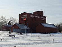 More images | ||
| Estevan Court House | 1016 Fourth Street | Estevan | S4A | 49°08′21″N 102°59′31″W / 49.1393°N 102.992°W | 4087 | | |||
| Wood End North West Mounted Police Post | 118 4th Street | Estevan | S4A | 49°07′54″N 102°58′23″W / 49.1318°N 102.973°W | 2681 | | |||
| Evans House | 946 2nd Street South East | Eston | S0L | 51°08′44″N 108°44′53″W / 51.1456°N 108.748°W | 11914 | | |||
| Battle of Tourond's Coulee / Fish Creek National Historic Site of Canada | Fish Creek | 52°31′47″N 106°08′17″W / 52.5296°N 106.138°W | 14085 |  | |||||
| Fleming Grain Elevator | South Railway Street | Fleming | S0G | 50°04′38″N 101°30′43″W / 50.0772°N 101.512°W | 10432 | | |||
| Fleming Lake of the Woods Grain Elevator National Historic Site of Canada | Fleming | 50°04′31″N 101°30′43″W / 50.0753°N 101.512°W | 12141 | | |||||
| Fleming Memorial Cemetery | Fleming | S0G | 50°04′49″N 101°29′42″W / 50.0803°N 101.495°W | 7001 | | ||||
| Foam Lake Museum | 133 Bray Avenue West | Foam Lake | S0A | 51°38′34″N 103°32′06″W / 51.6429°N 103.535°W | 4972 | | |||
| Grand Trunk Pacific Railway Station | Highway 10 | Fort Qu'Appelle | S0G | 50°45′44″N 103°47′38″W / 50.7622°N 103.794°W | 6906 | 4884 | 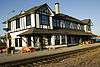 More images | ||
| Hospital, Indian Services | Broad Street | Fort Qu'Appelle | 50°45′57″N 103°47′17″W / 50.7657°N 103.788°W | 4695 | | ||||
| Echo Valley Conference Centre (Fort San) | Fort San | S0G | 50°47′45″N 103°48′43″W / 50.7959°N 103.812°W | 13889 | | ||||
| Public School | Fox Valley | S0N | 50°28′00″N 109°28′59″W / 50.4666°N 109.483°W | 4147 | | ||||
| Frenchman Butte National Historic Site of Canada | Frenchman Butte | 53°37′38″N 109°34′34″W / 53.6273°N 109.576°W | 14509 | | |||||
| Christ Church | 205 Bruce Street | Gainsborough | S0C | 49°10′32″N 101°26′56″W / 49.1756°N 101.449°W | 15881 | 16244 |  | ||
| Girvin Pump House | Girvin | S0G | 51°03′01″N 105°49′08″W / 51.0502°N 105.819°W | 4215 | | ||||
| Glenside United Church | NW corner of Main Street and Saskatchewan Avenue | Glenside | S0H | 51°27′06″N 106°48′11″W / 51.4517°N 106.803°W | 3780 | | |||
| Goodsoil Historical Museum Site | Main Street | Goodsoil | S0M | 54°24′09″N 109°13′41″W / 54.4024°N 109.228°W | 6999 | | |||
| Bishop's Residence | 112 1st Avenue W | Gravelbourg | S0H | 49°52′21″N 106°33′29″W / 49.8724°N 106.558°W | 1541 | | |||
| College Mathieu Pavillion | 1st Avenue East at Magnan Street | Gravelbourg | S0H | 49°52′20″N 106°32′53″W / 49.8722°N 106.548°W | 8402 | | |||
| Elementary School | 240 1st Ave | Gravelbourg | S0H | 49°52′18″N 106°33′36″W / 49.8718°N 106.56°W | 7052 | | |||
| Gaiety Theatre | 412 Main Street | Gravelbourg | S0H | 49°52′35″N 106°33′25″W / 49.8763°N 106.557°W | 7058 |  More images | |||
| Gravelbourg Post Office | 402 Main Street | Gravelbourg | S0H | 49°52′33″N 106°33′25″W / 49.8758°N 106.557°W | 8530 |  More images | |||
| La Cathédrale | 116 1st Avenue W | Gravelbourg | S0H | 49°52′22″N 106°33′25″W / 49.8727°N 106.557°W | 11188 | 2011 |  More images | ||
| Adare House | 711 Wolseley Avenue | Grenfell | S0G | 50°24′39″N 102°55′44″W / 50.4109°N 102.929°W | 4961 | | |||
| I.O.O.F. Lodge | 3372 Rutland Avenue | Gull Lake | S0N | 50°05′41″N 108°28′59″W / 50.0948°N 108.483°W | 14789 | | |||
| St. Andrew's United Church | Halifax St | Halbrite | S0C | 49°29′17″N 103°33′22″W / 49.4881°N 103.556°W | 3390 | | |||
| Harris United Church | 204 2nd Avenue N | Harris | S0L | 51°44′02″N 107°34′48″W / 51.734°N 107.58°W | 4823 | | |||
| Old Harris CNR Water Tower | 208 Railway Avenue N | Harris | S0L | 51°44′06″N 107°34′59″W / 51.7349°N 107.583°W | 1990 | | |||
| St. Brigitte Roman Catholic Church | 215 Main Street | Harris | S0L | 51°44′00″N 107°34′55″W / 51.7334°N 107.582°W | 4822 | | |||
| The Rural Municipality of Harris #316 Office | Main Street | Harris | S0L | 51°44′03″N 107°34′59″W / 51.7343°N 107.583°W | 4820 | | |||
| Hazenmore Community Church | Hazenmore | S0N | 49°41′12″N 107°08′06″W / 49.6868°N 107.135°W | 2244 | | ||||
| Hepburn School | Main Street & Second Street E | Hepburn | S0K | 52°31′31″N 106°43′26″W / 52.5252°N 106.724°W | 11531 | | |||
| Station Grounds of the Canadian Northern Railway Company | Hepburn | S0K | 52°31′32″N 106°43′55″W / 52.5256°N 106.732°W | 11532 | | ||||
| Klassen Museum | 801 Herbert Avenue | Herbert | S0H | 50°25′35″N 107°13′26″W / 50.4264°N 107.224°W | 6143 | | |||
| St. Patrick's Roman Catholic Church | 507 Shaw Street | Herbert | S0H | 50°25′51″N 107°13′08″W / 50.4307°N 107.219°W | 6142 | | |||
| Stone Church on Whyte Street | Whyte Street | Heward | S0G | 49°44′12″N 103°09′00″W / 49.7368°N 103.15°W | 1953 | | |||
| Hudson Bay School | 508 & 510 Churchill Street | Hudson Bay | S0E | 52°51′22″N 102°23′24″W / 52.8562°N 102.39°W | 3788 | | |||
| Canadian National Railways (Canadian Northern Railway) Station | 5th Avenue (at 9th St.) | Humboldt | S0K | 52°11′53″N 105°07′26″W / 52.198°N 105.124°W | 4560 | | |||
| Humboldt Post Office National Historic Site of Canada | Humboldt | S0K | 52°11′46″N 105°07′23″W / 52.196°N 105.123°W | 11807 |  More images | ||||
| Post Office | 602 Main Street | Humboldt | S0K | 52°11′56″N 105°07′19″W / 52.1989°N 105.122°W | 2880 | | |||
| Provincial Court House | 805 8th Avenue | Humboldt | S0K | 52°12′08″N 105°07′23″W / 52.2022°N 105.123°W | 2871 | | |||
| Water Tower | 407 3rd Avenue | Humboldt | S0K | 52°11′44″N 105°07′01″W / 52.1955°N 105.117°W | 2787 | | |||
| Cattle Barn Building 14 | Indian Head | 50°31′59″N 103°39′22″W / 50.5331°N 103.656°W | 18717 | | |||||
| Mainline Ford Building | 427 Grand Avenue | Indian Head | 50°31′58″N 103°40′08″W / 50.5328°N 103.669°W | 1286 | | ||||
| Red Brick Schoolhouse | 306 - 1st Street S.W. | Ituna | S0A | 51°10′04″N 103°29′49″W / 51.1678°N 103.497°W | 6451 | | |||
| Capital Theatre at 566 First Street | 566 1st Street | Kamsack | S0A | 51°33′44″N 101°54′22″W / 51.5621°N 101.906°W | 4782 | | |||
| Former Power Building | Kamsack | S0A | 51°34′12″N 101°55′16″W / 51.5699°N 101.921°W | 4794 | | ||||
| Former Water Tower | Queen Elizabeth Blvd | Kamsack | S0A | 51°33′54″N 101°53′24″W / 51.5649°N 101.89°W | 3406 | | |||
| Royal Canadian Legion - Kamsack Branch No. 24 | 324 2nd Street | Kamsack | S0A | 51°33′42″N 101°53′53″W / 51.5618°N 101.898°W | 5814 | | |||
| All Saints Anglican Church | Pelletier Park | Katepwa Beach | S0G | 50°40′09″N 103°36′04″W / 50.6693°N 103.601°W | 16223 | | |||
| Goddard's Dry Goods | 427 2nd Avenue | Kelliher | S0A | 51°15′49″N 103°44′13″W / 51.2636°N 103.737°W | 4973 | | |||
| Heritage Place | 99 Prouse Street | Kelvington | S0A | 52°09′41″N 103°31′44″W / 52.1614°N 103.529°W | 8405 | | |||
| Kerrobert Court House | 433 Manitoba Avenue | Kerrobert | S0L | 51°55′06″N 109°08′17″W / 51.9182°N 109.138°W | 3587 |  More images | |||
| Kerrobert Water Tower | Kerrobert | S0L | 51°55′04″N 109°08′35″W / 51.9179°N 109.143°W | 4084 |  More images | ||||
| Kipling and District Historical Museum | 201 4th Street | Kipling | S0G | 50°06′10″N 102°38′02″W / 50.1027°N 102.634°W | 4889 | | |||
| R.M. of Kingsley No. 124 Office | 613 Main Street | Kipling | S0G | 50°06′10″N 102°38′02″W / 50.1027°N 102.634°W | 2756 | | |||
| St. Radagonde Roman Catholic Church | 5 4th Avenue W | Lafleche | S0H | 49°42′17″N 106°34′26″W / 49.7048°N 106.574°W | 6458 | | |||
| Larson Mausoleum | Lang | S0G | 49°55′01″N 104°21′43″W / 49.9169°N 104.362°W | 1313 | | ||||
| Lanigan CPR Station | 75 Railway Avenue | Lanigan | S0K | 51°50′43″N 105°02′06″W / 51.8454°N 105.035°W | 8693 | | |||
| Bramshott Spirits | 7 Main Street | Leask | S0J | 53°01′18″N 106°44′28″W / 53.0218°N 106.741°W | 13869 | | |||
| Sacred Heart Parish, Rectory and The Stations of the Cross | Lebret | S0G | 50°45′18″N 103°42′25″W / 50.7549°N 103.707°W | 6393 |  | ||||
| Kellross Heritage Museum | 2nd Avenue | Leross | S0A | 51°17′14″N 103°51′50″W / 51.2873°N 103.864°W | 7501 | | |||
| Leross Heritage Park | 3rd Avenue | Leross | S0A | 51°17′20″N 103°51′54″W / 51.2889°N 103.865°W | 7499 | | |||
| Brinkworth Residence | 1108 Erin Avenue | Lipton | S0G | 50°53′59″N 103°51′00″W / 50.8998°N 103.85°W | 7060 | | |||
| R.M. of Lipton No. 217 Office Building and Site | 226 Main Street | Lipton | 50°54′01″N 103°51′04″W / 50.9004°N 103.851°W | 16280 | | ||||
| The Old Post Office | 5001 50th Street | Lloydminster | S9V | 53°17′02″N 110°00′18″W / 53.2838°N 110.005°W | 3779 |  More images | |||
| Bielby Residence | Loon Lake | S0M | 54°09′01″N 108°55′19″W / 54.1502°N 108.922°W | 1964 | | ||||
| Lucky Lake Museum | Lucky Lake | 50°59′06″N 107°08′02″W / 50.9851°N 107.134°W | 16250 | | |||||
| 165 Elgin Crescent | 165 Elgin Crescent | Lumsden | S0G | 50°38′43″N 104°51′43″W / 50.6453°N 104.862°W | 13866 | | |||
| John Nugent Studio | Lumsden | S0G | 50°39′12″N 104°52′12″W / 50.6534°N 104.87°W | 5859 | | ||||
| Lumsden & District Heritage Museum Property | 30 Qu'Appelle Drive West | Lumsden | 50°38′39″N 104°52′01″W / 50.6441°N 104.867°W | 16226 | | ||||
| Lumsden Plaza | 215 James Street North | Lumsden | S0G | 50°38′48″N 104°52′05″W / 50.6467°N 104.868°W | 1527 | | |||
| Luseland Theatre | 403 Grand Avenue | Luseland | S0L | 52°04′54″N 109°23′38″W / 52.0817°N 109.394°W | 4779 |  More images | |||
| Macrorie School | Macrorie | S0L | 51°19′38″N 107°05′06″W / 51.3272°N 107.085°W | 3778 | | ||||
| Manor Museum in Manor | Newcombe Street | Manor | S0C | 49°36′24″N 102°05′13″W / 49.6066°N 102.087°W | 10358 | | |||
| Cypress Hills Massacre National Historic Site of Canada | Maple Creek | S0N | 49°33′02″N 109°53′20″W / 49.5505°N 109.889°W | 9307 |  More images | ||||
| St. Mary's Anglican Church | 302 Jasper Street | Maple Creek | S0N | 49°54′24″N 109°28′44″W / 49.9066°N 109.479°W | 6621 | | |||
| St. Joseph's Roman Catholic Church | 2nd Avenue | Marcelin | S0J | 52°55′39″N 106°47′38″W / 52.9274°N 106.794°W | 10416 | | |||
| Anderson's Home | 810 Broadway Avenue South | Melfort | S0E | 52°51′02″N 104°36′47″W / 52.8505°N 104.613°W | 16951 | | |||
| McKendry House | 412 MacLeod Avenue W | Melfort | S0E | 52°51′48″N 104°37′05″W / 52.8634°N 104.618°W | 10711 | | |||
| Sask Tel Building at 103 MacLeod East | 103 McLeod Avenue East | Melfort | S0E | 52°51′40″N 104°36′32″W / 52.861°N 104.609°W | 7511 | | |||
| All Saints' Anglican Church | 602 Main Street | Melville | S0A | 50°55′52″N 102°48′14″W / 50.9312°N 102.804°W | 3184 | | |||
| Cornerstone Place | 101 3rd Avenue W | Melville | S0A | 50°55′43″N 102°48′22″W / 50.9287°N 102.806°W | 1413 | | |||
| Intercession of St. Mary Ukrainian Greek Orthodox Church | 398 Prince Edward Street | Melville | S0A | 50°55′41″N 102°47′46″W / 50.9281°N 102.796°W | 1577 | | |||
| Luther Academy | 920 9th Avenue W | Melville | S0A | 50°56′21″N 102°49′12″W / 50.9392°N 102.82°W | 1410 | | |||
| Melville City Hall | 420 Main Street | Melville | S0A | 50°55′47″N 102°48′18″W / 50.9298°N 102.805°W | 3096 | | |||
| Melville Railway Museum | Melville Regional Park | Melville | S0A | 50°55′48″N 102°48′11″W / 50.9299°N 102.803°W | 3949 | | |||
| St. Paul's Lutheran Church | 238 3rd Avenue E | Melville | S0A | 50°39′09″N 102°04′44″W / 50.6524°N 102.079°W | 3186 | | |||
| Ukrainian Greek Catholic Church of St. George | 708 3rd Avenue E | Melville | S0A | 50°55′34″N 102°47′35″W / 50.9261°N 102.793°W | 1412 | | |||
| Municipal Office at Meota | 1st Street Street E | Meota | S0M | 53°02′28″N 108°27′07″W / 53.041°N 108.452°W | 5756 | | |||
| Commissioners Residence | Merryflat | 49°33′52″N 109°53′20″W / 49.5645°N 109.889°W | 4322 | | |||||
| Fort Walsh National Historic Site of Canada | PO Box 278 | Merryflat | S0N | 49°33′52″N 109°53′20″W / 49.5645°N 109.889°W | 6666 |  More images | |||
| Milden Community Museum | Milden | S0L | 51°29′16″N 107°31′23″W / 51.4878°N 107.523°W | 7858 | | ||||
| Saint Aloysius Roman Catholic Church | 303 Main Street | Milestone | S0G | 49°59′42″N 104°30′50″W / 49.995°N 104.514°W | 9228 | | |||
| Doctor Chestnut's Home | 1001 Mark Avenue | Moosomin | S0G | 50°08′31″N 101°40′08″W / 50.142°N 101.669°W | 1965 | | |||
| McCurdy (Truman-Heinz) Building | 702 Windover Avenue | Moosomin | S0G | 50°08′42″N 101°40′16″W / 50.145°N 101.671°W | 4977 | | |||
| McNaughton Building | 608 Carleton Street | Moosomin | S0G | 50°08′41″N 101°39′50″W / 50.1448°N 101.664°W | 1515 | | |||
| Moosomin Communiplex and Bradley Park | Wright Road East | Moosomin | S0G | 50°08′14″N 101°40′19″W / 50.1372°N 101.672°W | 1643 | | |||
| The A.A. Hall | 708 Birtle Street | Moosomin | S0G | 50°08′42″N 101°40′08″W / 50.145°N 101.669°W | 1571 | | |||
| Old Morse School | 410 McKenzie Street | Morse | S0H | 50°25′05″N 107°02′35″W / 50.4181°N 107.043°W | 6459 | | |||
| Ambroz Blacksmith Shop and Residence | 115 Third Street | Mossbank | S0H | 49°56′29″N 105°57′50″W / 49.9413°N 105.964°W | 2873 | | |||
| Mossbank & District Museum Inc., the Schoolhouse, the Blacksmith Shop, & Ambroz House | 115 3rd Street W | Mossbank | S0H | 49°56′29″N 105°57′50″W / 49.9413°N 105.964°W | 13865 | | |||
| Old Mossbank Fire Hall | 112 Third Street West CN | Mossbank | S0H | 49°56′22″N 105°57′50″W / 49.9394°N 105.964°W | 6153 | | |||
| Muenster Hotel | 401 Railway Street | Muenster | S0K | 52°11′24″N 104°59′49″W / 52.1899°N 104.997°W | 9248 | | |||
| Pioneer School | 200 Third Avenue | Naicam | S0K | 52°25′03″N 104°29′49″W / 52.4174°N 104.497°W | 8676 | | |||
| Hickson - Maribelli Lakes Pictographs Protected Area | Northern Saskatchewan Administration District | 56°15′50″N 104°26′35″W / 56.264°N 104.443°W | 16228 | | |||||
| B. A. Garage | 123 Main Street | Ogema | S0C | 49°34′30″N 104°54′54″W / 49.5751°N 104.915°W | 2678 | | |||
| Fire Hall | 111 Main Street | Ogema | 49°34′28″N 104°54′54″W / 49.5745°N 104.915°W | 3603 | 13864 | | |||
| Greer Block | 233 Main Street | Oxbow | S0C | 49°13′45″N 102°10′26″W / 49.2292°N 102.174°W | 1335 | | |||
| Paddockwood Community Hall | First Street North | Paddockwood | S0J | 53°30′35″N 105°33′50″W / 53.5098°N 105.564°W | 11322 | | |||
| Parkside Public School and Grounds | Parkside | S0J | 53°09′51″N 106°32′10″W / 53.1641°N 106.536°W | 11698 | | ||||
| Fort Livingstone National Historic Site of Canada | Pelly | 51°54′18″N 101°59′06″W / 51.905°N 101.985°W | 11599 | | |||||
| Fort Pelly National Historic Site of Canada | Pelly | 51°46′36″N 101°59′56″W / 51.7767°N 101.999°W | 11745 | | |||||
| Fort Pelly-Livingstone Museum | First Avenue South | Pelly | S0A | 51°51′19″N 101°55′41″W / 51.8552°N 101.928°W | 5817 | | |||
| St. Alban's Anglican Church | 302 1st Avenue South | Pelly | S0A | 51°51′21″N 101°55′37″W / 51.8559°N 101.927°W | 4834 | | |||
| Synod of the Diocese of Qu'Appelle | 225 Ontario Street | Pense | S0G | 50°24′58″N 104°59′02″W / 50.416°N 104.984°W | 5507 | | |||
| Roman Catholic Church in the Village of Plenty | 5th Street | Plenty | S0L | 51°46′58″N 108°38′35″W / 51.7828°N 108.643°W | 4132 | | |||
| Notre Dame d’Auvergne Parish Church | 317 2nd Street West | Ponteix | S0N | 49°44′49″N 107°29′35″W / 49.747°N 107.493°W | 8399 | | |||
| Notre Dame d’Auvergne Parish Hall | 232 2nd Street West | Ponteix | S0N | 49°44′45″N 107°29′35″W / 49.7459°N 107.493°W | 8398 | | |||
| Log Cabin, Rural School & St. David's Church | Windsor Avenue & Elm Street | Porcupine Plain | S0E | 52°35′59″N 103°15′40″W / 52.5996°N 103.261°W | 7425 | | |||
| St. John the Evangelist Ukrainian Catholic Church | 30 1st Avenue | Prud'homme | S0K | 52°20′19″N 105°53′38″W / 52.3386°N 105.894°W | 9243 | | |||
| Sts. Donatien and Rogatien Roman Catholic Church | Prud'homme | S0K | 52°20′23″N 105°53′24″W / 52.3397°N 105.89°W | 9241 | | ||||
| Dr. Ernest Luthi Residence | 112 1st Avenue | Punnichy | S0A | 51°22′32″N 104°17′49″W / 51.3756°N 104.297°W | 7500 | | |||
| Brite Spot | 28 Qu'Appelle Street | Qu'Appelle | S0G | 50°33′00″N 103°52′59″W / 50.55°N 103.883°W | 9260 | | |||
| Mountjoy Residence | 35 Walsh Street | Qu'Appelle | S0G | 50°32′19″N 103°52′44″W / 50.5387°N 103.879°W | 4885 | | |||
| Qu'Appelle Royal Bank Building | Qu'Appelle Street | Qu'Appelle | S0G | 50°32′26″N 103°52′41″W / 50.5406°N 103.878°W | 1333 | | |||
| Qu'Appelle Town Hall | 25 9th Avenue | Qu'Appelle | S0G | 50°32′30″N 103°52′34″W / 50.5417°N 103.876°W | 13542 | | |||
| St. Peter's Anglican Church | 37 Walsh Street | Qu'Appelle | S0G | 50°32′19″N 103°52′44″W / 50.5386°N 103.879°W | 4895 | | |||
| St. Michael's Anglican Church | 28 Main Street | Quill Lake | S0A | 52°04′22″N 104°15′22″W / 52.0728°N 104.256°W | 9257 | | |||
| Rose Gill Hospital | 1st Street W & 2nd Avenue | Rabbit Lake | S0M | 53°08′37″N 107°46′05″W / 53.1435°N 107.768°W | 8022 | | |||
| Radville Senior Citizen's Club | 614 Healy Avenue | Radville | S0C | 49°27′41″N 104°17′49″W / 49.4615°N 104.297°W | 5580 | | |||
| Raymore Pioneer Museum | 700 Block 1st Avenue | Raymore | S0A | 51°20′36″N 104°01′48″W / 51.3433°N 104.03°W | 7426 | | |||
| Future Museum Site | 7, 8, 9 Brewer Bay | Regina Beach | S0G | 50°47′12″N 104°58′05″W / 50.7868°N 104.968°W | 3784 | | |||
| Stable, Building 6 | Reno | S0N | 49°33′52″N 109°53′20″W / 49.5645°N 109.889°W | 4323 | | ||||
| St. Rapheal's Roman Catholic Church | Richard | 52°41′41″N 107°42′22″W / 52.6948°N 107.706°W | 16370 | | |||||
| Ridgedale United Church | Corner of First St. West and First Ave. | Ridgedale | S0E | 53°03′22″N 104°09′18″W / 53.0561°N 104.155°W | 4902 | | |||
| Fort Espérance National Historic Site of Canada | Rocanville | S0A | 50°29′36″N 101°35′56″W / 50.4933°N 101.599°W | 11713 |  More images | ||||
| Rocanville and District Museum Site | 220 Qu'Appelle Avenue | Rocanville | S0A | 50°23′09″N 101°42′18″W / 50.3857°N 101.705°W | 6620 | | |||
| Rocanville Farmers Building | 620 Railway Avenue | Rocanville | S0A | 50°22′56″N 101°42′00″W / 50.3821°N 101.7°W | 1563 | | |||
| Symons Metalworkers Company Limited | 602 Railway Avenue | Rocanville | S0A | 50°22′57″N 101°42′07″W / 50.3825°N 101.702°W | 3590 | | |||
| Lions Community Hall | Rosthern | S0K | 52°39′42″N 106°19′55″W / 52.6617°N 106.332°W | 5020 | | ||||
| Rosthern Canadian National Railway Station | 701 Railway Avenue | Rosthern | S0K | 52°39′44″N 106°19′55″W / 52.6623°N 106.332°W | 5676 | | |||
| Rosthern Mennonite Heritage Museum | 7010 5th Street | Rosthern | S0K | 52°39′57″N 106°20′38″W / 52.6658°N 106.344°W | 1576 | | |||
| Saint Paul's Evangelical Church | 808 1st Avenue | Rosthern | S0K | 52°39′43″N 106°20′06″W / 52.662°N 106.335°W | 5019 | | |||
| Seager Wheeler's Maple Grove Farm National Historic Site of Canada | Rosthern | S0K | 52°40′24″N 106°13′05″W / 52.6734°N 106.218°W | 12136 | | ||||
| St. Augustine's Anglican Church | 2004 9th Street | Rosthern | S0K | 52°39′39″N 106°20′10″W / 52.6607°N 106.336°W | 5018 | | |||
| Town Office and Library | 702 Railway Avenue | Rosthern | S0K | 52°39′44″N 106°19′55″W / 52.6623°N 106.332°W | 5017 | | |||
| Little Chief Service Station | 344 20th Street W, Saskatoon | T0J | 52°07′35″N 106°40′30″W / 52.1265°N 106.675°W | 4983 | | ||||
| Grain Elevator 22 | Scott | 52°21′44″N 108°50′38″W / 52.3623°N 108.844°W | 9823 | | |||||
| 1923 portion of Sedley School | 519 Prairie Avenue | Sedley | S0G | 50°05′57″N 104°00′25″W / 50.0992°N 104.007°W | 11920 | | |||
| Grand Hotel | 37 & 41 Third Avenue E | Shaunavon | S0N | 49°38′55″N 108°24′29″W / 49.6485°N 108.408°W | 1387 | | |||
| Shaunavon Courthouse at 401 Third Street West | 401 3rd Street West | Shaunavon | S0N | 49°38′48″N 108°24′47″W / 49.6466°N 108.413°W | 7505 | | |||
| Shaunavon Hotel | 189 Centre Street | Shaunavon | S0N | 49°38′41″N 108°24′25″W / 49.6447°N 108.407°W | 1589 | | |||
| Hazel Ridge School | Shellbrook | S0J | 53°09′42″N 106°21′43″W / 53.1617°N 106.362°W | 6891 | | ||||
| Shellbrook C.N. Railway Station | CNR Right of Way, Main Street South | Shellbrook | S0J | 53°23′41″N 105°32′35″W / 53.3947°N 105.543°W | 11535 | | |||
| Rural Municipality Office | Simpson | S0G | 51°26′56″N 105°26′38″W / 51.4488°N 105.444°W | 4867 | | ||||
| Southey's First Original Classroom School | Southey | S0G | 50°56′24″N 104°29′31″W / 50.9399°N 104.492°W | 1988 | | ||||
| Reynold Rapp Residence | First Street South | Spalding | S0K | 52°19′47″N 104°29′46″W / 52.3296°N 104.496°W | 8675 | | |||
| Spalding United Church | 404 4th Avenue | Spalding | S0K | 52°19′50″N 104°30′04″W / 52.3305°N 104.501°W | 8404 | | |||
| St. Brieux Museum | 300 Barbier Drive | St. Brieux | S0K | 52°38′18″N 104°53′24″W / 52.6383°N 104.89°W | 10149 | | |||
| Assumption of the Blessed Virgin Mary Church | Main Street and Second Avenue | St. Walburg | S0M | 53°37′51″N 109°12′07″W / 53.6309°N 109.202°W | 9218 | | |||
| Holy Trinity Anglican Church, Stanley Mission | Stanley Mission | S0J | 55°25′04″N 104°33′04″W / 55.4179°N 104.551°W | 2917 |  | ||||
| Holy Trinity Church National Historic Site of Canada | Stanley Mission | S0J | 55°25′04″N 104°33′00″W / 55.4179°N 104.55°W | 12545 | More images | ||||
| Golden Age Club Buildings | 126 4th Street | Star City | S0E | 52°51′51″N 104°19′55″W / 52.8642°N 104.332°W | 4891 | | |||
| Stenen United Church | 1st Avenue | Stenen | S0A | 51°53′56″N 102°22′37″W / 51.8988°N 102.377°W | 4791 | | |||
| 315 Main Street | 315 Main Street | Stoughton | S0G | 49°40′48″N 103°01′34″W / 49.6799°N 103.026°W | 1310 | | |||
| Old Municipal Office | Strasbourg | S0G | 51°00′22″N 104°56′28″W / 51.006°N 104.941°W | 6150 | | ||||
| Old School (Teacherage) | 501 Railway Avenue | Strasbourg | 51°04′14″N 104°57′04″W / 51.0705°N 104.951°W | 16279 | | ||||
| Strongfield Cenotaph | Corner of Broadway Street and Saskatchewan Avenue | Strongfield | 51°19′55″N 106°35′49″W / 51.3319°N 106.597°W | 16258 | | ||||
| Battleford Trail Wheel Rut Area | Swift Current | S9H | 50°17′45″N 107°48′25″W / 50.2957°N 107.807°W | 4979 | | ||||
| C.P.R Dam | Swift Current | S9H | 50°16′44″N 107°47′17″W / 50.2788°N 107.788°W | 5558 | | ||||
| Central School | 121 Dufferin Street W | Swift Current | S9H | 50°17′28″N 107°48′07″W / 50.2911°N 107.802°W | 1551 | | |||
| Court House | 121 Lorne Street W | Swift Current | S9H | 50°17′23″N 107°48′07″W / 50.2898°N 107.802°W | 15925 | | |||
| First United Church | 233 3rd Avenue NE | Swift Current | S9H | 50°17′08″N 107°47′46″W / 50.2855°N 107.796°W | 4100 | 9201 | | ||
| Former Lyric Theatre | 227 Central Avenue North | Swift Current | S0N | 49°44′45″N 107°29′35″W / 49.7458°N 107.493°W | 8367 | | |||
| Powley House | 233 Lorne Street E | Swift Current | S9H | 50°17′31″N 107°47′49″W / 50.292°N 107.797°W | 1550 | | |||
| Swift Current Mennonite Heritage Village | Agricultural and Exhibition Association Grounds | Swift Current | S9H | 50°16′44″N 107°46′37″W / 50.2789°N 107.777°W | 5576 | | |||
| Elim Evangelical Lutheran Church | 121 Henry Street | Theodore | S0A | 51°25′30″N 102°55′08″W / 51.4251°N 102.919°W | 4777 | | |||
| Tugaske School | Tugaske | S0H | 50°52′16″N 106°17′28″W / 50.8712°N 106.291°W | 11915 | | ||||
| Unity Heritage Museum | 900 First Street East | Unity | S0K | 52°26′58″N 109°08′49″W / 52.4494°N 109.147°W | 7848 | | |||
| The old Val Marie Elevator | Val Marie | S0N | 49°14′37″N 107°43′41″W / 49.2435°N 107.728°W | 4150 |  More images | ||||
| The Red Brick School | 100 Centre Street | Val Marie | S0N | 49°14′43″N 107°43′55″W / 49.2452°N 107.732°W | 4149 | | |||
| Doukhobors at Veregin National Historic Site of Canada | Veregin | S0A | 51°35′00″N 102°04′59″W / 51.5833°N 102.083°W | 12783 | | ||||
| Veregin Doukhobor Prayer Home | Veregin | S0A | 51°34′56″N 102°05′02″W / 51.5821°N 102.084°W | 3102 |  More images | ||||
| Vibank Convent | 101 2nd Avenue | Vibank | S0G | 50°20′05″N 103°56′49″W / 50.3346°N 103.947°W | 1780 | | |||
| Vonda Rink | 403 Buffer Avenue | Vonda | S0K | 52°19′21″N 106°05′35″W / 52.3225°N 106.093°W | 9237 | | |||
| Wadena Glass & Mye Signs | 93 Main Street N | Wadena | S0A | 51°56′44″N 103°48′07″W / 51.9455°N 103.802°W | 10749 | | |||
| Wadena Town Office | 102 Main Street | Wadena | S0A | 51°56′45″N 103°48′04″W / 51.9459°N 103.801°W | 10754 | | |||
| Wakaw Elementary School | 316 Main Street | Wakaw | S0K | 52°38′58″N 105°44′38″W / 52.6495°N 105.744°W | 10150 | | |||
| Cenotaph Site | Main Street | Waldron | S0A | 50°51′07″N 102°30′50″W / 50.8519°N 102.514°W | 7850 | | |||
| Warman Senior Drop-In Centre | 422 Peters Street | Warman | S0K | 52°19′11″N 106°34′59″W / 52.3198°N 106.583°W | 10748 | | |||
| Anahareo's Cabin, Building 35 | Ajawaan Lake | Waskesiu | 53°54′51″N 106°04′26″W / 53.9143°N 106.074°W | 4497 | | ||||
| Assembly Hall | Lakeview Drive (I-7, B-1) | Waskesiu | 53°55′13″N 106°05′28″W / 53.9202°N 106.091°W | 4472 |  | ||||
| Community Hall | Waskesiu | 55°05′04″N 105°21′07″W / 55.0844°N 105.352°W | 4269 | 13275 | 17961 | | |||
| Golf Clubhouse Building 15 | Prospect Point | Waskesiu | 53°54′51″N 106°04′26″W / 53.9143°N 106.074°W | 4474 |  | ||||
| Grey Owl's Cabin | Twp. 59, Range 4 | Waskesiu | 53°54′51″N 106°04′26″W / 53.9143°N 106.074°W | 4496 | | ||||
| Nature Centre | Lakeview Drive | Waskesiu | 53°54′51″N 106°04′26″W / 53.9143°N 106.074°W | 4473 |  | ||||
| Superintendent's Garage, Building 22 | Prospect Drive | Waskesiu | 53°54′51″N 106°04′26″W / 53.9143°N 106.074°W | 4291 | | ||||
| Superintendent's Residence, Building 22 | Prospect Drive | Waskesiu | S0J | 53°54′51″N 106°04′26″W / 53.9143°N 106.074°W | 4287 | | |||
| W. L. Mackenzie King Cottage, Building 23 | Prospect Drive | Waskesiu | 53°54′51″N 106°04′26″W / 53.9143°N 106.074°W | 4293 | | ||||
| Warden's Headquarters / Visitor Information, Building 1 | Waskesiu Drive | Waskesiu | 53°54′51″N 106°04′26″W / 53.9143°N 106.074°W | 4495 | | ||||
| South Gate Registration, Building 3 | Highway 263 and 240 | Waskesiu Lake | 53°54′51″N 106°04′26″W / 53.9143°N 106.074°W | 4285 | | ||||
| Royal Bank of Canada Building | 104 Main Street | Wawota | S0G | 49°54′18″N 102°01′30″W / 49.9049°N 102.025°W | 3396 | | |||
| Wawota's Original Firehall | Main Street | Wawota | S0G | 49°54′17″N 102°01′30″W / 49.9048°N 102.025°W | 3397 | | |||
| Weekes Public School at Weekes | Weekes | S0E | 52°34′12″N 102°52′19″W / 52.5699°N 102.872°W | 6616 | | ||||
| Harper's Store | Welwyn | S0A | 50°19′33″N 101°30′58″W / 50.3259°N 101.516°W | 1562 | | ||||
| Moffet Residence | 614 4th Street SE | Weyburn | S4H | 49°39′20″N 103°51′04″W / 49.6556°N 103.851°W | 2702 | | |||
| Powell Residence | 815 4th Street SE | Weyburn | S4H | 49°39′04″N 103°51′07″W / 49.6512°N 103.852°W | 1591 | | |||
| Signal Hill Arts Centre | 424 10th Avenue S | Weyburn | 49°38′58″N 103°51′04″W / 49.6494°N 103.851°W | 16257 | | ||||
| Soo Line Historical Museum | #39 Highway SE | Weyburn | S4H | 49°39′31″N 103°51′04″W / 49.6586°N 103.851°W | 1592 | | |||
| T.C. Douglas Calvary Centre | 10th Avenue S | Weyburn | S4H | 49°39′01″N 103°51′40″W / 49.6502°N 103.861°W | 2370 | | |||
| Weyburn Court House | 301 Prairie Avenue NE | Weyburn | S4H | 49°39′59″N 103°51′07″W / 49.6664°N 103.852°W | 3101 | | |||
| Weyburn Security Bank | 76 - 3rd Street | Weyburn | S4H | 49°39′42″N 103°51′14″W / 49.6616°N 103.854°W | 4070 | | |||
| Knox Presbyterian Church | 611 Railway Street North | Whitewood | S0G | 50°19′57″N 102°16′01″W / 50.3325°N 102.267°W | 3491 | 9278 | | ||
| Old Bank of Montreal | 707 Lalonde Street | Whitewood | S0G | 50°19′48″N 102°16′01″W / 50.3299°N 102.267°W | 14801 | | |||
| R.M. of Willowdale No. 153 Municipal Office | 711 Lalonde Street | Whitewood | S0G | 50°19′47″N 102°16′01″W / 50.3298°N 102.267°W | 2500 |  More images | |||
| Rex Theatre | 714 Lalonde Street | Whitewood | S0G | 50°19′47″N 102°16′01″W / 50.3298°N 102.267°W | 9230 | | |||
| Ramsey Building | 208 1st Street E | Wilkie | S0K | 52°24′39″N 108°33′04″W / 52.4109°N 108.551°W | 11691 | | |||
| Catholic Rectory | 5 Ave C | Willow Bunch | S0H | 49°23′25″N 105°38′10″W / 49.3904°N 105.636°W | 3781 | | |||
| The Convent | Willow Bunch | S0H | 49°23′23″N 105°38′06″W / 49.3896°N 105.635°W | 3782 | | ||||
| Windthorst School (1926 portion) | 326 Moltke Avenue | Windthorst | S0G | 50°06′38″N 102°50′02″W / 50.1105°N 102.834°W | 1802 | | |||
| Banbury Residence | 104 Front Street | Wolseley | S0G | 50°25′33″N 103°16′48″W / 50.4258°N 103.28°W | 1570 | | |||
| Boarding House and Beaver Lumber Office | 101 Blanchard Street North | Wolseley | S0G | 50°25′31″N 103°16′05″W / 50.4253°N 103.268°W | 6614 | | |||
| Magee House | 104 Richmond Street | Wolseley | S0G | 50°25′26″N 103°16′16″W / 50.424°N 103.271°W | 1569 | | |||
| Town Hall/Opera House | 510 Varennes Street | Wolseley | S0G | 50°25′27″N 103°16′16″W / 50.4241°N 103.271°W | 2789 | 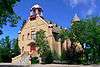 | |||
| Wolseley Court House | SE corner of Ouimet and Richmond Street | Wolseley | S0G | 50°25′35″N 103°16′12″W / 50.4264°N 103.27°W | 2778 | | |||
| Wolseley Town Hall/Opera House | 510 Varennes Street | Wolseley | S0G | 50°25′27″N 103°16′16″W / 50.4241°N 103.271°W | 2378 | More images | |||
| Wood Mountain School | 200 3rd Avenue | Wood Mountain | S0H | 49°22′12″N 106°23′06″W / 49.37°N 106.385°W | 8401 | | |||
| Wynyard Court House | 410 Avenue C E | Wynyard | S0A | 51°46′12″N 104°10′44″W / 51.7701°N 104.179°W | 6394 | | |||
| Wynyard Federated Church | 330 Bosworth Street | Wynyard | S0A | 51°46′06″N 104°11′06″W / 51.7683°N 104.185°W | 8943 | | |||
| Stone School | 215 Souris Street | Yellow Grass | S0G | 49°48′20″N 104°09′40″W / 49.8056°N 104.161°W | 4975 | | |||
| 29 Myrtle Avenue | 29 Myrtle Avenue | Yorkton | S3N | 51°13′00″N 102°28′01″W / 51.2167°N 102.467°W | 6077 |  More images | |||
| 81 Second Avenue North | 81 2nd Avenue North | Yorkton | S3N | 51°12′59″N 102°27′40″W / 51.2165°N 102.461°W | 6081 |  More images | |||
| Army Navy and Air Force Veterans Building | 43-45 Broadway Street East | Yorkton | 51°12′38″N 102°27′36″W / 51.2106°N 102.46°W | 16283 |  | ||||
| Dulmage Homestead | Yorkton | S3N | 51°12′44″N 102°29′49″W / 51.2122°N 102.497°W | 6390 | | ||||
| Hudson's Bay Company Store | 19 Broadway Street East | Yorkton | S3N | 51°12′38″N 102°27′43″W / 51.2105°N 102.462°W | 2704 | 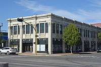 More images | |||
| St. Paul's Lutheran Church | 73 Smith Street E | Yorkton | S3N | 51°12′47″N 102°27′32″W / 51.2131°N 102.459°W | 6452 | | |||
| Yorkton Armoury | 56 1st Avenue | Yorkton | 51°12′45″N 102°27′50″W / 51.2126°N 102.464°W | 9585 |  More images | ||||
| Yorkton Court House | 29 Darlington Street East | Yorkton | S3N | 51°12′47″N 102°27′32″W / 51.2131°N 102.459°W | 2872 |  More images | |||
| Yorkton Organic Milling Ltd. | 120 Livingstone Street | Yorkton | S3N | 51°12′25″N 102°27′25″W / 51.207°N 102.457°W | 6078 |  More images | |||
| Zelma United Church | 2nd Avenue E | Zelma | S0K | 51°50′32″N 105°54′25″W / 51.8422°N 105.907°W | 4869 | | |||
| Paroisse Notre Dame de la Nativitie | Park Road | Zenon Park | S0E | 53°04′01″N 103°45′29″W / 53.0669°N 103.758°W | 4871 | |
See also
| Wikimedia Commons has media related to Cultural heritage monuments in Saskatchewan. |
This article is issued from Wikipedia - version of the 9/21/2016. The text is available under the Creative Commons Attribution/Share Alike but additional terms may apply for the media files.