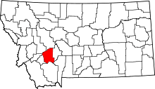
List of lakes in Jefferson County, Montana
This list is incomplete; you can help by expanding it.
There are at least 22 named lakes and reservoirs in Jefferson County, Montana.
Lakes
- Cliff Lake, 46°20′20″N 112°22′57″W / 46.33889°N 112.38250°W, el. 7,031 feet (2,143 m)[1]
- Cottonwood Lake, 46°19′41″N 112°28′50″W / 46.32806°N 112.48056°W, el. 7,290 feet (2,220 m)[2]
- Forest Lake, 46°27′06″N 112°10′00″W / 46.45167°N 112.16667°W, el. 6,256 feet (1,907 m)[3]
- Frog Pond, 46°17′01″N 112°21′03″W / 46.28361°N 112.35083°W, el. 6,020 feet (1,830 m)[4]
- Glenwood Lake, 46°17′56″N 111°53′23″W / 46.29889°N 111.88972°W, el. 8,199 feet (2,499 m)[5]
- Hidden Lake, 46°18′32″N 111°54′28″W / 46.30889°N 111.90778°W, el. 8,192 feet (2,497 m)[6]
- Homestake Lake, 45°55′11″N 112°24′25″W / 45.91972°N 112.40694°W, el. 6,270 feet (1,910 m)[7]
- Ice Pond, 46°09′41″N 112°22′35″W / 46.16139°N 112.37639°W, el. 6,234 feet (1,900 m)[8]
- Leslie Lake, 46°17′06″N 111°53′04″W / 46.28500°N 111.88444°W, el. 8,127 feet (2,477 m)[9]
- Quartz Lake, 46°25′13″N 112°10′11″W / 46.42028°N 112.16972°W, el. 6,345 feet (1,934 m)[10]
- South Fork Lakes, 46°16′49″N 111°49′37″W / 46.28028°N 111.82694°W, el. 6,673 feet (2,034 m)[11]
- Tizer Lakes, 46°18′42″N 111°53′22″W / 46.31167°N 111.88944°W, el. 7,585 feet (2,312 m)[12]
Reservoirs
- B and B Fishpond, 46°04′20″N 112°25′05″W / 46.07222°N 112.41806°W, el. 6,319 feet (1,926 m)[13]
- Columbia Gardens Water Supply, 46°02′41″N 112°25′17″W / 46.04472°N 112.42139°W, el. 6,398 feet (1,950 m)[14]
- Delmoe Lake, 45°59′06″N 112°20′30″W / 45.98500°N 112.34167°W, el. 6,099 feet (1,859 m)[15]
- Keogh Reservoir, 46°04′35″N 112°07′28″W / 46.07639°N 112.12444°W, el. 5,023 feet (1,531 m)[16]
- Maney Lake, 46°09′13″N 112°27′47″W / 46.15361°N 112.46306°W, el. 6,332 feet (1,930 m)[17]
- Northern Pacific Reservoir, 46°33′13″N 111°54′21″W / 46.55361°N 111.90583°W, el. 4,052 feet (1,235 m)[18]
- Northern Pacific Reservoir, 46°33′06″N 111°54′03″W / 46.55167°N 111.90083°W, el. 4,032 feet (1,229 m)[19]
- Park Lake, 46°26′41″N 112°10′24″W / 46.44472°N 112.17333°W, el. 6,371 feet (1,942 m)[20]
- Taylor Reservoir, 46°12′56″N 112°07′07″W / 46.21556°N 112.11861°W, el. 4,954 feet (1,510 m)[21]
- Whitetail Reservoir, 46°04′22″N 112°15′43″W / 46.07278°N 112.26194°W, el. 7,260 feet (2,210 m)[22]
See also
Notes
- ↑ "Cliff Lake". Geographic Names Information System. United States Geological Survey.
- ↑ "Cottonwood Lake". Geographic Names Information System. United States Geological Survey.
- ↑ "Forest Lake". Geographic Names Information System. United States Geological Survey.
- ↑ "Frog Pond". Geographic Names Information System. United States Geological Survey.
- ↑ "Glenwood Lake". Geographic Names Information System. United States Geological Survey.
- ↑ "Hidden Lake". Geographic Names Information System. United States Geological Survey.
- ↑ "Homestake Lake". Geographic Names Information System. United States Geological Survey.
- ↑ "Ice Pond". Geographic Names Information System. United States Geological Survey.
- ↑ "Leslie Lake". Geographic Names Information System. United States Geological Survey.
- ↑ "Quartz Lake". Geographic Names Information System. United States Geological Survey.
- ↑ "South Fork Lakes". Geographic Names Information System. United States Geological Survey.
- ↑ "Tizer Lakes". Geographic Names Information System. United States Geological Survey.
- ↑ "B and B Fishpond". Geographic Names Information System. United States Geological Survey.
- ↑ "Columbia Gardens Water Supply". Geographic Names Information System. United States Geological Survey.
- ↑ "Delmoe Lake". Geographic Names Information System. United States Geological Survey.
- ↑ "Keogh Reservoir". Geographic Names Information System. United States Geological Survey.
- ↑ "Maney Lake". Geographic Names Information System. United States Geological Survey.
- ↑ "Northern Pacific Reservoir". Geographic Names Information System. United States Geological Survey.
- ↑ "Northern Pacific Reservoir". Geographic Names Information System. United States Geological Survey.
- ↑ "Park Lake". Geographic Names Information System. United States Geological Survey.
- ↑ "Taylor Reservoir". Geographic Names Information System. United States Geological Survey.
- ↑ "Whitetail Reservoir". Geographic Names Information System. United States Geological Survey.
This article is issued from Wikipedia - version of the 6/20/2011. The text is available under the Creative Commons Attribution/Share Alike but additional terms may apply for the media files.
