List of protected heritage sites in Walhain
This table shows an overview of the protected heritage sites in the Walloon town Walhain. This list is part of Belgium's national heritage.
| Object |
Year/architect |
Town/section |
Address |
Coordinates |
Number? |
Image |
|---|---|---|---|---|---|---|
| Ruins of the feudal castle (nl) (fr) |
Walhain | 50°36′50″N 4°41′41″E / 50.613781°N 4.694855°E |
25124-CLT-0002-01 Info |
 | ||
| Ensemble of the ruins of the medieval castle (nl) (fr) |
Walhain | 50°36′44″N 4°41′34″E / 50.612356°N 4.692703°E |
25124-CLT-0003-01 Info |
 | ||
| Brick Windmill called "du Tiège" <sup style="text-align:right; line-height:1em;
margin-left:0.3em; color:blue; cursor:help; font-family:Verdana,sans-serif;"
title="Windmolen van baksteen: "du Tiège"">(nl) (fr) |
Walhain | 50°38′37″N 4°40′09″E / 50.643543°N 4.669255°E |
25124-CLT-0004-01 Info |
_-_Vu_de_face.JPG) | ||
| Tower of Sarrasins (nl) (fr) |
Walhain | 50°37′55″N 4°37′59″E / 50.631878°N 4.633012°E |
25124-CLT-0005-01 Info |
|||
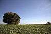
| Tumuli of Libersart, ensemble of two tumuli and environment (nl) (fr) |
Walhain | 50°39′17″N 4°43′21″E / 50.654587°N 4.722527°E |
25124-CLT-0006-01 Info |
 | ||
| Tumuli of Libersart, ensemble of tumuli and surrounding area (nl) (fr) |
Walhain | 50°39′17″N 4°43′17″E / 50.654822°N 4.721299°E |
25124-CLT-0007-01 Info |
 | ||
| Tumuli of Libersart, archaeological site (nl) (fr) |
Walhain | 50°39′17″N 4°43′21″E / 50.654587°N 4.722527°E |
25124-PEX-0001-01 Info |
|||
| Tumuli of Libersart, fields with tumuli and surrounding area (nl) (fr) |
Walhain | 50°39′17″N 4°43′17″E / 50.654822°N 4.721299°E |
25124-PEX-0002-01 Info |
See also
| Wikimedia Commons has media related to Cultural heritage monuments in Walhain. |
References
- Belgian heritage register: Direction générale opérationnelle - Aménagement du territoire, Logement, Patrimoine et Energie (DG4)
- www.dglive.be
This article is issued from Wikipedia - version of the 5/18/2016. The text is available under the Creative Commons Attribution/Share Alike but additional terms may apply for the media files.