List of tors
The following list enumerate and expand on notable tors.
Tors in Great Britain
Dartmoor
Dartmoor represents one of the largest areas of exposed granite in the United Kingdom, covering an area of 368 square miles (954 square kilometres).[1] It is part of a chain of granite stretching through Cornwall, as far as the Isles of Scilly.
Some of the more durable granite survived to form the rocky crowns of Dartmoor tors. One of the best known is at Haytor, on the eastern part of the moor, whose granite is of unusually fine quality and was quarried from the hillside below the tor during the 19th and early 20th centuries. Its stone was used to construct the pillars outside the British Museum in London, and to build London Bridge. The last granite to be quarried there was used to build Exeter War Memorial in 1919.
Ten Tors is an annual weekend hike on Dartmoor.

Cornwall
- Alex Tor, Bodmin Moor
- Hawk's Tor, Bodmin Moor
- Helman Tor, mid–Cornwall
- Rough Tor, Bodmin Moor
- Showery Tor, Bodmin Moor
- Cheesewring, Bodmin Moor
- Brown Willy, Bodmin Moor
- Temple Tor, Bodmin Moor
- Garrow Tor, Bodmin Moor
- Kilmar Tor, Bodmin Moor
- Butter's Tor, Bodmin Moor
Peak District
There are many tors in this area, notably in the Dark Peak where the host rock is Millstone Grit:
- Back Tor, Derwent Edge (538m)
- Carl Wark, Hathersage Moor
- Dovestone Tor, Derwent Edge (505m)
- Great Tor, Bamford

- Higger Tor (384m) and Over Owler Tor (375m)
- Howshaw Tor overlooking Sheffield
- Ladybower Tor, Upper Derwent Valley
- Low Tor, Bradfield Moors
- The Salt Cellar on Derwent Edge
- Whinstone Lee Tor
- White Tor, Derwent Moors (487m)
- Tor Raynor Broomhill, Sheffield
In addition there are hills which incorporate 'tor' in their name but yet do not feature the geomorphological feature described in this article. Examples include Mam Tor and Shining Tor.[2]
Pennines
- Almscliffe Crag west of Harrogate
- Cow and Calf, Ilkley Moor in West Yorkshire. Made from Millstone Grit.
- Haslingden Tor. (Musbury Hill) Helmshore Rossendale, Lancashire
Scotland
There are numerous tors developed in the Cairngorm granite in the Scottish Highlands:
- The Barns of Bynack, tors on Bynack More
- Ben Avon
- Beinn a' Bhuird
- Beinn Mheadhoin
Other areas
Tor Bay, one of the sandy beaches near Oxwich Bay on the Gower Peninsula in south Wales, is so-called because the beach is framed by a huge outcrop of Carboniferous Limestone.
Tors in other regions
Africa
- Kit-Mikayi, Kenya
- Castle koppies of Central Zimbabwe.[3]
Germany

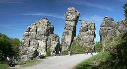
- Externsteine in the Teutoburg Forest, North Rhine-Westphalia
- Greifensteine in the Ore Mountains of Saxony
- Großer Waldstein in the Fichtelgebirge mountains of Bavaria
- Heinrichshöhe and Hohneklippen in the Harz mountains of central Germany
- Wolfenstein in Bavaria
India
Tors are very commonly found in the Telangana and the Rayalaseema regions of Andhra Pradesh
North America

- Angel Rocks and Granite Tors, Chena River State Recreation Area, Alaska
- Finger Mountain area, Dalton Highway, Alaska
- Elephant Rocks in Missouri
- Apache Leap Formation in Superior, Arizona
- Texas Canyon in Arizona
- Wichita Mountains, Oklahoma
New Zealand
- Schist tors in Central Otago
Spain
- Tors of the Central Pyrinees.[3]
- Castle koppies of Traba Massif, Galicia.[3]