Exeter
| Exeter City of Exeter | |
|---|---|
| City and non-metropolitan district | |
|
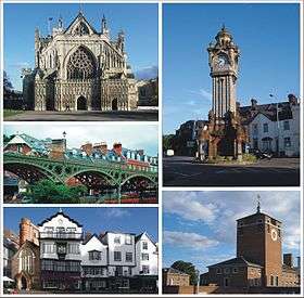
Clockwise: The Cathedral, The Clock Tower, Devon County Hall, Cathedral Close, The Iron Bridge. | |
| Motto: Semper fidelis (Always Faithful) | |
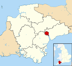 The District of Exeter including Topsham shown within Devon | |
| Coordinates: 50°43′N 3°32′W / 50.717°N 3.533°WCoordinates: 50°43′N 3°32′W / 50.717°N 3.533°W | |
| Sovereign state | United Kingdom |
| Constituent country | England |
| Region | South West England |
| Ceremonial and shire county | Devon |
| City status | Time immemorial |
| Non-metropolitan district | 1974 |
| Government | |
| • Type | Exeter City Council |
| • Lord Mayor | Olwen Foggin |
| • Members of Parliament |
Ben Bradshaw (L) Hugo Swire (C) |
| • HQ | Civic Centre, Paris Street |
| • UK Parliament |
Exeter East Devon |
| • European Parliament | South West England |
| Area[1] | |
| • Total | 18.16 sq mi (47.04 km2) |
| Area rank | 274th (of 326) |
| Population (mid-2014 est.)[2] | |
| • Total | 124,328 |
| • Rank | 176th (of 326) |
| • Density | 6,800/sq mi (2,600/km2) |
| • Demonyms | Exonian |
| • Ethnicity (2011)[3] |
93.05% White
|
| Time zone | GMT (UTC0) |
| • Summer (DST) | BST (UTC+1) |
| Postcode district | EX1-6 |
| Area code(s) | 01392 |
| Website |
www |
Exeter (![]() i/ˈɛksᵻtər/) is a cathedral city in Devon, England with a population of 124,328 (mid-2014 est.). It lies within the county of Devon, of which it is the county town as well as the home of Devon County Council. Currently, the administrative area has the status of a non-metropolitan district and is therefore under the administration of the County Council (there was a plan to grant the city unitary authority status, although this was scrapped under the 2010 coalition government). The city is on the River Exe about 37 miles (60 km) northeast of Plymouth and 70 miles (110 km) southwest of Bristol.
i/ˈɛksᵻtər/) is a cathedral city in Devon, England with a population of 124,328 (mid-2014 est.). It lies within the county of Devon, of which it is the county town as well as the home of Devon County Council. Currently, the administrative area has the status of a non-metropolitan district and is therefore under the administration of the County Council (there was a plan to grant the city unitary authority status, although this was scrapped under the 2010 coalition government). The city is on the River Exe about 37 miles (60 km) northeast of Plymouth and 70 miles (110 km) southwest of Bristol.
Exeter was the most south-westerly Roman fortified settlement in Britain, although there is evidence a Cornish tribe existed in Exeter before the Roman invasion. Exeter became a religious centre during the Middle Ages and into the Tudor times: Exeter Cathedral, founded in the mid 11th century, became Anglican during the 16th-century English Reformation. During the late 19th century, Exeter became an affluent centre for the wool trade, although by the First World War the city was in decline. After the Second World War, much of the city centre was rebuilt and is now considered to be a centre for modern business and tourism in Devon and Cornwall.
Name
The modern name of Exeter is a development of the Old English Escanceaster,[4] from the anglicised form of the river now known as the Exe and the Old English suffix -ceaster, used to mark important fortresses or fortified towns. (The Welsh name for the city, Caerwysg, similarly means "fortress on the Exe".) The Exe is a separate development of the Brittonic name—meaning "water"[5] or, more exactly, "full of fish" (cf. Welsh pysg, pl. "fish")[6]—that also appears in the English Axe and Esk, the Welsh Usk (Welsh: Wysg), and Scottish whisky.
History
Prehistory
Exeter began as settlements on a dry ridge ending in a spur overlooking a navigable river teeming with fish, with fertile land nearby. Although there have been no major prehistoric finds, these advantages suggest the site was occupied early.[7] Coins have been discovered from the Hellenistic kingdoms, suggesting the existence of a settlement trading with the Mediterranean as early as 250 BC.[8] Such early towns had been a feature of pre-Roman Gaul as described by Julius Caesar in his Commentaries and it is possible that they existed in Britannia as well.
Roman times
The Romans established a 42-acre (170,000 m2) 'playing-card' shaped fort (Latin: castrum) named Isca around AD 55. The fort was the southwest terminus of the Fosse Way (Route 15 of the Antonine Itinerary) and served as the base of the 5 000-man Second Augustan Legion originally led by Vespasian, later Roman Emperor, (Legio II Augusta) for the next 20 years before they moved to Caerleon in Wales, which was also known as Isca. To distinguish the two, the Romans also referred to Exeter as Isca Dumnoniorum, "Watertown of the Devonians", and Caerleon as Isca Augusta. A small fort was also maintained at Topsham; a supply depot on the route between the two was excavated at St Loyes on Topsham Road in 2010.
The presence of the fort built up an unplanned civilian community (vicus or canabae) formed of natives and the soldiers' families, mostly to the northeast of the fort. This settlement served as the tribal capital (civitas) of the Devonians[9] and was listed as one of their four cities (Greek: poleis) by Ptolemy in his Geography[10] (It also appeared in the 7th-century Ravenna Cosmography, where it appears as the apparently confused entry of Scadu Namorum.[11]) When the fortress was abandoned around the year 75, its grounds were converted to civilian purposes; its very large bathhouse was demolished to make way for a forum and basilica and a smaller-scale bath was erected to the southeast.[9] This area was excavated in the 1970s,[12][13] but could not be maintained for public view owing to its proximity to the present-day cathedral. In January 2015, it was announced that Exeter Cathedral had launched a bid to restore the baths and open an underground centre for visitors.[14]
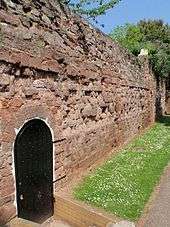
In the late 2nd century, the ditch and rampart defences around the old fortress were replaced by a bank and wall enclosing a much larger area, some 92 acres (37 ha).[15] Although most of the visible structure is older, the course of the Roman wall was used for Exeter's subsequent city walls, meaning about 70% of it remains and most of its route can be traced on foot. The Devonian Isca seems to have been most prosperous in the first half of the 4th century: more than a thousand Roman coins have been found around the city and there is evidence for copper and bronze working, a stock-yard, and markets for the livestock, crops, and pottery produced in the surrounding countryside.[16] The dating of the coins so far discovered, however, suggests a rapid decline: virtually none have been discovered dating after the year 380.[17]
Medieval times
Bishop Ussher identified the Cair Pensa vel Coyt[18] listed among the 28 cities of Britain by the History of the Britons as Isca,[19] although David Nash Ford read it as a reference to Penselwood and thought it more likely to be Lindinis (modern Ilchester).[20] Nothing is certainly known of Exeter from the time of the Roman withdrawal from Britain around the year 410 until around 680 when a document about St Boniface reports that he was educated at an abbey in Exeter.[21] By that time, the city was held by the Saxons, who had arrived in Exeter after defeating the British Dumnonians at Peonnum in Somerset in 658.[22] It seems likely that the Saxons maintained a quarter of the city for the Britons under their own laws around present-day Bartholomew Street,[23] which was known as "Britayne" Street until 1637 in memory of its former occupants.[24]
Exeter was known to the Saxons as Escanceaster.[4] In 876, it was attacked and briefly captured by Danish Vikings. Alfred the Great drove them out the next summer.[25] Over the next few years, he elevated Exeter to one of the four burhs in Devon, rebuilding its walls on the Roman lines.[26] These permitted the city to fend off another attack and siege by the Danes in 893.[26] King Athelstan again strengthened the walls around 928 and, at the same time, drove out the remaining Britons from the city.[25] (It is uncertain, though, whether they had lived in the city continuously since the Roman period or returned from the countryside when Alfred strengthened its defenses.[27]) According to William of Malmesbury, they were sent beyond the River Tamar, which was fixed as the boundary of Devon. (This may, however, have served as a territorial boundary within the former kingdom of Dumnonia as well.[28]) Other references suggest that the British simply moved to what is now the St. David's area, not far outside Exeter's walls. The quarter vacated by the Britons was apparently adapted as "the earl's burh" and was still named Irlesberi in the 12th century.[25] In 1001, the Danes again failed to get into the city, but they were able to plunder it in 1003 because they were let in, for unknown reasons, by the French reeve of Emma of Normandy, who had been given the city as part of her dowry on her marriage to Æthelred the Unready the previous year.[25]

Two years after the Norman conquest of England, Exeter rebelled against King William. Gytha Thorkelsdóttir, the mother of the slain King Harold, was living in the city at the time and William promptly marched west and initiated a siege. After 18 days, William accepted the city's honourable surrender, swearing an oath not to harm the city or increase its ancient tribute. However, William quickly arranged for the building of Rougemont Castle to strengthen Norman control over the area. Properties owned by Saxon landlords were transferred into Norman hands and, on the death of Bishop Leofric in 1072, the Norman Osbern FitzOsbern was appointed his successor.[29]
In 1136, early in the Anarchy, Rougemont Castle was held against King Stephen by Baldwin de Redvers. Redvers submitted only after a three-month siege, not when the three wells in the castle ran dry, but only after the exhaustion of the large supplies of wine that the garrison was using for drinking, baking, cooking, and putting out fires set by the besiegers.[30] During the siege, King Stephen built an earthen fortification at the site now known (erroneously) as Danes Castle.[31]

The city held a weekly market for the benefit of its citizens from at least 1213, and by 1281 Exeter was the only town in the south west to have three market days per week. There are also records of seven annual fairs, the earliest of which dates from 1130, and all of which continued until at least the early 16th century.[33]
During the high medieval period, both the cathedral clergy and the citizens enjoyed access to sophisticated aqueduct systems which brought pure drinking water into the city from springs in the neighbouring parish of St Sidwell’s. For part of their length, these aqueducts were conveyed through a remarkable network of subterranean tunnels, or ‘underground passages’, which survive largely intact and which may still be visited today.[34]
Modern times
- Tudor and Stuart eras
In 1537, the city was made a county corporate. In 1549, the city successfully withstood a month-long siege by the so-called Prayer Book rebels: Devon and Cornish folk who had been infuriated by the radical religious policies of King Edward VI. The insurgents occupied the suburbs of Exeter, burnt down two of the city gates and attempted to undermine the city walls, but were eventually forced to abandon the siege after they had been worsted in a series of bloody battles with the king’s army. A number of rebels were executed in the immediate aftermath of the siege.[35] The Livery Dole almshouses and chapel at Heavitree were founded in March 1591 and finished in 1594.
The city's motto, Semper fidelis, is traditionally held to have been suggested by Elizabeth I, in acknowledgement of the city's contribution of ships to help defeat the Spanish Armada in 1588;[36] however its first documented use is in 1660. Schools in Exeter teach that the motto was bestowed by Charles II in 1660 at the Restoration due to Exeter's role in the English Civil War.
When in 1638 Reverend John Wheelwright was exiled from the Massachusetts Bay Colony and subsequently established a community on the banks of the Squamscott River, he named the region Exeter after its Devonian counterpart. During the American Revolution it became the capital of New Hampshire.
Exeter was secured for Parliament at the beginning of the English Civil War, and its defences very much strengthened, but in September 1643 it was captured by the Cornish Royalist Army led by Prince Maurice. Thereafter, the city remained firmly under the king’s control until near the end of the war, being one of the final Royalist cities to fall into Parliamentarian hands.[37] The surrender of Exeter was negotiated in April 1646 at Poltimore House by Thomas Fairfax.[38] During this period, Exeter was an economically powerful city, with a strong trade of wool. This was partly due to the surrounding area which was "more fertile and better inhabited than that passed over the preceding day" according to Count Lorenzo Magalotti who visited the city when he was 26 years old.[39] Magalotti writes of over thirty thousand people being employed in the county of Devon as part of the wool and cloth industries, merchandise that was sold to "the West Indies, Spain, France and Italy".[40] Celia Fiennes also visited Exeter during this period, in the early 1700s. She remarked on the "vast trade" and "incredible quantity" in Exeter, recording that "it turns the most money in a week of anything in England", between £10,000 and £15,000.[41]
- Georgian and Victorian eras
Early in the Industrial Revolution, Exeter's industry developed on the basis of locally available agricultural products and, since the city's location on a fast-flowing river gave it ready access to water power, an early industrial site developed on drained marshland to the west of the city, at Exe Island. However, when steam power replaced water in the 19th century, Exeter was too far from sources of coal (or iron) to develop further. As a result, the city declined in relative importance, and was spared the rapid 19th century development that changed many historic European cities. Extensive canal redevelopments during this period further expanded Exeter's economy, with "vessels of 15 to 16 tons burthen [bringing] up goods and merchandise from Topsham to the City Quay".[42] In 1778 a new bridge across the Exe was opened to replace the old medieval bridge. Built at a cost of £30,000, it had three arches and was built of stone.[43]
In 1832, cholera, which had been erupting all across Europe, reached Exeter. The only known documentation of this event was written by Dr Thomas Shapter, one of the medical doctors present during the epidemic.[44]
The first railway to arrive in Exeter was the Bristol and Exeter Railway that opened a station at St Davids on the western edge in 1844. The South Devon Railway Company extended the line westwards to Plymouth, opening their own smaller station at St Thomas, above Cowick Street. A more central railway station, that at Queen Street, was opened by the London and South Western Railway in 1860 when it opened its alternative route to London. Butchers Lloyd Maunder moved to their present base in 1915, to gain better access to the Great Western Railway for transportation of meat products to London.

The first electricity in Exeter was provided by the Exeter Electric Light Company, which was formed at the end of the 1880s, but it was municipalised in 1896 and became the City of Exeter Electricity Company.[45]
The first horse-drawn trams in Exeter were introduced in 1882 with 3 lines radiating from the city's East Gate. One line went to St David's station via New North Road, the Obelisk (where the Clock Tower now stands) and St David's Hill. The second line went out along Heavitree Road to Livery Dole and the third went to Mount Pleasant along Sidwell Street. There was a depot off New North Road.[46]
20th century
On 29 March 1905 a new bridge across the Exe was opened replacing the former Georgian bridge. Made of cast-iron and steel with a three hinged arch design, it cost £25,000 and was designed by Sir John Wolfe Barry.[43] Also in 1905 electric trams replaced the horse trams[47] with a new route which passed along the High Street, down Fore Street and over the new Exe Bridge. Once over the Exe the line divided, with one route along Alphington Road and another along Cowick Street. The line to St David's Station travelled along Queen Street instead of along New North Road and the line to Heavitree was extended.[48] On 17 March 1917, a tram went out of control going down Fore Street, hit a horse-drawn wagon, then overturned on Exe Bridge and one female passenger was killed.[49] By the 1920s, there were problems with congestion caused by the trams, a need for expensive track renewal work and the slow speed of the trams in Exeter's narrow streets. After much discussion the council decided to replace the tram service with double-decker buses and the last tram ran on 19 August 1931. The only remaining Exeter tram in service is car 19, now at the Seaton Tramway.[50]
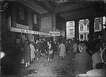
Exeter was bombed by the German Luftwaffe in the Second World War, when a total of 18 raids between 1940 and 1942 flattened much of the city centre. In 1942, as part of the Baedeker Blitz and specifically in response to the RAF bombing of Lübeck and Rostock, 40 acres (16 ha) of the city, particularly adjacent to its central High Street and Sidwell Street, were levelled by incendiary bombing. Many historic buildings in the heart of the city were destroyed and others, including the Cathedral, were damaged. 156 people were killed in the attacks.[51]
Large areas of the city centre were rebuilt in the 1950s, when little attempt was made to preserve Exeter's heritage. Damaged buildings were generally demolished rather than restored, and the street plan was altered in an attempt to improve traffic circulation. Former landmarks such as St. Lawrence and the College of the Vicars Choral disappeared. The modern architecture stands in sharp contrast to the red sandstone of buildings that survived the Blitz.[51]
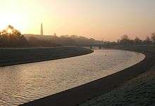
On 27 October 1960, following very heavy rain, the Exe overflowed and flooded large areas of Exeter including Exwick, St Thomas and Alphington. The water rose as high as 2 metres above ground level in places and 150 employees of the local firm Beach Bros were trapped for nine hours. 2,500 properties were flooded. Later the same year on 3 December the river levels rose again, flooding 1,200 properties. These floods led to the construction of new flood defences for Exeter. Work began in 1965, took 12 years to complete and cost £8 million. The defences included three flood relief channels, and were complemented by the construction of two new concrete bridges (built in 1969 and 1972) to replace the old Exe Bridge which had obstructed the flow of the river and made the flooding worse.[52]
21st century
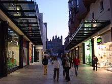
The Princesshay shopping centre adjoining the Cathedral Close and the High Street was redeveloped between 2005 and 2007,[53][54] despite some local opposition.[55] It incorporates 123 varied residential units.[56]
To enable people with limited mobility to enjoy the city, Exeter Community Transport Association provides manual and powered wheelchairs and scooters (called Shopmobility) for use by anyone suffering from short or long-term mobility impairment to access to the city centre and shopping facilities, events and meetings with friends and company.[57]
In May 2008 there was an attempted terrorist attack on the Giraffe cafe in Princesshay, but the bomber was the only one injured.[58]
A £30 million improvement scheme for the flood defences was approved in March 2015. The plans involve the removal of check weirs and a deeper, "meandering stream" in the centre of the drainage channels to improve flow. The plans followed a study by the Environment Agency that revealed weaknesses in the current defences.[59]
A serious fire broke out in buildings in central Exeter on 28 October 2016. The fire largely destroyed the Royal Clarence Hotel, considered the first venue in England to call itself a hotel. Other historic buildings, including 18 Cathedral Yard,[60] were also destroyed.[61][62]
Governance
Exeter is in two parliamentary constituencies, the majority of the city is in the Exeter constituency but two wards (St Loyes and Topsham) are in East Devon. Exeter itself is relatively marginal, and since World War II its Member of Parliament has usually been drawn from the governing party. The Exeter MP is Ben Bradshaw and Hugo Swire represents East Devon. Exeter is part of the South West England European constituency, which elects 6 MEPs.
Exeter's city council is a district authority, and shares responsibility for local government with the Devon County Council. In May 2012 Labour became the majority party on the council. Exeter City Council's bid for the city to become a Unitary Authority was initially approved by ministers in February 2010. A judicial review was called by Devon County Council and the Court held that the Minister had acted unlawfully in granting Unitary status to Exeter at the same time, however, following the 2010 general election the new coalition government announced in May 2010 that the reorganisation would be blocked.[63][64]
From Saxon times, it was in the hundred of Wonford.[65] Exeter has had a mayor since at least 1207 and until 2002, the city was the oldest 'Right Worshipful' Mayoralty in England. As part of the Golden Jubilee of Elizabeth II Exeter was chosen to receive the title of Lord Mayor. Councillor Granville Baldwin became the first Lord Mayor of Exeter on 1 May 2002 when Letters Patent were awarded to the city during a visit by the Queen. The Lord Mayor is elected each year from amongst the 40 Exeter city councillors and is non-political for the term of office.
Public services
Policing in Exeter is provided by the Devon and Cornwall Constabulary who have their headquarters based at Middlemoor in the east of the city.
The fire service is provided by the Devon and Somerset Fire and Rescue Service, which is headquartered at Clyst St. George near Exeter. It has two fire stations located at Danes Castle and Middlemoor.
The Royal Devon and Exeter NHS Foundation Trust has a large hospital located to the south east of the city centre. Ambulance services in Exeter are provided by South Western Ambulance Service NHS Trust. The West Trust Divisional HQ and 999 control is in Exeter which provides cover for Devon, Cornwall, Somerset and the Isles of Scilly.
Geography
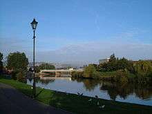
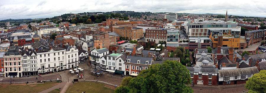
The city of Exeter was established on the eastern bank of the River Exe on a ridge of land backed by a steep hill. It is at this point that the Exe, having just been joined by the River Creedy, opens onto a wide flood plain and estuary which results in quite common flooding. Historically this was the lowest bridging point of the River Exe which was tidal and navigable up to the city until the construction of weirs later in its history. This combined with the easily defensible higher ground of the ridge made the current location of the city a natural choice for settlement and trade. In George Oliver's The History of the City of Exeter, it is noted that the most likely reasons for the original settling of what would become modern Exeter was the "fertility of the surrounding countryside" and the area's "beautiful and commanding elevation [and] its rapid and navigable river".[66] Its woodland would also have been ideal for natural resources and hunting.
Exeter sits predominantly on sandstone and conglomerate geology, although the structure of the surrounding areas is varied.[67] The topography of the ridge which forms the backbone of the city includes a volcanic plug, on which the Rougemont Castle is situated. The Cathedral is located on the edge of this ridge and is therefore visible for a considerable distance.
Climate
Exeter has mild wet winters and warm changeable summers with hot and cooler rainy spells. Temperatures do not vary much throughout the year. The hottest month is July with an average high of 21.7 °C (71.1 °F), and the coldest month is January with an average high of 8.8 °C (47.8 °F). October is the wettest month with 88.9 millimetres (3.50 in) of rain. Because of shelter from Dartmoor, Exeter is more frost prone than areas to the southwest, such as Plymouth. It is also drier, and warmer in the summer for the same reason. The highest recorded temperature in Exeter stands at 33.5 °C (92.3 °F)[68] recorded in June 1976, whilst the lowest recorded temperature in Exeter is −16.4 °C (2.5 °F)[69] recorded in December 2010.
| Climate data for Exeter, elevation: 7 m or 23 ft (1981–2010) extremes (1960–present) | |||||||||||||
|---|---|---|---|---|---|---|---|---|---|---|---|---|---|
| Month | Jan | Feb | Mar | Apr | May | Jun | Jul | Aug | Sep | Oct | Nov | Dec | Year |
| Record high °C (°F) | 16.6 (61.9) |
14.3 (57.7) |
21.0 (69.8) |
23.6 (74.5) |
27.5 (81.5) |
33.5 (92.3) |
32.2 (90) |
32.4 (90.3) |
26.9 (80.4) |
26.0 (78.8) |
18.6 (65.5) |
15.9 (60.6) |
33.5 (92.3) |
| Average high °C (°F) | 8.8 (47.8) |
8.8 (47.8) |
11.1 (52) |
13.3 (55.9) |
16.8 (62.2) |
19.8 (67.6) |
21.7 (71.1) |
21.5 (70.7) |
19.2 (66.6) |
15.2 (59.4) |
11.7 (53.1) |
9.1 (48.4) |
14.8 (58.6) |
| Daily mean °C (°F) | 5.8 (42.4) |
5.6 (42.1) |
7.4 (45.3) |
8.9 (48) |
12.2 (54) |
15.2 (59.4) |
17.1 (62.8) |
16.9 (62.4) |
14.8 (58.6) |
11.6 (52.9) |
8.3 (46.9) |
5.8 (42.4) |
10.8 (51.4) |
| Average low °C (°F) | 2.7 (36.9) |
2.4 (36.3) |
3.7 (38.7) |
4.5 (40.1) |
7.6 (45.7) |
10.5 (50.9) |
12.4 (54.3) |
12.3 (54.1) |
10.3 (50.5) |
8.0 (46.4) |
4.8 (40.6) |
2.4 (36.3) |
6.8 (44.2) |
| Record low °C (°F) | −13.1 (8.4) |
−9.3 (15.3) |
−9.6 (14.7) |
−4.4 (24.1) |
−1.7 (28.9) |
0.9 (33.6) |
2.1 (35.8) |
2.0 (35.6) |
−1.0 (30.2) |
−3.9 (25) |
−6.2 (20.8) |
−16.4 (2.5) |
−16.4 (2.5) |
| Average precipitation mm (inches) | 82.2 (3.236) |
60.7 (2.39) |
56.8 (2.236) |
62.1 (2.445) |
57.2 (2.252) |
48.4 (1.906) |
45.8 (1.803) |
53.4 (2.102) |
58.8 (2.315) |
88.9 (3.5) |
83.4 (3.283) |
87.3 (3.437) |
784.9 (30.902) |
| Average precipitation days (≥ 1.0 mm) | 12.4 | 10.4 | 10.2 | 9.9 | 9.7 | 7.4 | 7.8 | 7.9 | 8.8 | 12.1 | 12.6 | 12.0 | 121.0 |
| Mean monthly sunshine hours | 57.7 | 73.1 | 109.5 | 162.9 | 190.4 | 194.7 | 192.6 | 177.4 | 136.0 | 96.6 | 71.5 | 51.0 | 1,513.1 |
| Source #1: Met Office[70] | |||||||||||||
| Source #2: KNMI[71] | |||||||||||||
Demography
From the 2011 Census, the Office for National Statistics published that Exeter's district area population was 117,773;[72] 6,697 more people than that of the last census from 2001, which indicated that Exeter had a population of 111,076.[73] At the time of the 2011 UK census, the ethnic composition of Exeter's population was 93.1% White, with the largest minority ethnic group being Chinese at 1.7%.[3] The White British, White Irish and other ethnic group all declined in numbers since the 2001 census (−1%, -6% and −10% respectively). Meanwhile, the Chinese and Other Asian had the largest increases (429% and 434% respectively).[3][74] This excludes the two new ethnic groups added to the 2011 census of Gypsy or Irish Traveller and Arab. Below are the 10 largest immigrant groups in Exeter as of 2011.[3]
| Country of Birth | Immigrants in Exeter (2011 Census) |
|---|---|
| 1,665 | |
| 1,296 | |
| 710 | |
| 653 | |
| 469 | |
| 438 | |
| 350 | |
| 310 | |
| 295 | |
| 242 | |
In 2011, the city of Exeter had a population of 117,773, while its inner urban subdivision had a population of 113,507. The Exeter USD does not include the outlying suburb of Topsham.
| Exeter compared 2011 | Exeter USD | Exeter City |
|---|---|---|
| White British | 88.1% | 88.3% |
| Asian | 4.0% | 3.9% |
| Black | 0.6% | 0.5% |
In 2011, 11.9% of the population of the Exeter USD (urban subdivision) were non white British, compared with 11.7% for the actual city and surrounding borough of Exeter.
In 2009, Exeter City was 89.1% White British, compared with 88.3% in 2011.[76]
The Exeter Urban Area had a population of 124,079[77] in 2014, compared with 124,328 for the city and borough of Exeter. While the Exeter Metropolitan Area had a population of 467,257 in the same year and includes Exeter along with Teignbridge, Mid Devon and East Devon.
Economy
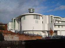
The Met Office, the main weather forecasting organisation for the United Kingdom and one of the most significant in the world, relocated from Bracknell in Berkshire to Exeter in early 2004. It is one of the largest employers in the area (together with the University of Exeter, Devon County Council and the Royal Devon and Exeter NHS Foundation Trust).
Around 35,000 people commute into Exeter on a daily basis, from nearby surrounding towns.[78] Exeter provides services, employment and shopping for local residents within the city limits and also from nearby towns in Teignbridge, Mid Devon and East Devon, together sometimes known as the Exeter & Heart of Devon area (EHOD). Exeter therefore provides for the EHOD area population of 457,400.[79]
Exeter has been identified among the top ten most profitable locations for a business to be based.[80]
The city centre provides substantial shopping facilities. The High Street is mainly devoted to branches of national chains: a NEF survey in 2005 rated Exeter as the worst example of a clone town in the UK, with only a single independent store in the city's High Street, and less diversity (in terms of different categories of shop) than any other town surveyed. In 2010, a similar survey reported the city was still the worst clone town.[81] Three significant shopping areas that connect to the High Street provide a somewhat more varied menu. Princesshay, a post-war retail area connecting to the south side of the High Street was home to a number of independent stores prior to redevelopment in 2007, but is now also largely occupied by national chains. It is an innovative, varied development, and it is still intended that a number of the new units will be let to local independent stores. On the other side of the High Street, the partly undercover Guildhall Shopping Centre houses a mixture of national and more regional shops, and connects to the wholly enclosed Harlequins Centre where smaller businesses predominate. Smaller streets off the High Street such as Gandy Street also offer a range of independent shops.
On 26 June 2004, Exeter was granted Fairtrade City status.
Although Exeter contains a number of tourist attractions, the city is not dominated by tourism, with only 7% of employment dependent on tourism compared with 13% for Devon as a whole (2005 figures).[82]
There are also plans to build on land in the Teignbridge and East Devon areas, which border Exeter's boundaries.[83]
Landmarks
Among the notable buildings in Exeter are:
Religious buildings

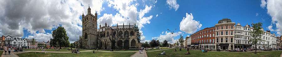
- The cathedral, founded in 1050 when the bishop's seat was moved from the nearby town of Crediton (birthplace of Saint Boniface) because Exeter's Roman walls offered better protection against "pirates", presumably Vikings. A statue of Richard Hooker, the 16th century Anglican theologian, who was born in Exeter, has a prominent place in the Cathedral Close.
- St Nicholas Priory in Mint Lane, the remains of a monastery, later used as a private house and now a museum owned by the city council. The priory was founded in 1087 and was home to Benedictine monks for over 400 years, until it was closed and partly demolished by Henry VIII. The remaining buildings were then sold off in 1602 and became the home of the locally wealthy Hurst family. The property has been fully renovated by Exeter City Council, and the small garden area features Tudor plants and herbs[84]
- A number of medieval churches including St Mary Steps which has an elaborate clock.
- The Exeter Synagogue is the third oldest synagogue in Britain, completed in 1763.
Secular buildings
- The ruins of Rougemont Castle, built soon after the Norman Conquest; later parts of the castle were still in use as a County Court until early 2006 when a new Crown Courts building opened. A plaque near the ruined Norman gatehouse recalls the fate of Alice Molland, tried for witchcraft at Exeter in 1685, and reputedly the last person in England to have been executed for that crime. Other supposed ‘witches’ are known to have hanged in Exeter in 1581, 1610 and 1682.[85][86]
- The Guildhall, which has medieval foundations and has been claimed to be the oldest municipal building in England still in use.[87]
- Mol's Coffee House, a historic building in the Cathedral Close.
- Tuckers' Hall, a fine old building that is still used for smart functions.
- The Custom House in the attractive Quay area, which is the oldest brick building surviving in the city.
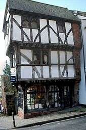
- "The House That Moved", a 14th-century Tudor building, earned its name in 1961 when it was moved from its original location on the corner of Edmund Street in order for a new road to be built in its place. Weighing more than twenty-one tonnes, it was strapped together and slowly moved a few inches at a time to its present-day position.
- Parliament Street in the city centre is one of the narrowest streets in the World.
- The Butts Ferry, an ancient cable ferry across the River Exe.
- Wyvern Barracks, a former artillery barracks, dates back to about 1800.[88]
- Higher Barracks, a former cavalry barracks, dates back to 1794.[89]
- The Devon County War Memorial in the Cathedral Close, designed by Sir Edwin Lutyens and unveiled in 1922 by Edward, Prince of Wales.[90]
Many of these are built in the local dark red sandstone, which gives its name to the castle and the park that now surrounds it (Rougemont means red hill). The pavements on Queen Street are composed of the rock diorite and exhibit feldspar crystals, while those around Princesshay are composed of granodiorite
Northernhay Gardens
Located just outside the castle, Northernhay Gardens is the oldest public open space in England, being originally laid out in 1612 as a pleasure walk for Exeter residents. Much of Northernhay Gardens now reflects Victorian design, with trees, mature shrubs and bushes and plenty of flower beds. There are many statues here, including the war memorial by John Angel, The Deer Stalker by E. B. Stephens, and the Volunteer Memorial from 1895, which commemorates the formation of the 1st Rifle Volunteers in 1852. Other statues include John Dinham, Thomas Dyke Acland and Stafford Northcote (a local landowner who was a Victorian Chancellor of the Exchequer).
Transport
Car

The M5 motorway to Bristol and Exeter starts at Birmingham, and connects at Bristol with the M4 to London and South Wales. The older A30 road provides a more direct route to London via the A303 and M3. The M5 is the modern lowest bridging point of the River Exe. Going westwards, the A38 connects Exeter to Plymouth and south east Cornwall, whilst the A30 continues via Okehampton to north and west Cornwall.
Travel by car in the city is often difficult with regular jams centred on the Exe Bridges area. Historically, the bridges were a significant bottleneck for holiday traffic heading to southwest England, leading to the construction of the first bypass in the mid-1930s over Countess Wear Bridge, followed by the M5 in 1977.[91] To further address the problem of congestion in the city centre, Devon County Council has current park and ride services and is considering the introduction of congestion charges.[92]
Bus
Exeter's main operator of local buses is Stagecoach South West, which operates most of the services in the city. Dartline is a minor operator in the City. Former Cooks Coaches were taken over by Stagecoach forming Stagecoach South West. Western Greyhound was also a main operator connecting Exeter to Cornwall, Somerset and many different places in South West England until being taken over by First Devon & Cornwall, Plymouth Citybus and Stagecoach South West in March 2015.
The High Street, pedestrianised except for bus and bicycle traffic, serves as the main hub for local buses. Country and express services operate from the city's bus station, in Paris Street, which intersects the High Street at its eastern end; some also call at Exeter St Davids railway station for direct connection to train services.
Country bus services, mostly operated by Stagecoach, run from Exeter to most places in East and North Devon, but some are very infrequent. Regional express services run to Plymouth, Torbay, Bude, and along the Jurassic Coast to Lyme Regis and Weymouth, some operated by Stagecoach and others by First Bus. National Express operates long distance routes, for example to Heathrow and London.
Railway

Exeter is considered to be a rail hub within the south-west and is linked to all branch lines in Devon, including to Paignton, Exmouth, Okehampton and Barnstaple and Gunnislake (by a special service). This makes it possible to reach every station in Devon directly from Exeter St. Davids, although only during the summer months.
Exeter is served by three main railway stations. Exeter St Davids is served by all services and is a major interchange station within the South West Peninsula's rail network, whilst Exeter Central is more convenient for the city centre but served only by local services and the main line route to London Waterloo. In the south-west of the city, Exeter St Thomas serves the western side of the city. There are also six suburban stations, Topsham, St James Park, Polsloe Bridge, Pinhoe, Digby & Sowton and Newcourt, served only by local services.
There are two main line railway routes from Exeter to London, the faster route via Taunton and Reading to London Paddington and the slower West of England Main Line via Salisbury and Basingstoke to London Waterloo. Another main line, the Cross-Country Route, links Exeter with Bristol, Birmingham, Derby, Leeds, Newcastle, Edinburgh and Aberdeen. First Great Western and CrossCountry services continue westwards along the Exeter to Plymouth Line, variously serving Torquay, Plymouth and Cornwall. Local branch lines run to Paignton (see Riviera Line), Exmouth (see Avocet Line) and Barnstaple (see Tarka Line). There is also a summer weekend service to Okehampton for access to Dartmoor.
The Exeter to Plymouth line of the London and South Western Railway (LSWR) used to provide an alternative route connecting Cornwall and Plymouth to Exeter and the rest of the UK railway system until its closure in 1968. There are proposals to reopen the line from Tavistock to Bere Alston for a through service to Plymouth.[93] On the night of 4 February 2014, amid high winds and extremely rough seas, part of the South Devon Railway sea wall at Dawlish was breached, washing away around 40 metres (130 ft) of the wall and the ballast under the railway immediately behind and closing the Exeter to Plymouth Line. Network Rail began repair work [94] and the line reopened on 4 April 2014.[95] In the wake of widespread disruption caused by damage to the mainline track at Dawlish by coastal storms in February 2014, Network Rail are considering reopening the Tavistock to Okehampton and Exeter section of the former LSWR line as an alternative to the coastal route.[96]
Air
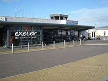
Exeter International Airport lies east of the city, and the local airline, previously called Jersey European and British European but now known as Flybe, is a significant local employer. It is also a base for Thomson Airways with flights to Faro, Mallorca, Lanzarote and elsewhere. The airport offers a range of scheduled flights to British and Irish regional airports and charter flights. Connections to international hubs began with Paris-Charles de Gaulle in 2005 and later a daily service to Amsterdam Schiphol Airport.
Canal
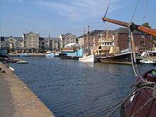
The Exeter Canal also known as the Exeter Ship Canal was first completed in about 1566,[97] making it one of the oldest artificial waterways in Britain. It was cut to bypass weirs that had been built across the River Exe to prevent trade in the city and to force boats to unload at Topsham from where the Earls of Devon were able to exact large tolls to transport goods to Exeter. Originally 3 feet deep and 16 feet wide (0.9 m by 5 m), it ran 1.75 miles (2.82 km) from just below the Countess Weir to the centre of Exeter. It was later extended to Topsham, deepened and widened, and was successful until the middle of the 19th century since when its use gradually declined – the last commercial use was in 1972. However it is now widely used for leisure purposes, and the city basin is being included as part of a £24 million redevelopment scheme.
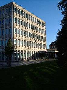
Education

The University of Exeter has two campuses in the city, both notable for their attractive parkland. It is one of the largest employers in the city. Exeter is one of the four main sites of the University of Plymouth. St Loye's School of Health Studies, which provides training in occupational therapy has now been incorporated into the University of Plymouth.
Exeter College is a further education college. It previously operated as the sole sixth form for the entire maintained school sector in the city. However, in 2014 Exeter Mathematics School was established, a free school sixth form with a specialism in Mathematics.
For about 30 years the city of Exeter operated a maintained school system in which the divisions between phases came at different ages from most of the United Kingdom, with first, middle and high rather than infant, junior and secondary schools, so that children transferred between schools at the age of about 8 and 12 rather than 7 and 11. From 2005, however, it has adopted the more usual pattern, because of the pressures of the UK National Curriculum. The changeover back to the more typical structure led to a citywide, PFI funded, rebuilding programme for the high schools and led to the changing of names for some schools. Following the reorganisation there are 25 primary schools, four referral schools, three special schools and five secondary schools within Exeter.[98] The secondary schools are Isca Academy (formerly Priory High School), St James School (formerly St James High School), St Luke's Science and Sports College (formerly Vincent Thompson High School), St Peter's Church of England Aided School (a consolidation of the former Bishop Blackall High School for Girls and Heles High School for Boys), and West Exe School (formerly St Thomas High School).
The city has a number of independent schools, including Exeter School, Exeter Cathedral School, The Maynard School, Bramdean School, St Wilfrid's School and Exeter Tutorial College.
There are specialist schools for pupils with sensory needs, including Exeter Royal Academy for Deaf Education, and the West of England School for the Partially Sighted.
The Atkinson Unit is a secure specialist residential and educational complex for children in care or remanded by the courts.
Religion
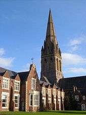
There are many churches in Exeter belonging to different Christian denominations and an Anglican cathedral. It is the seat of the Anglican Bishop of Exeter. The present building was complete by about 1400, and has the longest uninterrupted vaulted ceiling in England, and other notable features. The Anglican churches form the Exeter Deanery. The Catholic community has two main Churches, the Sacred Heart and the Blessed Sacrament, with congregations reflecting the nature of older and more recent immigration.
Exeter Synagogue, located off Mary Arches Street, was completed in 1763. Exeter's mosque and Islamic centre is on York Road. A purpose-built mosque is currently being constructed on the same site.
At the 2001 census, 69.12% of the population stated their religion as Christian, which is lower than the regional average of 73.99% and the national average of 71.74%. All other religions were under 1%, which was slighter higher than regional averages, although much lower than national averages, except for Buddhism, which was slightly higher than the average. 20.45% stated as having no religion, which was higher than the regional average of 16.75% and the national average of 14.59% and the percentage of people not stating their religion was also slightly higher.[99]
Anglican churches

John Betjeman (writing in 1958) selects St David's ("Caroe's best church"), St Martin's ("characteristic little city church, 15th century"), St Mary Steps ("medieval city church; font"), St Michael's ("Victorian, on a fine site"), and St. Thomas's ("fittings"). His coverage of St Mary Arches is more detailed: "worth seeing ... as the completest Norman church in Devon: beautifully light and airy after its restoration from the bombing in 1942. 18th-century altar arrangements. Memorials to Exeter worthies, 16th to 18th centuries."[100]
The churches include St David's, near Exeter St Davids Station. It is a fine building by W. D. Caroe and was built between 1897 and 1900. The tower stands on the northeast side, and the whole design is, according to Nikolaus Pevsner, "highly picturesque". Many of the windows are by Kempe & Tower. St Edmund-on-the-Bridge was built on the Exe Bridge ca. 1230–40. Two arches of the bridge remain under the undercroft though the church was rebuilt in the Perpendicular style in 1835, using the old materials.
St Martin's is in the Cathedral Close; the plan is odd, and there are numerous items of church furniture, though these are not of high aesthetic value. St Mary Arches is a Norman church with aisles. St Mary Steps was originally by the West Gate of the city; the font is Norman, and there is a remarkable early clock. St Michael, Heavitree was built in 1844–46 and extended later in the century. St Pancras is of the 13th century and has a nave and chancel only; the font is Norman. The plan of St Petroc's church is highly unusual: a second chancel has been added facing north while the original chancel has another use and faces east. There are two aisles on the south, one of 1413 and another of the 16th century.
St Sidwell's church is by W. Burgess, 1812, in the Perpendicular style. St Stephen's church is partly of the 13th century but most of the structure is as rebuilt in 1826.[101] St Michael and All Angels Church on Mount Dinham has a spire which exceeds the height of the towers of Exeter Cathedral.
Sport

The rugby union team Exeter Chiefs play its home games at Sandy Park on the edge of the city and regularly achieve attendances of over 9,000. They play in the Aviva Premiership and moved to their new home at Sandy Park in September 2006 at a cost of £15m from their old ground which they had used since 1905.[102] The Chiefs achieved promotion in the 2009–10 season following back to back victories over Bristol and have remained in the top division of English rugby. In the 2011–12 season the Chiefs finished in fifth place, earning a spot in the Heineken Cup. Exeter Chiefs picked up their first silverware when they beat the current league leaders Northampton 15-8 at Sandy Park in the 2014 LV Cup final.[103] The city also has two other clubs: Wessex Rugby Club, which is located in Exwick, and Exeter Saracens Rugby Club,[104] which is located in Whipton.
The city's professional football club is Exeter City. The club became founder members of the Football League's new Third Division (south) in 1920, but have never progressed beyond the third tier of the English football league system and in 2003 were relegated to the Conference, reclaiming their Football League place in 2008, before completing successive promotions to League One in 2009. They were relegated to League Two at the end of the 2011/12 season.
Exeter Cricket Club play in the Premier Division of the Devon Cricket League at both First and Second XI level.
Exeter Rowing Club enjoys much success both locally and nationally, and has a recorded history stretching back to the early 19th century.[105] The City of Exeter Rowing Regatta is run annually in July, and is the oldest and biggest regatta in the South West, with racing first recorded on the river in the 1860s.[106]
The Devon & Exeter Squash club is one of the most active squash clubs in the region, annually hosting the Exeter Diamonds which is a professional team of world class players. The club also has a strong membership, high standards and a notable junior team.
The Great West Run, a half marathon, is an annual run taking to the streets of Exeter, taking place on Sunday 13 October in 2013.
Exeter's speedway team, Exeter Falcons, was founded in 1929 and were located at the County Ground until its closure in 2005. In a fixture during the 2004 season, they beat Rye House by the maximum score of 75–18 scoring 5–1s in every heat. Exeter Falcons are hoping to ride again in a proposed new location, possibly at Exeter Racecourse in 2008. The site was where Exeter Falcons legend Australian Jack Geran trained youngsters in the art of the shale sport on a speedway training track in the late 1970s and early-1980s. Speedway was also staged briefly at tracks in Alphington and Peamore after the Second World War. The history of Speedway in Exeter up to the mid-1950s has been recorded in three books by Tony Lethbridge.
Rugby league team Exeter Centurions play in the South West Division of the Rugby League Conference.
There are two archery clubs in Exeter: the University of Exeter Archery Club,[107] and the Exeter Company of Archers.[107]
Notable people from Exeter
- See List of people from Exeter and Category:People from Exeter
Culture
Literature
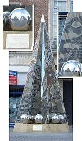
The Exeter Book, an original manuscript and one of the most important documents in Anglo-Saxon literature, is kept in the vaults of the cathedral. The Exeter Book dates back to the 10th century and is one of four manuscripts that between them contain virtually all the surviving poetry in Old English. It includes most of the more highly regarded shorter poems, some religious pieces, and a series of riddles, a handful of which are famously lewd. Some of the riddles are inscribed on a highly polished steel obelisk in the High Street, placed there on 30 March 2005.[108]
The Exon Domesday (so called from the preservation of the volume at Exeter), is a volume of Domesday Book that contains the full details which the original returns supplied, but only for part of south-west England, i.e. Cornwall, Devon, part of Somerset, part of Dorset and one manor of Wiltshire; it also contains a record of the geld of 1084 for the whole of these counties.[109][110][111]
One of Rosemary Sutcliff's best-known children's books, The Eagle of the Ninth, begins in Roman Isca Dumnoniorum. Lindsey Davis' Marcus Didius Falco was stationed with the Second Augusta legion in Isca, and revisits it in The Silver Pigs. The Crowner John Mysteries by Bernard Knight are a series of books set in 12th century Exeter.
Van Helsing, in Bram Stoker's Dracula, travels there.
Exeter is mentioned in Martin's Close, a short ghost story by M.R. James, first published in More Ghost Stories in 1911.
Theatre
The Northcott Theatre is located on the Streatham campus of the University of Exeter and is one of relatively few provincial English theatres to maintain its own repertory company. This theatre is the successor to the former Theatre Royal, Exeter.
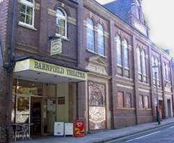
There are also three other theatres in Exeter. The Barnfield Theatre was converted in 1972 from the Barnfield Hall which was built towards the end of the 19th century by Exeter Literary Society. The theatre is a charity and is used as a venue for both amateur and professional theatrical companies. The Cygnet Theatre in Friars Walk is the home of the Cygnet Training Theatre and is a member of the Conference of Drama Schools. As well as performances given by students in training, this theatre also stages performances from visiting repertory companies and has a good reputation for quality events. In September 2010, the Bike Shed Theatre opened in basement premises of a shop at the upper end of Fore Street, providing an intimate environment for theatre, comedy and live music.
In addition, more innovative and contemporary performances, theatrical productions and dance pieces are programmed by Exeter Phoenix off Gandy Street in the City Centre and The Exeter Corn Exchange in Market Street.
Music
There are two festivals each year, of all the arts but with a particular concentration of musical events: the annual "Vibraphonic"[112] festival held in March provides a fortnight of soul, blues, jazz, funk, reggae and electronic music. The largest orchestra based in Exeter is the EMG Symphony Orchestra[113] which presents regular concerts at the University of Exeter and in Exeter Cathedral.
Museums and galleries
- The city museum is the Royal Albert Memorial Museum in Queen Street. The museum recently underwent extensive refurbishment. It reopened on 14 December 2011, and was subsequently awarded the National Art Fund Prize – UK Museum of the Year 2012.[114] The Museum also runs St Nicholas Priory which is just off Fore Street.
- Exeter Phoenix and the adjacent digital Media Centre occupies the former university site in Gandy Street and programmes international, national and outstanding regional artists.
- The Spacex (art gallery) shows exhibitions of contemporary art and promotes artist-led projects, events and research.
Newspapers
- Express and Echo, twice-weekly with a Monday edition and a Thursday edition.
- The Exeter Times, formerly known as the Exeter Leader, a free weekly paper which ceased publication in 2011.[115]
- Exeter Flying Post, weekly (discontinued 1917, but title revived in 1976 as an alternative community magazine).
- The Western Morning News, a Plymouth-printed daily regional paper, is also popular.
- Exeposé, the University's student paper printed fortnightly, also gets a bit of local attraction and has Exeter-related local news in it.
Radio
BBC Radio Devon broadcasts to Exeter locally on FM (95.8) and AM (990 AM/MW), although the majority of programming comes from Plymouth. In the evenings, BBC Radio Devon joins the South West Regional service. Heart South West, formerly Gemini FM and Devonair, covers the city on 97.0 FM, with East Devon and Torbay using their own frequencies. Both Heart and BBC Devon broadcast from the St. Thomas transmitter, which also provides the city with television coverage; AM radio is broadcast from Pearce's Hill next to J31 of the M5. Other radio stations include Exeter FM, an easy listening station broadcasting on 107.3 FM, Phonic.FM which provides a "no adverts no playlist" alternative on 106.8 FM or online at www.phonic.fm, VI, a station broadcasting from the West of England School and College on 1386 AM/MW. The University has a well established student station, Xpression FM, which broadcasts on 87.7 FM using two low-powered transmitters, although it can be heard over much of the north of the city.
The local commercial radio station is Radio Exe.
Television
BBC Spotlight and ITV Westcountry provide Exeter with regional news outputs. The majority of the local BBC output originates in Plymouth, and ITV Westcountry is broadcast from Bristol. Both services have newsrooms in Exeter. The St Thomas and Stockland Hill transmitting station cover the city, with both transmitters now having completed the digital switchover.
Twin towns

Exeter is twinned with Rennes in France,[116] Bad Homburg in Germany, Yaroslavl in Russia, and Terracina in Italy.[117]
See also
References
- ↑ "Standard Area Measurements - Local Authorities - Dec 2010 (SAM_LAD_DEC_2010_UK)". UK Standard Area Measurements (SAM). Office for National Statistics. 31 December 2010. Retrieved 1 October 2011.
- ↑ "Population estimates for UK mid-2014 analysis tool" (zip). Office for National Statistics. 25 June 2015. Retrieved 27 June 2015.
- 1 2 3 4 "Ethnic Group, 2011". Office for National Statistics. 30 January 2013. Retrieved 18 July 2013.
- 1 2 Eilert Ekwall (1981). The Concise Oxford Dictionary of English Place-names. Oxford University Press. p. 171. ISBN 0-19-869103-3.
- ↑ Eilert Ekwall (1981). The Concise Oxford Dictionary of English Place-names. Oxford [Eng.]: OUP. p. 171. ISBN 0-19-869103-3.
- ↑ Owen, H.W. & Morgan, R. 2007 Dictionary of the Place-names of Wales Gomer Press, Ceredigion; Gwasg Gomer / Gomer Press; page 484.
- ↑ Hoskins (2004), pp. 4–5.
- ↑ Hoskins (2004), p. 1.
- 1 2 Bidwell, Paul T. Roman Exeter: Fortress and Town, p. 56. Exeter City Council (Exeter), 1980. ISBN 0-86114-270-5.
- ↑ "The Celtic Tribes of Britain: The Dumnonii". Roman Britain Organisation. Retrieved 5 July 2012.
- ↑ "isca dvmnoniorvm". Roman Britain Organisation. Retrieved 5 July 2012.
- ↑ "Great Sites: Exeter Roman Baths". British Archaeology magazine. June 2002. Retrieved 12 July 2008.
- ↑ "The Roman Fortress at Exeter: the Roman Bath House". Archived from the original on 4 June 2008. Retrieved 12 July 2008.
- ↑ Jones, Claire (16 January 2015). "Excavation plans for Exeter's Roman Baths". BBC.
- ↑ Bidwell (1980), p. 59.
- ↑ Bidwell (1980), pp. 69–76 & 80.
- ↑ Hoskins, William George. Two Thousand Years in Exeter, rev. ed., p. 14. Phillimore (Chicester), 2004. ISBN 1-86077-303-6.
- ↑ Nennius (attrib.). Theodor Mommsen (ed.). Historia Brittonum, VI. Composed after AD 830. (Latin) Hosted at Latin Wikisource.
- ↑ Newman, John Henry & al. Lives of the English Saints: St. German, Bishop of Auxerre, Ch. X: "Britain in 429, A. D.", p. 92. James Toovey (London), 1844.
- ↑ Ford, David Nash. "The 28 Cities of Britain" at Britannia. 2000.
- ↑ Hoskins 2004, p. 15
- ↑ Sellman (1985), p. 16.
- ↑ Hoskins (2004), pp. 15–16.
- ↑ Hoskins (2004), p. 159.
- 1 2 3 4 Hoskins (2004), p. 23.
- 1 2 Sellman (1985), p. 17.
- ↑ Higham (2008), p. 47.
- ↑ Higham (2008), p. 19.
- ↑ Hoskins (2004), pp. 26–27.
- ↑ Hoskins (2004), pp. 31–32.
- ↑ "Danes Castle". Exeter Memories. 4 November 2009. Retrieved 16 September 2012.
- ↑ "The Exe Bridge, Exeter". Devon County Council. Retrieved 30 August 2014.
- ↑ Letters, Samantha. "Online Gazetteer of Markets and Fairs in England & Wales to 1516: Devon". Centre for Metropolitan History, Institute of Historical Research. Retrieved 26 July 2009.
- ↑ Stoyle, Mark (2014). Water in the City: The Aqueducts and Underground Passages of Exeter. Exeter: University of Exeter Press. pp. passim. ISBN 9780859898775.
- ↑ Stoyle, Mark (2003). Circled with Stone: Exeter's City Walls, 1485-1660. Exeter: University of Exeter Press. pp. 78–80, 190–91. ISBN 9780859897273.
- ↑ "Exeter's Coat of Arms". Exeter City Council website. Retrieved 13 July 2008.
- ↑ Stoyle, Mark (1996). From Deliverance to Destruction: Rebellion and Civil War in an English City. Exeter: University of Exeter Press. pp. 62–108. ISBN 9780859894784.
- ↑ Hoskins, W.G. (2003). Devon. Phillimore and Co. pp. 196–198. ISBN 978-1-86077-270-2.
- ↑ Gray 2000, p.16
- ↑ Gray 2000, p.18
- ↑ Gray 2000, p.31
- ↑ Oliver, George (1861). History of the City of Exeter. p. 107. ISBN 0-217-79997-3.
- 1 2 "History of the Exe Bridges". Exeter Memories. Retrieved 15 September 2012.
- ↑ Shapter, Thomas (1848). The History of the Cholera in Exeter 1832. ISBN 0-85409-674-4.
- ↑ Neville, Julia (2010). Exeter and the Trams 1882–1931. Exeter Civic Society. p. 27. ISBN 978-0-9544343-1-1.
- ↑ Neville, Julia (2010). Exeter and the Trams 1882–1931. Exeter Civic Society. pp. 18–19. ISBN 978-0-9544343-1-1.
- ↑ Neville, Julia (2010). Exeter and the Trams 1882–1931. Exeter Civic Society. p. 30. ISBN 978-0-9544343-1-1.
- ↑ Neville, Julia (2010). Exeter and the Trams 1882–1931. Exeter Civic Society. pp. 86–89. ISBN 978-0-9544343-1-1.
- ↑ Neville, Julia (2010). Exeter and the Trams 1882–1931. Exeter Civic Society. pp. 76–78. ISBN 978-0-9544343-1-1.
- ↑ Neville, Julia (2010). Exeter and the Trams 1882–1931. Exeter Civic Society. pp. 104–124. ISBN 978-0-9544343-1-1.
- 1 2 Payne, John (2011). The West Country: A Cultural History. Andrews UK Limited. p. 176. ISBN 978-1-908-49350-7.
- ↑ "The Exeter floods of the 1960s". Exeter Memories. 28 October 2010. Retrieved 15 September 2012.
- ↑ "Doors open at Princesshay". BBC Devon. 20 September 2007. Retrieved 21 September 2007.
- ↑ "Heaven for shoppers as Princesshay gets off to a flying start with huge crowds for opening day". Express & Echo. 21 September 2007. Retrieved 21 September 2007.
- ↑ "High Street revamp plans criticised". BBC News Online. 4 March 2003. Retrieved 21 September 2007.
- ↑ "Key facts about Princesshay". Princesshay.com. Land Securities Group. Retrieved 21 September 2007.
- ↑ "Shopmobility". Exeter Community Transport Association. Retrieved 13 July 2008.
- ↑ "Nail-bomber given life sentence". BBC News Online. 30 January 2009. Retrieved 15 September 2012.
- ↑ "Exeter flood defence scheme".
- ↑ "Architecture experts mourn loss of "irreplaceable" interior in building where fire started", Express & Echo, 29 October 2016. Retrieved 29 October 2016
- ↑ Exeter fire wrecks 'oldest hotel in England' BBC
- ↑ Exeter blaze destroys hotel thought to be oldest in Britain The Guardian
- ↑ "The Coalition: our programme for government" (PDF). HM Government, United Kingdom. 20 May 2010. Retrieved 24 May 2010.
- ↑ Hennessy, Patrick (22 May 2010). "The Queen's Speech: Bill by Bill". The Daily Telegraph. Retrieved 24 May 2010.
- ↑ "The hundreds of devon". GENUKI. Retrieved 18 June 2011.
- ↑ Oliver, George (1861). History of the City of Exeter. p. 1. ISBN 0-217-79997-3.
- ↑ DEFRA. "Southwest EDRP Geographical Area and Physical Context". Retrieved 13 July 2008.
- ↑ "June 1976". Retrieved 5 March 2016.
- ↑ "December 2010". Retrieved 5 March 2016.
- ↑ "Exeter 1981–2010 averages". Met Office. Retrieved 4 November 2012.
- ↑ "Exeter extreme values". KNMI. Retrieved 8 November 2011.
- ↑ "Key Figures for 2011 Census: Key Statistics". Office for National Statistics. Retrieved 18 July 2013.
- ↑ "Key Figures for 2001 Census: Key Statistics". Census 2001. The Office for National Statistics. Retrieved 19 July 2013.
- ↑ "Ethnic Group, 2001". Office for National Statistics. 9 November 2004. Retrieved 19 July 2013.
- ↑ https://www.nomisweb.co.uk/census/2011/ks201ew
- ↑ http://www.neighbourhood.statistics.gov.uk/dissemination/LeadPage.do?pageId=1001&tc=1462006029195&a=7&b=6275100&c=exeter&d=13&e=13&f=27655&g=6415645&i=1001x1003x1004x1005&l=1812&o=322&m=0&r=1&s=1462006029195&enc=1
- ↑ http://www.citypopulation.de/UK-EnglandUA.html?cityid=7160
- ↑ "Exeter commuters". Exeter City Council. Retrieved 1 June 2011.
- ↑ "EHOD population" (PDF). Exeter City Council. Retrieved 1 February 2009.
- ↑ Dun & Bradstreet, 2001
- ↑ "Traders hit back after 'clone town' attack". Western Morning News. 15 September 2010. Retrieved 15 August 2016.
- ↑ South West Tourism (2006), The Value of Tourism in Devon 2005. Exeter: SWT
- ↑ "Exeter Growth Point". Devon County Council. 1 January 2011. Retrieved 1 January 2011.
- ↑ St Nicholas Priory: Discover a Tudor Home Booklet produced by Exeter City Council (July 2009)
- ↑ Stoyle, Mark (April 2011). "It is but an old wytche gonne': Prosecution and Execution for Witchcraft in Exeter, 1558-1610". History. 96 (2): 129–51.
- ↑ Sharpe, James (1996). Instruments of Darkness: Witchcraft in England, 1550-1750. London: Hamish Hamilton. p. 121.
- ↑ See for example: Hele's School Historical Society. (1947). Exeter – Then and Now. A. Wheaton & Co. p. 31.
- ↑ "Guard House and attached wall Wyvern Barracks". English Heritage. Retrieved 18 April 2014.
- ↑ "The Higher Barracks, or Cavalry Barracks - Howell Road". Exeter memories. Retrieved 9 November 2014.
- ↑ Historic England. "Devon County War Memorial and Processional Way (1393228)". National Heritage List for England.
- ↑ "The changing face of Bridge Road in Exeter". Devon County Council. 24 March 2016. Retrieved 15 August 2016.
- ↑ "Drivers facing congestion charge". BBC News. 7 November 2006. Retrieved 13 July 2008.
- ↑ Harris, Nigel (2008). "Taking trains back to Tavistock". Rail. Bauer (590): 40–45.
- ↑ "UK storms destroy railway line and leave thousands without power". BBC Online. Retrieved 5 February 2014.
- ↑ "Dawlish's storm-damaged railway line reopens". BBC news. 4 April 2014. Retrieved 4 April 2014.
- ↑ "Network Rail chooses Dawlish alternative route". BBC News. 10 February 2014. Retrieved 10 February 2014.
- ↑ Clew, Kenneth R. (1984). The Exeter Canal. Chichester: Phillimore. ISBN 0-85033-544-2.
- ↑ "Schools, locations and details". Devon County Council website. Retrieved 19 July 2008.
- ↑ "Religion". United Kingdom Census 2001. Office for National Statistics. 1 April 2001. Retrieved 11 January 2009.
- ↑ Betjeman, John, ed. (1968) Collins Pocket Guide to English Parish Churches; the South. London: Collins; p. 164
- ↑ Pevsner, N. (1952) South Devon. Harmondsworth: Penguin Books; pp. 148–53
- ↑ "Exeter Chiefs – History". Retrieved 9 March 2013.
- ↑ Osborne, Chris (16 March 2014). "Cup final: Exeter Chiefs 15-8 Northampton Saints". BBC.
- ↑ "Exeter Saracens Rugby Football Club Website". Retrieved 19 July 2008.
- ↑ "History – Exeter Rowing Club". Retrieved 15 September 2012.
- ↑ "About the regatta". Retrieved 15 September 2012.
- 1 2 "Devon and Cornwall Archery Society Affiliated Clubs". Devon and Cornwall Archery Society. Retrieved 7 February 2011.
- ↑ The Riddle of the new Exeter Statue (retrieved 19 November 2010)
- ↑ Thorn, C., et al. (1979) Cornwall. (Domesday; vol. 10.) Chichester: Phillimore
- ↑ The Record Commission published the text in 1816 in vol. 3 of Domesday Book (including an account by Sir Henry Ellis). V. H. Galbraith gives a contents table of Exeter Domesday in his Domesday Book, 1974, pp. 184–88. R. W. Finn The Liber Exoniensis, 1964; and N. R. Ker Medieval Manuscripts in British Libraries, vol 2, pp. 800–07 are useful sources of information.
- ↑ "Liber Exoniensis". Retrieved 24 April 2010.
- ↑ "Vibraphonic 2011 website". Vibraphonic 2011 Festival website.
- ↑ "EMG Symphony Orchestra website". Retrieved 19 July 2008.
- ↑ "Royal Albert Memorial Museum". RAM Museum Website.
- ↑ "Exeter Times (defunct)". British Newspapers Online. Retrieved 17 September 2012.
- ↑ "British towns twinned with French towns [via WaybackMachine.com]". Archant Community Media Ltd. Archived from the original on 5 July 2013. Retrieved 20 July 2013.
- ↑ "Town twinning". Exeter City Council. Retrieved 16 September 2012.
Sources and further reading
- Gray, Todd (2000). Exeter: The Traveller's Tales. Exeter: The Mint Press. ISBN 1-903356-00-8.
- Higham, Robert (2008). Making Anglo-Saxon Devon. Exeter: The Mint Press. ISBN 978-1-903356-57-9.
- Hoskins, W. G. (2004). Two Thousand Years in Exeter (Revised and updated ed.). Chichester: Phillimore. p. 23. ISBN 1-86077-303-6.
- Sellman, R.R. (1985). Aspects of Devon History (New ed.). Exeter: Devon Books. ISBN 0-86114-756-1.
- Sharp, Thomas (1946). Exeter Phoenix: A Plan for Rebuilding. London: The Architectural Press.
- Stoyle, Mark (2003). Circled With Stone: Exeter's City Walls, 1485–1660. Exeter: University of Exeter Press. ISBN 978-0-85989-727-3.
- Stoyle, Mark (1996). From Deliverance to Destruction: Rebellion and Civil War in an English City. Exeter: University of Exeter Press. ISBN 978-0-85989-478-4.
- Stoyle, Mark (2014). Water in the City: The Aqueducts and Underground Passages of Exeter. Exeter: University of Exeter Press. ISBN 978-0-85989-877-5.
External links
| Wikimedia Commons has media related to Exeter. |
| Wikivoyage has a travel guide for Exeter. |
- Exeter City Council
- History of Exeter from White's Devonshire Directory, 1850
- Exeter at DMOZ
- Exeter in the Domesday Book