Litchfield, California
| Litchfield | |
|---|---|
| census-designated place | |
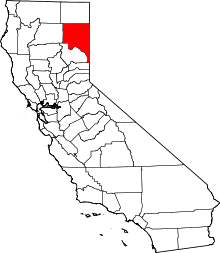
 Litchfield Location in California | |
| Coordinates: 40°22′58″N 120°23′14″W / 40.38278°N 120.38722°WCoordinates: 40°22′58″N 120°23′14″W / 40.38278°N 120.38722°W | |
| Country |
|
| State |
|
| County | Lassen County |
| Area[1] | |
| • Total | 3.945 sq mi (10.217 km2) |
| • Land | 3.945 sq mi (10.217 km2) |
| • Water | 0 sq mi (0 km2) 0% |
| Elevation[2] | 4,065 ft (1,239 m) |
| Population (2010) | |
| • Total | 195 |
| • Density | 49/sq mi (19/km2) |
| Time zone | Pacific (PST) (UTC-8) |
| • Summer (DST) | PDT (UTC-7) |
| GNIS feature IDs | 252725; 2628751 |
| U.S. Geological Survey Geographic Names Information System: Litchfield, California; U.S. Geological Survey Geographic Names Information System: Litchfield, California | |
Litchfield is a census-designated place[3] in Lassen County, California.[2] It is located 15 miles (24 km) east of Susanville,[4] at an elevation of 4065 feet (1239 m).[2] The population was 195 at the 2010 census.
History
The first post office at Litchfield opened in 1914, and moved in 1941.[4] The name honors pioneer Thomas Litch.[4]
Geography
According to the United States Census Bureau, the CDP has a total area of 3.9 square miles (10.2 km²), all land.
Climate
This region experiences warm (but not hot) and dry summers, with no average monthly temperatures above 71.6 °F. According to the Köppen Climate Classification system, Litchfield has a warm-summer Mediterranean climate, abbreviated "Csb" on climate maps.[5]
Demographics
The 2010 United States Census[6] reported that Litchfield had a population of 195. The population density was 49.4 people per square mile (19.1/km²). The racial makeup of Litchfield was 176 (90.3%) White, 0 (0.0%) African American, 0 (0.0%) Native American, 0 (0.0%) Asian, 0 (0.0%) Pacific Islander, 14 (7.2%) from other races, and 5 (2.6%) from two or more races. Hispanic or Latino of any race were 25 persons (12.8%).
The Census reported that 195 people (100% of the population) lived in households, 0 (0%) lived in non-institutionalized group quarters, and 0 (0%) were institutionalized.
There were 77 households, out of which 22 (28.6%) had children under the age of 18 living in them, 41 (53.2%) were opposite-sex married couples living together, 4 (5.2%) had a female householder with no husband present, 10 (13.0%) had a male householder with no wife present. There were 11 (14.3%) unmarried opposite-sex partnerships, and 0 (0%) same-sex married couples or partnerships. 12 households (15.6%) were made up of individuals and 5 (6.5%) had someone living alone who was 65 years of age or older. The average household size was 2.53. There were 55 families (71.4% of all households); the average family size was 2.80.
The population was spread out with 46 people (23.6%) under the age of 18, 16 people (8.2%) aged 18 to 24, 39 people (20.0%) aged 25 to 44, 64 people (32.8%) aged 45 to 64, and 30 people (15.4%) who were 65 years of age or older. The median age was 43.9 years. For every 100 females there were 97.0 males. For every 100 females age 18 and over, there were 101.4 males.
There were 94 housing units at an average density of 23.8 per square mile (9.2/km²), of which 52 (67.5%) were owner-occupied, and 25 (32.5%) were occupied by renters. The homeowner vacancy rate was 0%; the rental vacancy rate was 24.2%. 105 people (53.8% of the population) lived in owner-occupied housing units and 90 people (46.2%) lived in rental housing units.
Politics
In the state legislature, Litchfield is in the 1st Senate District, represented by Republican Ted Gaines,[7] and the 1st Assembly District, represented by Republican Brian Dahle.[8]
Federally, Litchfield is in California's 1st congressional district, represented by Republican Doug LaMalfa.[9]
References
- ↑ U.S. Census
- 1 2 3 U.S. Geological Survey Geographic Names Information System: Litchfield, California
- ↑ U.S. Geological Survey Geographic Names Information System: Litchfield, California
- 1 2 3 Durham, David L. (1998). California's Geographic Names: A Gazetteer of Historic and Modern Names of the State. Clovis, Calif.: Word Dancer Press. p. 393. ISBN 1-884995-14-4.
- ↑ Climate Summary for Litchfield, California
- ↑ "2010 Census Interactive Population Search: CA - Litchfield CDP". U.S. Census Bureau. Retrieved July 12, 2014.
- ↑ "Senators". State of California. Retrieved March 10, 2013.
- ↑ "Members Assembly". State of California. Retrieved March 2, 2013.
- ↑ "California's 1st Congressional District - Representatives & District Map". Civic Impulse, LLC. Retrieved March 3, 2013.