Logoly State Park
| Logoly State Park | |
|---|---|
| Arkansas state park | |
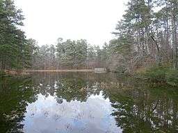 A three-acre lake at Logoly State Park | |
| Country | United States |
| State | Arkansas |
| Regions | Gulf Coastal Plain, Mississippi Delta |
| County | Columbia |
| City | McNeil |
| Location | [1] |
| - coordinates | 33°20′39″N 93°11′13″W / 33.34417°N 93.18694°WCoordinates: 33°20′39″N 93°11′13″W / 33.34417°N 93.18694°W |
| Area | 368 acres (149 ha) [2] |
| Opened | May 19, 1978 [2] |
| Managed by | Arkansas Department of Parks and Tourism |
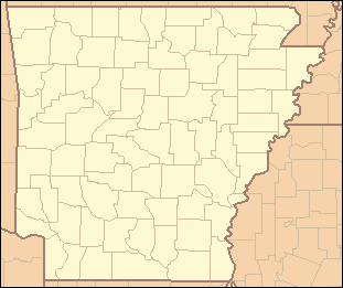 Location of Logoly State Park in Arkansas | |
| Website : Logoly State Park | |
Logoly State Park is one of the 52 state parks of the Arkansas State Parks System, located in the Gulf Coastal Plain, 6 miles (10 km) north of Magnolia, 0.75 miles (1.2 km) east of McNeil, off U.S. Route 79 on Loyola Road (County Road 47) in southwestern Arkansas in the United States. The 368-acre (1.49 km2) park surrounds an area of mineral springs that have been known for over a century.
See also
- List of Arkansas state parks
-
 Arkansas portal
References
- ↑ Logoly State Park Guide (PDF). Arkansas Department of Parks and Tourism. 2005. Retrieved June 17, 2014.
- 1 2 Staff of the Arkansas Department of Parks and Tourism (2011). "Logoly State Park". The Encyclopedia of Arkansas History and Culture. The Central Arkansas Library System. Retrieved June 17, 2014.
External links
This article is issued from Wikipedia - version of the 7/14/2015. The text is available under the Creative Commons Attribution/Share Alike but additional terms may apply for the media files.