Longriggend
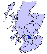
Longriggend is a village in North Lanarkshire, Scotland, with a population of approximately 200. It is situated on moorland 8 km north-east of Airdrie, in the parish of New Monkland. The village appeared on a map by Pont in 1596, under the name of Langrodge, and on another map by Roy c1754. Slamannan Railway joined Longriggend with Airdrie and the Union Canal in 1840, but its gauge prevented its connection with the Edinburgh & Glasgow Railway. Coal pits in the area used the railway extensively, and by 1895 there was a station at Longriggend. By 1901 its population had reached over 1500, and it had a post and telegraph office, and an inn nearby.[1]
The Ordnance Survey in 1867 also recorded a Roman Catholic school in the village.[2]
References
- ↑ The Making of Scotland, Robin Smith, Canongate Books Ltd, 2001, ISBN 1-84195-170-6
- ↑ History of Longriggend, accessed 18 February 2011
| Wikimedia Commons has media related to Longriggend. |
Coordinates: 55°54′35″N 3°53′07″W / 55.9097°N 3.8852°W