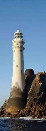
Loop Head
 Loop Head Lighthouse operated by the Commissioners of Irish Lights | |
 Loop Head Lighthouse Ireland | |
| Location | Loop Head |
|---|---|
| Coordinates | 52°33′39.5″N 9°55′54.3″W / 52.560972°N 9.931750°W |
| Year first constructed | 1854 |
| Automated | 1991 |
| Construction | masonry tower |
| Tower shape | cylindrical tower with balcony and lantern |
| Markings / pattern | white tower, red balcony rail |
| Height | 23 metres (75 ft) |
| Focal height | 84 metres (276 ft) |
| Current lens | 1st order Fresnel lens |
| Range | 23 nautical miles (43 km; 26 mi) |
| Characteristic | Fl (4) W 20s |
| Admiralty number | A6338 |
| NGA number | 7528 |
| ARLHS number | IRE-050 |
| Ireland number | CIL-2130[1] [2] |
Loop Head (Irish: Ceann Léime, meaning "leap head"),[3][4][5] is a headland on the north side of the mouth of the River Shannon, in County Clare in the west of Ireland.
Loop Head is marked by a prominent lighthouse. The opposite headland on the south side of the Shannon is Kerry Head. The Shannon Foynes Port Company controls navigation in the Shannon estuary and river.[6]
Loop Head peninsula, has the Atlantic Ocean on one side and the Shannon Estuary on the other, with barely a mile of land saving it from island status.
In 2010, the Loop Head peninsula was awarded a European Destinations of Excellence Award, which is an EU accolade for emerging tourism destinations which are developing in a responsible and sustainable manner.[7] In 2013, Loop Head was named the “Best Place to Holiday in Ireland” by The Irish Times,[8] and was shortlisted in the Best Destination category at the World Responsible Tourism awards. The Loop Head Peninsula is the only Irish destination listed in the 2014 Global Sustainable Top 100 Destinations and in 2015 took the Gold medal at the Irish Responsible Tourism Awards.
See also
References
- ↑ Loop Head Lighthouse Commissioners of Irish Lighthouses
- ↑ Lighthouses Directory
- ↑ Ceann Léime, Irish Placenames Database. Retrieved: 2010-08-13.
- ↑ Parish of Kilballyowen (b), Ordnance Survey Letters by John O'Donovan and Eugene Curry, 1839. Clare County Library. Retrieved: 2010-08-13
- ↑ Clare Topography, A Topographical Dictionary of Ireland by Samuel Lewis, 1837. LibraryIreland.com. Retrieved: 2010-08-13
- ↑ "Shannon Foynes Port Company - Deepwater multimodal port - serving Ireland's west, south and midlands". Shannon Foynes Port Company. Retrieved 2011-07-07.
- ↑ Proposed suspension bridge would link Bishop's Island with Clare coast
- ↑ "Loop Head takes the holiday crown in 'Irish Times' competition: Co Clare area won an Eden award, which recognises sustainable tourism, in 2010". The Irish Times. 27 May 2013. Retrieved 27 May 2013.
External links
- Awarded "EDEN - European Destinations of Excellence" non traditional tourist destination 2010
- Commissioners of Irish Lights
Coordinates: 52°33′N 9°56′W / 52.550°N 9.933°W
