Lot 5, Prince Edward Island
| Lot 5, Prince Edward Island | |
|---|---|
| Township | |
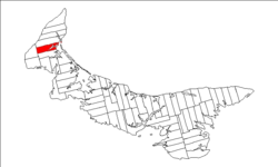 Map of Prince Edward Island highlighting Lot 5 | |
| Coordinates: 46°45′N 64°12′W / 46.750°N 64.200°WCoordinates: 46°45′N 64°12′W / 46.750°N 64.200°W | |
| Country | Canada |
| Province | Prince Edward Island |
| County | Prince County |
| Parish | Egmont Parish |
| Area | |
| • Total | 80.61 km2 (31.12 sq mi) |
| Population (2006) | |
| • Total | 1,253 |
| • Density | 15.5/km2 (40/sq mi) |
| Time zone | AST (UTC-4) |
| • Summer (DST) | ADT (UTC-3) |
| Canadian Postal code | C0B |
| Area code(s) | 902 |
| NTS Map | 011L06 |
| GNBC Code | BAERK |
Lot 5 is a township in Prince County, Prince Edward Island, Canada created during the 1764-1766 survey of Samuel Holland. It is part of Egmont Parish.
Communities
Incorporated municipalities:
Civic address communities:
- Alberton
- Bloomfield
- Bloomfield Corner
- Brooklyn
- Cascumpec
- Duvar
- Forestview
- Fortune Cove
- Glengarry
- Howlan
- Mill River East
- Northport
- Piusville
- Rosebank
- Union
- Woodstock
History
Lot 5 was awarded to Edward Lewis in the 1767 land lottery while Lewis was the Member of Parliament (MP) for Radnor. The township became jointly owned with John Hill in 1779 and subsequently went through various owners under feudalism when Prince Edward Island was a British colony prior to Canadian Confederation. [1]
References
- ↑ Clark, Andrew Hill (1959). Three Centuries and the Island. Toronto Press. pp. Appendix B.
| Subdivisions | |
|---|---|
| Cities | |
| Towns | |
| Incorporated communities |
|
| Unincorporated communities | |
| Townships | |
| |
This article is issued from Wikipedia - version of the 10/8/2014. The text is available under the Creative Commons Attribution/Share Alike but additional terms may apply for the media files.