Low Rocky Point
| Low Rocky Point | |
| Peninsula | |
| Country | Australia |
|---|---|
| State | Tasmania |
| Region | South West |
| Location | South West Tasmania |
| - coordinates | 42°59′24″S 145°29′24″E / 42.99000°S 145.49000°ECoordinates: 42°59′24″S 145°29′24″E / 42.99000°S 145.49000°E |
| UNESCO World Heritage Site | |
| Name | Tasmanian Wilderness |
| Year | 1982 (#6) |
| Number | 181 |
| Region | Oceania |
| Criteria | Mixed |
| National park | Southwest NP |
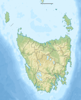
 Location of Low Rocky Point in Tasmania | |
The Low Rocky Point is a location on the south west coast of Tasmania, Australia, that is used a location for weather forecasting. It is almost due west of Hobart, it is south of Point Hibbs and north of South West Cape.[1]
Location and features
Wrecks and other events in the region use the location as a reference point [2][3][4]
In the early twentieth century, the need for a light was canvassed [5][6][7]
It is also an important reference point for nautical maps.[8][9]
To the south east and east of the point is Elliott Bay. North of the point is the Lewis River, and the next headland south is Elliot Point approximately 20 kilometres (12 mi) south east. High Rocky Point lies less than 20 kilometres (12 mi) to the north.[10][11][12]
It is also a location on the west coast walking track between Cape Sorell and Port Davey[10]
See also
References
- ↑ "WEST PASSAGE.". The Mercury. Hobart, Tas.: National Library of Australia. 15 December 1938. p. 2. Retrieved 11 July 2011.
- ↑ "TASMANIA.". The Sydney Morning Herald. National Library of Australia. 16 January 1905. p. 8. Retrieved 11 July 2011.
- ↑ "Divers find fishermen's bodies.". The Canberra Times. National Library of Australia. 23 December 1993. p. 5. Retrieved 3 March 2014.
- ↑ "THE WRECK OF THE BRIARHOLME.". The West Australian. Perth: National Library of Australia. 16 January 1905. p. 7. Retrieved 3 March 2014.
- ↑ "THE WEST COAST.". Zeehan and Dundas Herald. Tas.: National Library of Australia. 12 July 1909. p. 4. Retrieved 3 March 2014.
- ↑ "WEST PASSAGE.". The Mercury. Hobart, Tas.: National Library of Australia. 15 December 1938. p. 2. Retrieved 3 March 2014.
- ↑ ""FAULTY CHARTING AND TOO FEW LIGHTS".". The Mercury. Hobart, Tas.: National Library of Australia. 14 December 1938. p. 5. Retrieved 3 March 2014.
- ↑ Australian Government; Royal Australian Navy (2008). Trial Harbour to Low Rocky Point, Tasmania [cartographic material] (Map) (No. 1 ed.). 1:150,000. Hydrographic charts of Australian, Papua New Guinean and Antarctic waters; AUS 792. Wollongong, NSW: Australian Hydrographic Service.
Mercator proj. (E 144°34'30"--E 145°33'54"/S 41°49'12"--S 43°04'24"). World Geodetic System 1984 (WGS84)
- ↑ Australian Government; Royal Australian Navy (2008). Hunter island to Low Rocky Point, Tasmania [cartographic material] (Map) (No. 1 ed.). 1:300,000. Hydrographic charts of Australian, Papua New Guinean and Antarctic waters; AUS 353. Wollongong, NSW: Australian Hydrographic Service.
- 1 2 Chapman, John (2008). South west Tasmania (5th ed.). John Chapman. pp. 180–191. ISBN 978-1-920995-03-4.
Low Rocky Point is a potential helicopter 'supply dump' for walkers.
- ↑ Moore, Thomas. The Last Explorer. pp. 219–232.
- ↑ Binks, C. J. (1980). Explorers of Western Tasmania. Launceston: Mary Fisher Bookshop. ISBN 0-908291-16-7.