Luc-en-Diois
| Luc-en-Diois | |
|---|---|
|
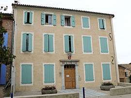
Town hall | |
 Luc-en-Diois | |
|
Location within Auvergne-Rhône-Alpes region  Luc-en-Diois | |
| Coordinates: 44°36′56″N 5°27′12″E / 44.6156°N 5.4533°ECoordinates: 44°36′56″N 5°27′12″E / 44.6156°N 5.4533°E | |
| Country | France |
| Region | Auvergne-Rhône-Alpes |
| Department | Drôme |
| Arrondissement | Die |
| Canton | Luc-en-Diois |
| Intercommunality | Diois |
| Government | |
| • Mayor (2008–2014) | Raymond Parent |
| Area1 | 23.49 km2 (9.07 sq mi) |
| Population (2008)2 | 533 |
| • Density | 23/km2 (59/sq mi) |
| Time zone | CET (UTC+1) |
| • Summer (DST) | CEST (UTC+2) |
| INSEE/Postal code | 26167 / 26310 |
| Elevation |
501–1,245 m (1,644–4,085 ft) (avg. 581 m or 1,906 ft) |
|
1 French Land Register data, which excludes lakes, ponds, glaciers > 1 km² (0.386 sq mi or 247 acres) and river estuaries. 2 Population without double counting: residents of multiple communes (e.g., students and military personnel) only counted once. | |
Luc-en-Diois (Latin: Lucus Augusti or Lucus) is a commune in the Drôme department in southeastern France. It is situated on the Drôme River.
History
The Latin name of Luc-en-Diois, Lucus Augusti or Lucus for short, evokes a crowned wood of the Gauls. Perhaps this is the origin of this Roman capital installed in the first century BC at the foot of the mountains of Diois. It shared with Vaison-la-Romaine the title of chief city of Vocontii, an important romanized Gallic people. (Tacitus, Hist. i. 66, calls it municipium Vocontiorum; Pliny iii. 4).
Lucus was incorporated into the Roman province of Gallia Narbonensis, and is placed by the Antonine Itinerary on a road from Vapincum (modern Gap) to Lugdunum (modern Lyon): it is the first stage after Mons Seleucus, and lies between Mons Seleucus and Dea Vocontiorum (modern Die).
The vestiges of the ancient city, which one supposes to be monumental, are partially hidden by landslide debris which having stopped the course of the Drôme river, caused the river to spread out and form lakes which further obscured the site. What is visible includes the remains of a large temple, built on the same model as that of Vienne, an arm of a monumental statue (more than 4 m in height) and many inscriptions are visible in Museums of Die and of Diois. For unknown reasons, the capital of Voconces was transferred to Die around the beginning of the 2nd century AD. Little by little, the city withered, eventually becoming a mansio, merely a station on the side of a Roman road, by the beginning of 4th century. A fort was however installed at the same time at the top of the peak of Luc, in order to supervise the road, which acquired a strategic importance since the Roman armies fought on the Rhine. The road, which ran between the Durance and the Rhône, was the most practicable route in winter to connect Milan and Cologne.
Population
| Historical population | ||
|---|---|---|
| Year | Pop. | ±% |
| 1911 | 785 | — |
| 1962 | 491 | −37.5% |
| 1968 | 518 | +5.5% |
| 1975 | 452 | −12.7% |
| 1982 | 450 | −0.4% |
| 1990 | 478 | +6.2% |
| 1999 | 490 | +2.5% |
| 2008 | 533 | +8.8% |
See also
References
 This article incorporates text from a publication now in the public domain: Smith, William, ed. (1854–1857). "article name needed". Dictionary of Greek and Roman Geography. London: John Murray.
| Wikimedia Commons has media related to Luc-en-Diois. |