Lundu, Sarawak
| Lundu | ||
|---|---|---|
| Town | ||
| ||
 Lundu | ||
| Coordinates: 1°40′0″N 109°50′0″E / 1.66667°N 109.83333°E | ||
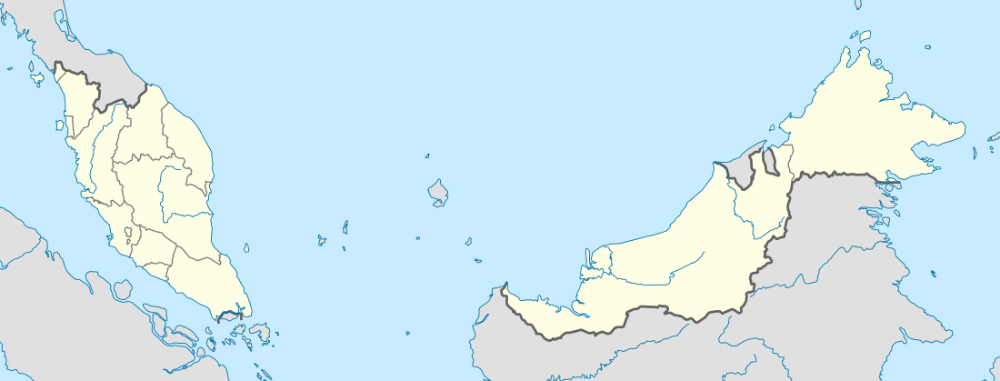
| Country |
| |
| State |
| |
| Government | ||
| • Type | Local government (Lundu District Council) | |
| • District Officer | Azmi Bujang | |
| Area | ||
| • Total | 1,962.2 km2 (757.6 sq mi) | |
| Population (1995-1997 Census) | ||
| • Total | 30,390 | |
| Time zone | MST (UTC+8) | |
| • Summer (DST) | Not observed (UTC) | |
| Website | lundudc.sarawak.gov.my | |
Lundu is a town located in the Northwest of Kuching Division of Sarawak, Malaysia, and borders with Indonesian Province of West Kalimantan.
History
Little is known about the history of Lundu. The lands around Lundu were empty of people until relatively recently. The main river is called Batang Kayan, "the Kayan river," but there is no evidence that any Kayan people ever lived there. In the mid-eighteenth century a group of Bidayuh people from near Bau migrated and settled on the west bank of the Batang Kayan, where Kampong Stunggang Melayu now stands. They came to be called the Dayak Lundu, and though the last member of the tribe died in the 1960s, you can still see the grove of durian trees they planted. The name "Lundu" itself is taken from a small catfish that abounds in the Sungai Lundu which flows down from Gunung Gading.[1]
Lundu is currently under constant development, with more and more public infrastructures and other being built and proposed.
Politics
In State & Federal Constituencies, Lundu area is represented by Barisan Nasional:
- Y.B. Tan Sri Datuk Amar Adenan Satem of PBB - Member of Sarawak State Legislative Council for N3 Tanjung Datu.
- Y.B. Ranum anak Mina of SUPP - Member of Sarawak Legislative Council for N1 Opar
- Y.B. Datuk Dr. Wan Junaidi Tuanku Hj. Jaafar of PBB - Member of Parliament of Malaysia for P193 Santubong
- Y.B. Anthony Nogeh of SPDP - Member of Parliament of Malaysia for P192 Mas Gading.
Local Government
Lundu District Office is the nerve center of the administration of the District. The first District Officer was appointed in 1877 and the current District Officer is the 44th. The District Officer has wide Statutory powers, to enable him to function effectively.
The District Officer is also Chairman of the Lundu District Council, that provides municipal services. It was first established in 1953,as Lundu District Authority. In 1957,it was restructured and known as Lundu District Council until today. The Chairman is assisted by 21 Councilors appointed by the Government. The Secretary to the Council is the CEO.
Transportation
Lundu is located 100 km from Kuching City, 70 km from Bau Town, 28 km from Sematan Bazzar, 26 km from Biawak Bazzar,18 km from Kampong Sebako and 10 km from Pandan Beach.It is accessible by road.In mid to late 2000s, Batang Kayan Bridge was officially opened to traffic, and it marks the end of Ferry services to and from Lundu through Batang Kayan.Lundu was also previously connected by air, as there were remains of the former airstrip in Lundu.Part of the runway of the old airstrip is now used as road.
Education
Primary School
- SK Raso
- SK Stungkor
- SK Sampadi
- SK Pandan
- SK Biawak
- SK Hollyname
- SK Bumiputra
- SK Sebiris
- SK Serayan/Keranji
- SK Paon
- SK Sebako
- SK Sebat
- SK Pueh
- SK Sematan
- SK Telok Melano/Serabang
- SJK (C) Chung Hua Serayan/Selarat
- SJK (C) Chung Hua Sematan
- SJK (C) Chung Hua Lundu
Secondary School
- SMK Lundu
- SMK Sematan
Economic Activities
Economic Activities in Lundu are
- Agricultural Sector (Cocoa, Black Pepper, Paddy, Fruits and Palm Oil)
- Aquaculture [Fish (sea bass growout and hatchery), Prawns (Tiger prawns) and Crab (Flower & Mud Crabs)]
- Fishing Industry
- Tourism Industry (Homestay programs)
- Cottage Industry (Fish crackers, traditional cakes and biscuits & chips - Supported by Government Agencies such as Department of Agriculture, FELCRA, SALCRA and other)
Tourist attractions
Lundu is known for:
- Tanjung Datu National Park - Westernmost Tip of Sarawak
- Gunung Gading National Park - Home to the Rafflesia
- Siar Beach
- Pandan Beach
- Sematan Beach - Abang Amin Beach, Sungai Kilong Beach & Pueh Beach
- Telok Melano Beach
- Talang-Talang Islands (Greater & Lesser Talang-talang)- Turtle Sanctuary
- Samunsam Wildlife Sanctuary
- Sampadi Island
- Rambungan Beach
- Sebako Hotspring
- Jangkar Waterfalls
- Pueh Longhouse Homestay - Salako Ethnic
- Telok Melano Homestay - Malay Ethnic
- Kangka Longhouse Homestay - Iban Ethnic
Coordinates: 1°40′N 109°51′E / 1.667°N 109.850°E
References
- ↑ A Short History of Lundy by Dr.Otto Steinmeyer
- http://www.ikanlundu.com/lundu/lundupage6.html (A Short History of Lundu, by Dr.Otto Steinmeyer)
External links
- http://www.lundudc.sarawak.gov.my (Lundu District Council Official Website)
- http://www.sarawakforestry.com/htm/snp-np-gading.html (Gunung Gading National Park)
- http://www.ikanlundu.com/lundu/lundupage1.html (Otto's Lundu Page, created by Dr.Otto Steinmeyer)
- http://www.lundudo.sarawak.gov.my (Lundu District Office Official Website)
Capital: Kuching | |||||||||||||||||||||||
| Topics |
| ||||||||||||||||||||||
| Society |
| ||||||||||||||||||||||
| Administrative divisions |
| ||||||||||||||||||||||
| |||||||||||||||||||||||