Lypovets
| Lypovets Липовець | ||
|---|---|---|
|
Lypovets skyline | ||
| ||
| Coordinates: 49°13′15″N 29°03′25″E / 49.22083°N 29.05694°ECoordinates: 49°13′15″N 29°03′25″E / 49.22083°N 29.05694°E | ||
| Country |
| |
| Region | Vinnytsia Oblast | |
| Raion | Lypovetskyi Raion | |
| Administrative Classification | KOATUU: 0522210100 | |
| Area | ||
| • Total | 10.33 km2 (3.99 sq mi) | |
| Elevation | 242 m (794 ft) | |
| Population (2015) | ||
| • Total | 8,674[1] | |
| • Density | 910/km2 (2,400/sq mi) | |
| Demonym(s) | Lypovets' | |
| Time zone | EET (UTC+2) | |
| • Summer (DST) | EEST (UTC+3) | |
| Postal code | 22500-22505 | |
| Area code(s) | +380-4358 | |
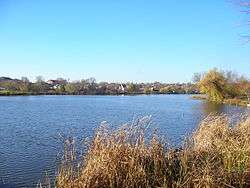

Lypovets (Ukrainian: Липовець) is a town in Vinnytsia Oblast, Ukraine. It serves as the administrative center of Lypovets Raion, one of twenty-seven districts of the oblast. Population: 8,674 (2015 est.)[1]
Gallery
 Lypovets district executive committee
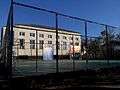 Sports ground
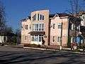 Employment centre in Lypovets
 Palace of culture
References
- 1 2 "Чисельність наявного населення України (Actual population of Ukraine)" (PDF) (in Ukrainian). State Statistics Service of Ukraine. Retrieved 1 July 2016.
External links
- Website «Наш Липовець»
- The murder of the Jews of Lypovets during World War II, at Yad Vashem website.
| Raions | |||||||
|---|---|---|---|---|---|---|---|
| Cities |
| ||||||
| |||||||
This article is issued from Wikipedia - version of the 11/10/2016. The text is available under the Creative Commons Attribution/Share Alike but additional terms may apply for the media files.