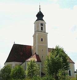
Münzkirchen
| Münzkirchen | ||
|---|---|---|
 | ||
| ||
 Münzkirchen Location within Austria | ||
| Coordinates: 48°29′00″N 13°34′00″E / 48.48333°N 13.56667°ECoordinates: 48°29′00″N 13°34′00″E / 48.48333°N 13.56667°E | ||
| Country | Austria | |
| State | Upper Austria | |
| District | Schärding | |
| Government | ||
| • Mayor | Helmut Schopf (SPÖ) | |
| Area | ||
| • Total | 21 km2 (8 sq mi) | |
| Elevation | 486 m (1,594 ft) | |
| Population (1 January 2016)[1] | ||
| • Total | 2,575 | |
| • Density | 120/km2 (320/sq mi) | |
| Time zone | CET (UTC+1) | |
| • Summer (DST) | CEST (UTC+2) | |
| Postal code | 4792 | |
| Area code | 07716 | |
| Vehicle registration | SD | |
| Website | www.muenzkirchen.at | |
Münzkirchen is a municipality in the district of Schärding in Upper Austria, Austria.
Geography
Münzkirchen is divided into the 6 cadastral subdivisions: Eisenbirn, Freundorf, Hofalt, Landertsberg, Münzkirchen and Schießdorf.
The 14 localities which belong to the municipality are Eisenbirn, Eitzenberg, Feicht, Ficht, Freundorf, Füxledt, Geibing, Hötzenberg, Landertsberg, Ludham, Prackenberg, Raad, Schießdorf and Wilhelming.
Maria Mandl
Münzkirchen was the birthplace of Nazi concentration camp guard, Maria Mandl.
References
| Wikimedia Commons has media related to Münzkirchen. |
This article is issued from Wikipedia - version of the 6/22/2015. The text is available under the Creative Commons Attribution/Share Alike but additional terms may apply for the media files.