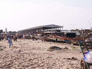
M'bour Department
| M'bour | |
|---|---|
| Department | |
 | |
 Location in the Thiès Region | |
| Country |
|
| Region | Thiès Region |
| Capital | M'bour |
| Area | |
| • Total | 1,607 km2 (620 sq mi) |
| Population (2013 census) | |
| • Total | 668,878 |
| • Density | 420/km2 (1,100/sq mi) |
| Time zone | GMT (UTC+0) |
M'bour Department is one of the 45 departments of Senegal, one of three in the Thiès Region. Its capital is M'Bour.[1]
The department has 8 urban communes; Joal-Fadiouth, Mbour, Nguékhokh, Thiadiaye, Saly Portudal, Ngaparou, Somone and Popenguine.
The rural districts (communautés rurales) are:
- Arrondissement of Fissel:
- Fissel
- Ndiaganiao
- Arrondissement of Séssène:
- Séssène
- Nguéniène
- Arrondissement de Sindia:
- Sindia
- Malicounda
- Diass
Historic sites [2]
- Residence at Popenguine and the Cap de Naze
- Tumuli of the forest of Bandia
- Church and Sanctuary of Popenguine
- Fadiouth Island, Cemetery Island and Granaries on stilts
- Fort of the Comptoir of Saly Portudal
- Thiémassas prehistoric site
- Little Seminary of Ngazobil
- Senghor family house at Joal
- Ndianda church
- Sangomar, place of the Sereer cult, at Palmarin
- Fangool and cannon at Mbalamson
- Sereer Tumulus of Mbafaye at Godaguène Fissel
References
- ↑ "Découpage administratif". Découpage administratif. senegalaisement.com. Retrieved 16 March 2011.
- ↑ List of historic sites
Coordinates: 14°27′09″N 17°08′15″W / 14.45250°N 17.13750°W
This article is issued from Wikipedia - version of the 12/4/2016. The text is available under the Creative Commons Attribution/Share Alike but additional terms may apply for the media files.