Maes Down
| Site of Special Scientific Interest | |
 | |
 Location within Somerset | |
| Area of Search | Somerset |
|---|---|
| Grid reference | ST647406 |
| Coordinates | 51°09′49″N 2°30′22″W / 51.16355°N 2.50621°WCoordinates: 51°09′49″N 2°30′22″W / 51.16355°N 2.50621°W |
| Interest | Geological |
| Area | 0.2 hectares (0.0020 km2; 0.00077 sq mi) |
| Notification | 1985 |
| Natural England website | |
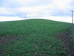
Maes Down (grid reference ST647406) is a 0.2 hectare geological Site of Special Scientific Interest between Shepton Mallet and Stoney Stratton in Somerset, notified in 1985. It is a Geological Conservation Review site.
The rocks seen at Maes Down were laid down about 190 million years ago, during the Upper Pliensbachian and Lower Toarcian Stages of the Jurassic Period of geological times, when this part of Britain lay beneath the sea.
References
- English Nature citation sheet for the site (accessed 10 August 2006)
External links
- English Nature website (SSSI information)
This article is issued from Wikipedia - version of the 1/27/2011. The text is available under the Creative Commons Attribution/Share Alike but additional terms may apply for the media files.