Maidstone Line
| Maidstone Line | |
|---|---|
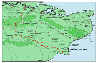
 The Maidstone Line, shown with other railway lines in Kent. | |
| Overview | |
| Type | Suburban rail, Heavy rail |
| System | National Rail |
| Status | Operational |
| Locale |
Kent South East England |
| Operation | |
| Owner | Network Rail |
| Operator(s) |
Southeastern Thameslink |
| Technical | |
| Track gauge | 1,435 mm (4 ft 8 1⁄2 in) standard gauge |
The Maidstone Line is a railway line in Kent, England.[1][2] It diverges from the Chatham Main Line at Swanley Junction and proceeds down the Darenth valley to Otford junction[3] (where the Bat & Ball line[3] divides towards Sevenoaks). It continues via Borough Green & Wrotham and Maidstone East to Ashford, where it joins the South Eastern Main Line.[4]
History
The line was built by the London, Chatham and Dover Railway from their first line (the Chatham Main Line). Upon the creation of the South Eastern and Chatham Railway the original Ashford terminus was closed in 1899 and services diverted to the South Eastern Railway's Ashford station. The line was electrified in 1939 (750 V DC third rail) to Maidstone East by the Southern Railway prior to World War Two. Electrification between Maidstone East and Ashford was completed in 1961 under the BR 1955 Modernisation Plan.
Infrastructure
Traction current is supplied at 750 volts DC via the Third Rail. The supply for this is overseen by Paddock Wood Electrical Control Room.[3] Signalling is Track Circuit Block with multiple aspect colour light signals throughout, controlled by Ashford IECC.[3] The line is double track throughout.
Services
Services on the line are run by Southeastern. Services run to London Victoria and Ashford,or Canterbury West with some peak services to Bedford via London Blackfriars, which are run as a joint service with Thameslink.
Due to its route between the two main lines through Kent (the South Eastern Main Line and the Chatham Main Line), the line has comparatively infrequent services and longer journey times.
References
- ↑ Network Rail (Apr 2001). Southern Appendix. Module SO. p. 1/12. A0260A03. Retrieved 2012-01-12
- ↑ Quail Map 5 - England South & London Underground [pages 6,7 & 11A ] February 1998 (Retrieved 2012-01-12)
- 1 2 3 4 Network Rail (Apr 2001). Southern Appendix. Module SO. p. 1/64. A0260A03. Retrieved 2012-01-12
- ↑ Network Rail (Apr 2001). Southern Appendix. Module SO. p. 1/54. A0260A03. Retrieved 2012-01-12
- Yonge, John (October 1994). Gerald Jacobs, ed. Railway Track Diagrams – Volume 5 England, South and London Underground (1st ed.). Exeter: Quail Map Co. ISBN 1-8983-1907-3.
Coordinates: 51°16′40″N 0°31′22″E / 51.2778°N 0.5228°E
