Majdal Bani Fadil
| Majdal Bani Fadil | |
|---|---|
| Other transcription(s) | |
| • Arabic | مجدل بني فاضل |
|
Majdal Bani Fadil | |
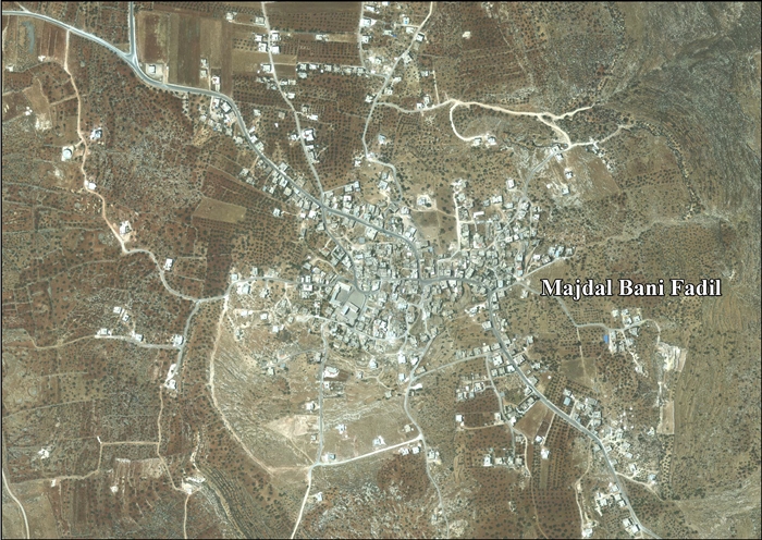
 Majdal Bani Fadil Location of Majdal Bani Fadil within the Palestinian territories | |
| Coordinates: 32°05′01″N 35°21′46″E / 32.08361°N 35.36278°ECoordinates: 32°05′01″N 35°21′46″E / 32.08361°N 35.36278°E | |
| Governorate | Nablus |
| Government | |
| • Type | Village council |
| • Head of Municipality | Walid Othman |
| Area | |
| • Jurisdiction | 28,000 dunams (28.0 km2 or 10.8 sq mi) |
| Population (2007) | |
| • Jurisdiction | 2,382 |

Majdal Bani Fadil (Arabic: مجدل بني فاضل) is a Palestinian town in the Nablus Governorate in northern West Bank, located 23 kilometers (14 mi) southeast of Nablus. According to the Palestinian Central Bureau of Statistics (PCBS), the town had a population of 2,382 inhabitants in 2007.[1]
Majdal Bani Fadil is under the local administration of a nine-member village council headed by Walid Othman.[2] Most of the village's residents are from the Othman and Zayn ad-Din clans. The main economic activities are herding and agriculture, specifically olives, grapes, prunes and figs. The main road connecting Majdal Bani Fadil to Ramallah and Nablus and Jericho has been closed off to the village since 2000 during the Second Intifada.[3]
References
- ↑ 2007 PCBS Census. Palestinian Central Bureau of Statistics (PCBS). 2008.
- ↑ Council Members. Majdal Bani Fadil Council.
- ↑ Majdal Bani Fadil Village. Applied Research Institute-Jerusalem. 2010-07-02.
Bibliography
| Wikimedia Commons has media related to Majdal Bani Fadil. |
- Barron, J. B., ed. (1923). Palestine: Report and General Abstracts of the Census of 1922. Government of Palestine.
- Conder, Claude Reignier; Kitchener, H. H. (1882). The Survey of Western Palestine: Memoirs of the Topography, Orography, Hydrography, and Archaeology. 2. London: Committee of the Palestine Exploration Fund. (pp. 386-387, 402)
- Dauphin, Claudine (1998). La Palestine byzantine, Peuplement et Populations. BAR International Series 726 (in French). III : Catalogue. Oxford: Archeopress. ISBN 0-860549-05-4. (p. 850)
- Department of Statistics (1945). Village Statistics, April, 1945. Government of Palestine.
- Guérin, Victor (1875). Description Géographique Historique et Archéologique de la Palestine (in French). 2: Samarie, pt. 2. Paris: L'Imprimerie Nationale. (pp. 9-10)
- Hadawi, Sami (1970). Village Statistics of 1945: A Classification of Land and Area ownership in Palestine. Palestine Liberation Organization Research Center.
- Hütteroth, Wolf-Dieter; Abdulfattah, Kamal (1977). Historical Geography of Palestine, Transjordan and Southern Syria in the Late 16th Century. Erlanger Geographische Arbeiten, Sonderband 5. Erlangen, Germany: Vorstand der Fränkischen Geographischen Gesellschaft. ISBN 3-920405-41-2. (p. 133)
- Mills, E., ed. (1932). Census of Palestine 1931. Population of Villages, Towns and Administrative Areas. Jerusalem: Government of Palestine.
- Palmer, E. H. (1881). The Survey of Western Palestine: Arabic and English Name Lists Collected During the Survey by Lieutenants Conder and Kitchener, R. E. Transliterated and Explained by E.H. Palmer. Committee of the Palestine Exploration Fund. (p. 257)
External links
- Welcome To Majdal Bani Fadil
- Survey of Western Palestine, Map 15: IAA, Wikimedia commons
- Majdal Bani Fadil Village Profile, ARIJ
- Majdal Bani Fadil, aerial photo, ARIJ
| Cities |
|  |
|---|---|---|
| Municipalities | ||
| Villages |
| |
| Refugee camps | ||