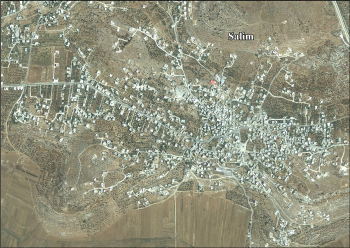
Salim, Nablus
| Salim | |
|---|---|
| Other transcription(s) | |
| • Arabic | سالم |
| • Also spelled | Salem (official) |
 Salim Location of Salim within the Palestinian territories | |
| Coordinates: 32°13′N 35°20′E / 32.217°N 35.333°ECoordinates: 32°13′N 35°20′E / 32.217°N 35.333°E | |
| Palestine grid | 181/179 |
| Governorate | Nablus |
| Government | |
| • Type | Village council |
| Area | |
| • Jurisdiction | 10,283 dunams (10.3 km2 or 4.0 sq mi) |
| Population (2006) | |
| • Jurisdiction | 5,100 |
| Name meaning | Salem[1] |
Salim (Arabic: سالم) is a Palestinian town in the northern West Bank, located six kilometers east of Nablus and is a part of the Nablus Governorate. Nearby towns include Deir al-Hatab to the northwest, Balata to the west and Beit Furik to the south. According to the Palestinian Central Bureau of Statistics (PCBS), Salim had a population of approximately 5,100 inhabitants in 2006.[2]
History
The village is ancient with foundations of houses.[3] In 1882, traces of ruins, cisterns, a ruined tank, and a cemetery of rock-cut tombs were noted.[4]
Salim dates back to the Middle Bronze Age. It was near the ancient Canaanite and later Israelite town of Shechem.[5]
Ottoman era
In 1517, Salim was incorporated into the Ottoman Empire with the rest of Palestine. In 1596, it appeared in Ottoman tax registers as being in the Nahiya of Jabal Qubal of the Liwa of Nablus. It had a population of 42 households, all Muslim. The villagers paid taxes on wheat, barley, summercrops, olives, and goats or beehives, and a press for olives or grapes.[6]
French explorer Victor Guérin came to the village in May 1870, after walking through fields of olives, figs and almond trees. He found a village with a maximum of 200 people, in ancient houses. A dozen cisterns in the village were dry, so the women had to fetch water from a stream, called Ain Salim, about 1 kilometre north-northwest of the village.[7]
In 1882, the Palestine Exploration Fund's Survey of Western Palestine described Salim as a small village, but evidently ancient, surrounded by olive-trees and with two springs to the north.[8]
British Mandate era
In a census conducted in 1922 by the British Mandate authorities, Salem had a population of 423, all Muslims,[9] while in the 1931 census, Salim, including El Hamra, had 100 occupied houses and a population of 490, again all Muslim.[10]
In 1945 Salim had a population of 660, all Muslims,[11] with 10,293 dunams of land, according to an official land and population survey.[12] Of this, 229 dunams were plantations and irrigable land, 5,158 used for cereals,[13] while 24 dunams were built-up land.[14]
1948-1967
During the 1948 war the area was held by units from the Iraqi Army.[15]
In the wake of the 1948 Arab–Israeli War Salim came under Jordanian rule.
Post-1967
After the Six-Day War in 1967, Salim has been under Israeli occupation.
See also
- Ma'ale Iron, including village Salim, northeast of Umm al-Fahm
References
- ↑ Palmer, 1881, p. 206
- ↑ Projected Mid -Year Population for Nablus Governorate by Locality 2004- 2006 Palestinian Central Bureau of Statistics (PCBS).
- ↑ Dauphin, 1998, p. 847
- ↑ Conder and Kitchener, 1882, SWP II, p. 244
- ↑ Sychem also Sikima and Salim - (Tell Balatah) Studium Biblicum Franciscanum - Jerusalem. 19 December 2000.
- ↑ Hütteroth and Abdulfattah, 1977, p. 130.
- ↑ Guérin, 1874, p. 456 ff
- ↑ Conder and Kitchener, 1882, SWP II, p. 230
- ↑ Barron, 1923, Table IX, Sub-district of Nablus, p. 24
- ↑ Mills, 1932, p. 64
- ↑ Department of Statistics, 1945, p. 19
- ↑ Government of Palestine, Department of Statistics. Village Statistics, April, 1945. Quoted in Hadawi, 1970, p. 61
- ↑ Government of Palestine, Department of Statistics. Village Statistics, April, 1945. Quoted in Hadawi, 1970, p. 107
- ↑ Government of Palestine, Department of Statistics. Village Statistics, April, 1945. Quoted in Hadawi, 1970, p. 157
- ↑ Morris, Benny (1993) Israel's Border Wars, 1949 - 1956. Arab Infiltration, Israeli Retaliation, and the Countdown to the Suez War. Oxford University Press, ISBN 0-19-827850-0. pp.146.147
Bibliography
- Barron, J. B., ed. (1923). Palestine: Report and General Abstracts of the Census of 1922. Government of Palestine.
- Conder, Claude Reignier; Kitchener, H. H. (1882). The Survey of Western Palestine: Memoirs of the Topography, Orography, Hydrography, and Archaeology. 2. London: Committee of the Palestine Exploration Fund.
- Dauphin, Claudine (1998). La Palestine byzantine, Peuplement et Populations. BAR International Series 726 (in French). III : Catalogue. Oxford: Archeopress. ISBN 0-860549-05-4.
- Department of Statistics (1945). Village Statistics, April, 1945. Government of Palestine.
- Finkelstein, Israel; Lederman, Zvi, eds. (1997). Highlands of many cultures. Tel Aviv: Institute of Archaeology of Tel Aviv University Publications Section. ISBN 965-440-007-3.
- Guérin, Victor (1874). Description Géographique Historique et Archéologique de la Palestine (in French). 2: Samarie, pt. 1. Paris: L'Imprimerie Nationale.
- Hadawi, Sami (1970). Village Statistics of 1945: A Classification of Land and Area ownership in Palestine. Palestine Liberation Organization Research Centre.
- Hütteroth, Wolf-Dieter; Abdulfattah, Kamal (1977). Historical Geography of Palestine, Transjordan and Southern Syria in the Late 16th Century. Erlanger Geographische Arbeiten, Sonderband 5. Erlangen, Germany: Vorstand der Fränkischen Geographischen Gesellschaft. ISBN 3-920405-41-2.
- Mills, E., ed. (1932). Census of Palestine 1931. Population of Villages, Towns and Administrative Areas. Jerusalem: Government of Palestine.
- Palmer, E. H. (1881). The Survey of Western Palestine: Arabic and English Name Lists Collected During the Survey by Lieutenants Conder and Kitchener, R. E. Transliterated and Explained by E.H. Palmer. Committee of the Palestine Exploration Fund.
External links
- Welcome To Salim
- Survey of Western Palestine, Map 12: IAA, Wikimedia commons
- Salim Village Profile, ARIJ
- Salim, aerial photo, ARIJ
- "A Palestinian woman cries in her home after a raid on Sunday by Israeli troops searching for three abducted Israeli teens, in Salim", Haaretz, Jun. 23, 2014
- Palestinians condemn Israeli sanctions as 'piracy', 11 April 2014, Daily Mail
- Settlers Activities Case Study ... Salim village land 11 October 2001, ARIJ
- The Village of Salem Between the Israeli Military Occupation and the Israeli Settlements 18 December 2005, ARIJ
- Elon Moreh Settlers Contaminate Drinking Water in Deir Al Hatab Village 20 September 2007, POICA
- Israeli Halt-of-Construction Orders to 17 Palestinian houses in Salim Village 3 September 2009, POICA
- Under the pretext of building in zone C "Halt of construction orders against 17 Palestinian houses and barracks in Salim village" 7 September 2009, POICA
| Cities |
|  |
|---|---|---|
| Municipalities | ||
| Villages |
| |
| Refugee camps | ||