Manassas Regional Airport
| Manassas Regional Airport Harry P. Davis Field | |||||||||||||||
|---|---|---|---|---|---|---|---|---|---|---|---|---|---|---|---|
 | |||||||||||||||
| IATA: MNZ[1][2] – ICAO: KHEF – FAA LID: HEF | |||||||||||||||
| Summary | |||||||||||||||
| Airport type | Public | ||||||||||||||
| Owner | City of Manassas | ||||||||||||||
| Serves | Manassas, Virginia | ||||||||||||||
| Elevation AMSL | 192 ft / 59 m | ||||||||||||||
| Coordinates | 38°43′17″N 077°30′56″W / 38.72139°N 77.51556°W | ||||||||||||||
| Website | www.manassasregionalairport.aero.... | ||||||||||||||
| Map | |||||||||||||||
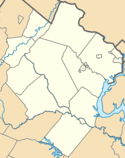 Manassas Regional Airport  Manassas Regional Airport  Manassas Regional Airport | |||||||||||||||
| Runways | |||||||||||||||
| |||||||||||||||
| Statistics (2006) | |||||||||||||||
| |||||||||||||||
Manassas Regional Airport (IATA: MNZ[1][2], ICAO: KHEF, FAA LID: HEF), also known as Harry P. Davis Field, is a city-owned public-use airport located four nautical miles (7 km) southwest of the central business district of Manassas, in a section of Manassas that was carved out of Prince William County specifically for the purpose of containing the airport.[3] The largest regional airport in the state of Virginia, Manassas Regional Airport is located 30 miles from Washington, D.C.
History
An airport for Manassas was proposed in 1930, when the mayor was Harry P. Davis.[4] It was built in 1931 on 94 acres (0.38 km2)[5] located along Virginia Route 234, in the area now known as Manaport Shopping Center. Originally owned privately, the Town of Manassas bought the airport in 1945.[6] Due to airport activity and nearby housing development, the airport was moved to its current location in 1964. The new airport opened with a single 3700' x 100' paved runway. In 1992, the city purchased a control tower from Centennial Airport near Denver and reassembled it at Manassas Regional Airport. A new terminal was built in 1996.[7]
Facilities and aircraft
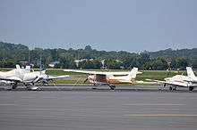
Manassas Regional Airport covers an area of 888 acres (359 ha) at an elevation of 192 feet (59 m) above mean sea level. It has two asphalt paved runways: 16L/34R measuring 6,200 x 100 feet (1,737 x 30 m) and 16R/34L measuring 3,704 x 100 feet (1,129 x 30 m).[3]
For the 12-month period ending December 2011, the airport had 85,000 aircraft operations, an average of 236 per day: 98% general aviation, 1% air taxi and 1% military. At that time there were 401 aircraft based at this airport: 78% single-engine, 10% multi-engine, 7% jet and 5% helicopter.[3]
See also
- Broad Run/Airport (VRE station)
- Colgan Air (headquarters formerly located on airport grounds)
- City of Manassas
References
- 1 2 Great Circle Mapper (IATA: MNZ)
- 1 2 "Airline and Airport Code Search". IATA. Retrieved 12 November 2015.
- 1 2 3 4 FAA Airport Master Record for HEF (Form 5010 PDF), effective 2013-01-10
- ↑ "Manassas Airport Dedication Is Set: State and Federal Officials to Attend Ceremony on Wednesday". The Washington Post. June 5, 1932. p. 8.
- ↑ "Manassas Airport to Be Begun Soon: Citizens Buy 94 Acres for Emergency Landing". The Washington Post. June 16, 1931. p. 22.
- ↑ "Leased Airport Is Purchased By Manassas". The Washington Post. October 21, 1945. p. M3.
- ↑ Airport History at City of Manassas website
External links
| Wikimedia Commons has media related to Manassas Regional Airport. |
- Manassas Regional Airport at City of Manassas website
- Bussmann Aviation
- FAA Airport Diagram (PDF), effective December 8, 2016
- FAA Terminal Procedures for HEF, effective December 8, 2016
- Resources for this airport:
- FAA airport information for HEF
- AirNav airport information for KHEF
- ASN accident history for HEF
- FlightAware airport information and live flight tracker
- NOAA/NWS latest weather observations
- SkyVector aeronautical chart, Terminal Procedures
| Administration |
|  | |||||
|---|---|---|---|---|---|---|---|
| Organizations | |||||||
| Landmarks | |||||||
| Transportation | |||||||
| Culture |
| ||||||
| Education | |||||||