Manouba Governorate
| Manouba ولاية منوبة La Manouba | |
|---|---|
| Governorate | |
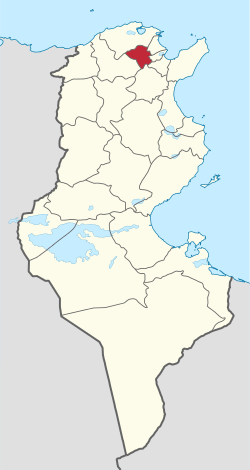 Map of Tunisia with Manouba highlighted | |
| Coordinates: 36°48′28″N 10°6′4″E / 36.80778°N 10.10111°ECoordinates: 36°48′28″N 10°6′4″E / 36.80778°N 10.10111°E | |
| Country | Tunisia |
| Created | July 31, 2000 |
| Capital | Manouba |
| Area | |
| • Total | 1,137 km2 (439 sq mi) |
| Area rank | Ranked 20th of 24 |
| Population (2014) | |
| • Total | 379,518 |
| • Rank | Ranked 15th of 24 |
| • Density | 330/km2 (860/sq mi) |
| Time zone | CET (UTC+01) |
| Postal prefix | xx |
| ISO 3166 code | TN-14 |
Manouba Governorate (Tunisian Arabic: ولاية منوبة Wilāyat Mannūbah pronounced [ˌmænˈnuːbæ]) is one of the twenty-four governorates (provinces) of Tunisia and is in inland, northern Tunisia. It has a population of 379,518 (as at the 2014 census),[1][2] and an area of 1,137 km2. The capital is Manouba.
Geography
The governorate is 5.5 kilometres (3.4 mi) from the capital, in an area of foothills of and verdant plains below the Tell Atlas uplands and borders Bizerte, Zaghouan, Beja, Tunis, Ariana and Ben Arous Governorates. The east and west of the province have high foothills; from both ranges the three lakes of Tunis and the Bay of Tunis can be seen. The east part of the west range is named the Forest of Tebourba, one of its four largest settlements.
The average temperature is 18.7 °C and annual rainfall is 450 millimeters.
Administrative divisions
Administratively, the governorate is divided into eight delegations (mutamadiyat), nine municipalities, eight rural councils and 47 imadas.
| Delegation[3] | Population in 2004[4] | Population in 2014[1] |
|---|---|---|
| Borj El Amri | 16,184 | 17,408 |
| Djedeida | 40,327 | 44,748 |
| Douar Hicher | 75,959 | 84,090 |
| El Battan | 17,321 | 18,977 |
| Manouba | 51,398 | 58,792 |
| Mornaguia | 35,129 | 42,687 |
| Oued Ellil | 58,544 | 69,317 |
| Tebourba | 41,050 | 43,499 |
Nine municipalities are in Manouba Governorate:
| Code | Municipality | Population (2014)[5] |
|---|---|---|
| 1411 | Manouba | 41,670 |
| 1412 | Den Den | 17,122 |
| 1413 | Douar Hicher | 82,532 |
| 1414 | Oued Ellil | 57,851 |
| 1415 | Mornaguia | 19,834 |
| 1416 | Borj El Amri | 6,519 |
| 1417 | Djedeida | 28,660 |
| 1418 | Tebourba | 27,545 |
| 1419 | El Battan | 6,453 |
By contrast eight delgations are in the area.
References
- 1 2 "2014 Tunisian census data".
- ↑ (French) Census 2014 (National Institute of Statistics)
- ↑ (French) "Gouvernorat de Manouba" Portail de l'industrie Tunisienne
- ↑ (French) 2004 Census: Manouba Governorate from Institut national de la statistique of Tunisia
- ↑ Recensement Général de la Population et de l'Habitat 2014 – Population, logements et ménages par commune et arrondissement [Census 2014 results – population, accommodation and households per municipality and delegation] (Report) (in French). National Institute of Statistics. 1 April 2015. Retrieved 18 February 2016.
WikiProject Tunisia | ||