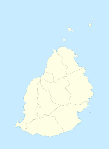
Mapou
- For the New Zealand shrub, see Myrsine australis.
| Mapou | |
|---|---|
| Village | |
 Mapou | |
| Coordinates: 20°4′45″S 57°36′31″E / 20.07917°S 57.60861°ECoordinates: 20°4′45″S 57°36′31″E / 20.07917°S 57.60861°E | |
| Country |
|
| Districts | Rivière du Rempart District |
| Population (2011)[1] | |
| • Total | 1,275 |
| Time zone | MUT (UTC+4) |
| ISO 3166 code | MU |
| Climate | Am |
Mapou is a village in northern Mauritius, located in Rivière du Rempart District. The village is administered by the Mapou Village Council under the aegis of the Rivière du Rempart District Council.[2] According to the census made by Statistics Mauritius in 2011, the population was 1,275.[1]
Places of Interest
The village is mostly known for being home to The Château de Labourdonnais, a colonial house dating from 1859 and which sits on a property dating from 1777. The house has been converted to a museum about colonial life in the island of Mauritius and a restaurant. Other facilities on the domain include the gardens and orchards and the "Rhumerie des Mascareignes" Rum distillery which produces the "La Bourdonnais" and "Rhumeur" brands of rum. Fruits from the orchard are used to produce the "Labourdonnais" range of products such as jellies, jams and fruit juice.[3][4]
Education
Northfields International High School is in Mapou.[5]
See also
References
- 1 2 "Table G1 - Resident population by geographical location, whereabouts on census night and sex" (PDF). Statistics Mauritius. 2011: 3 and 4. Retrieved 19 December 2012.
- ↑ Ministry of Local Government and Outer Islands. "Local Government Act 2011" (PDF). Government of Mauritius. Retrieved 19 December 2012.
- ↑ Wiehe, Johann. Christian W. Wiehe (île Maurice, 1807-1878): Sucre & Raffinement. Patrimoine en Partage.
- ↑ "Un Château dans la Nature". Un Château dans la Nature. Retrieved 5 February 2014.
- ↑ "Contact Us." Northfields International High School. Retrieved on May 4, 2015. "Address: Main Road Labourdonnais Village Mapou Mauritius"