Marcus Hook Range Rear Light
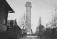 Lightouse viewed from shore. | |
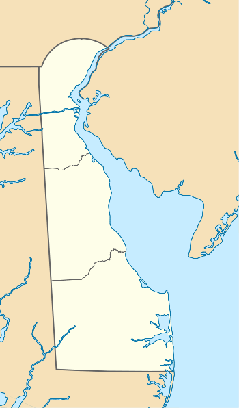 Delaware | |
| Location | Just South of Bellefonte, Delaware |
|---|---|
| Coordinates | 39°45′44.2″N 75°30′11.3″W / 39.762278°N 75.503139°W |
| Year first constructed | 1915 |
| Year first lit | 1920 |
| Automated | 1950s |
| Foundation | Concrete |
| Construction | Reinforced concrete |
| Tower shape | Square |
| Height | 105 feet (32 m) |
| Focal height | 278 feet (85 m) |
| Original lens | Fourth order Fresnel lens |
| Current lens | RL-24 |
| Characteristic | Fixed red (initially fixed white) |
| Admiralty number | J1314.1 |
| ARLHS number | USA-474 |
| USCG number |
2-3140[1] |
|
Marcus Hook Range Rear Light | |
 | |
| Location |
Light House Road Wilmington, Delaware |
| Coordinates | 39°45′44″N 75°30′11″W / 39.7622°N 75.5031°WCoordinates: 39°45′44″N 75°30′11″W / 39.7622°N 75.5031°W |
| Built | 1918 |
| Architect | unknown |
| Architectural style | Colonial Revival/other |
| NRHP Reference # | 89000287[2][3] |
| Added to NRHP | March 27, 1989 |
Marcus Hook Range Rear Light is a lighthouse near Bellefonte, Delaware marking a range on the Delaware River. It is the highest light on the Atlantic coast of the United States.[4]
History
The permanent structure was preceded by a temporary light on a post, erected in 1915.[4] The present tower was built in 1918 and was composed of nine sections of reinforced concrete; there is also an oil house and a keeper's dwelling on the site. The original beacon displayed a fixed white light using a Fourth order Fresnel lens; this was removed in the early 1980s and replaced with a RL-24 beacon, displaying a fixed red indication. The light was automated in the 1950s, but the keeper's house was occupied by Coast Guard personnel until 2004.[5][6]
In March 2005 the lighthouse became available for transfer under the National Historic Lighthouse Preservation Act, but in 2010 a private owner bought the lighthouse and the accompanying home on the property. The tower is an active aid to navigation and not open to the public.
Front Light
The Marcus Hook Range Front Light stands about 100 yards (91 m) offshore, 1.6 miles (2.6 km) to the northeast of Marcus Hook Range Rear Light.[4] The present tower was erected in 1925 and was preceded by a temporary light tower erected in 1915.[4] It has always been automated.
References
- ↑ Lightouses Directory
- ↑ National Park Service (2010-07-09). "National Register Information System". National Register of Historic Places. National Park Service.
- ↑ NHRP Registration form
- 1 2 3 4 "The rear range light of Marcus Hook on the Delaware River, 278 feet above the level of the sea, is the highest light on the Atlantic Coast of the continental United States." Trapani, Bob (2007). Delaware Lights: A History of Lighthouses in the First State. The History Press. p. 138. ISBN 1-59629-021-8.
- ↑ "Marcus Hook Rear Range, DE". Lighthouse Friends.
- ↑ DeWire, Elinor (2011). Lighthouses of the Mid-Atlantic Coast: Your Guide to the Lighthouses of New York, New Jersey, Maryland, Delaware, and Virginia. Minneapolis: Voyageur Press. p. 154. Retrieved 2012-10-05.
| Topics |   | |
|---|---|---|
| Lists by county | ||
| Lists by city | ||
| Other lists | ||
| ||