Marguerite-D'Youville Regional County Municipality
| Marguerite-D'Youville | |
|---|---|
| Regional county municipality | |
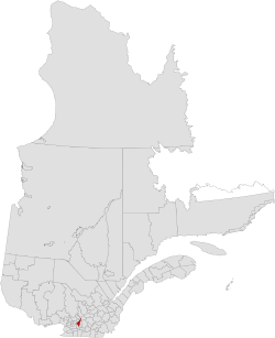 Location in province of Quebec. | |
| Coordinates: 45°41′N 73°26′W / 45.683°N 73.433°WCoordinates: 45°41′N 73°26′W / 45.683°N 73.433°W[1] | |
| Country |
|
| Province |
|
| Region | Montérégie |
| Effective | January 1, 1982 |
| Named for | Marguerite d'Youville |
| County seat | Verchères |
| Government[2] | |
| • Type | Prefecture |
| • Prefect | Suzanne Roy |
| Area[2][3] | |
| • Total | 405.90 km2 (156.72 sq mi) |
| • Land | 345.55 km2 (133.42 sq mi) |
| Population (2011)[3] | |
| • Total | 74,416 |
| • Density | 215.4/km2 (558/sq mi) |
| • Pop 2006-2011 |
|
| • Dwellings | 28,622 |
| Time zone | EST (UTC−5) |
| • Summer (DST) | EDT (UTC−4) |
| Area code(s) | 450 and 579 |
| Website |
www |
Marguerite-D'Youville is a regional county municipality located in the Montérégie region of southwestern Quebec, Canada. The seat is in Verchères.
The RCM was formerly named Lajemmerais Regional County Municipality, after Christophe du Frost de Lajemmerais, the father of Marguerite d'Youville. On February 12, 2011, the name was changed to honour d'Youville directly. However, Statistics Canada retained the name "Lajemmerais" for the 2011 census because the name change came after its reference date of January 1, 2012.[4]
Subdivisions
There are 6 subdivisions within the RCM:[2]
|
|
Demographics
Population
| Canada census – Marguerite-D'Youville Regional County Municipality community profile | |||
|---|---|---|---|
| 2011 | 2006 | 2001 | |
| Population: | 74,416 (+6.5% from 2006) | 69,881 (+9.2% from 2001) | 100,263 (+4.9% from 1996) |
| Land area: | 345.55 km2 (133.42 sq mi) | 345.52 km2 (133.41 sq mi) | 416.32 km2 (160.74 sq mi) |
| Population density: | 215.4/km2 (558/sq mi) | 202.2/km2 (524/sq mi) | 240.8/km2 (624/sq mi) |
| Median age: | 38.6 (M: 38.0, F: 39.1) | 36.9 (M: 36.5, F: 37.2) | 37.1 (M: 36.7, F: 37.5) |
| Total private dwellings: | 28,622 | 26,148 | 37,274 |
| Median household income: | $77,652 | $68,562 | $65,610 |
| References: 2011[3] 2006[5] 2001[6] | |||
| Historical Census Data - Marguerite-D'Youville Regional County Municipality, Quebec[7] | |||||||||||||||||||||||||||||
|---|---|---|---|---|---|---|---|---|---|---|---|---|---|---|---|---|---|---|---|---|---|---|---|---|---|---|---|---|---|
|
|
| |||||||||||||||||||||||||||
(A) adjustment due to boundary change. | |||||||||||||||||||||||||||||
Language
| Canada Census Mother Tongue - Marguerite-D'Youville Regional County Municipality, Quebec[7] | ||||||||||||||||||
|---|---|---|---|---|---|---|---|---|---|---|---|---|---|---|---|---|---|---|
| Census | Total | French |
English |
French & English |
Other | |||||||||||||
| Year | Responses | Count | Trend | Pop % | Count | Trend | Pop % | Count | Trend | Pop % | Count | Trend | Pop % | |||||
| 2011 |
74,070 |
71,120 | |
96.02% | 1,145 | |
1.54% | 390 | |
0.53% | 1,415 | |
1.91% | |||||
| 2006 |
69,485 |
66,975 | |
96.39% | 970 | |
1.39% | 165 | |
0.24% | 1,375 | |
1.98% | |||||
| 2001 |
99,385 |
95,470 | |
96.06% | 1,755 | |
1.77% | 505 | |
0.51% | 1,655 | |
1.66% | |||||
| 1996 |
94,720 |
92,095 | n/a | 97.23% | 1,795 | n/a | 1.89% | 385 | n/a | 0.41% | 445 | n/a | 0.47% | |||||
Transportation
Access Routes
Highways and numbered routes that run through the municipality, including external routes that start or finish at the county border:[8]
|
|
|
See also
References
- ↑ Reference number 411217 of the Commission de toponymie du Québec (French)
- 1 2 3 Geographic code 590 in the official Répertoire des municipalités (French)
- 1 2 3 "(Code 2459) Census Profile". 2011 census. Statistics Canada. 2012.
- ↑ Soucy, Audrée (February 2011). "Modifications aux divisions territoriales" (PDF). Modifications aux municipalités du Québec: 4. ISSN 1715-6408.
Cependant, c’est seulement dans le Recensement de 2016 que Statistique Canada utilisera ce nouveau nom, puisque la date de référence pour la géographie du Recensement de 2011 est le 1er janvier 2011.
- ↑ "2006 Community Profiles". Canada 2006 Census. Statistics Canada. March 30, 2011. Retrieved 2014-02-28.
- ↑ "2001 Community Profiles". Canada 2001 Census. Statistics Canada. February 17, 2012. Retrieved 2014-02-28.
- 1 2 Statistics Canada: 1996, 2001, 2006, 2011 census
- ↑ Official Transport Quebec Road Map
 |
Saint Lawrence River L'Assomption RCM |
Saint Lawrence River D'Autray RCM |
Pierre-De Saurel RCM | |
| Saint Lawrence River Montréal TE |
|
La Vallée-du-Richelieu RCM | ||
| ||||
| | ||||
| Longueuil TE |
This article is issued from Wikipedia - version of the 7/22/2015. The text is available under the Creative Commons Attribution/Share Alike but additional terms may apply for the media files.