Maryland Route 275
| ||||
|---|---|---|---|---|
| Perrylawn Drive | ||||
|
Maryland Route 275 highlighted in red | ||||
| Route information | ||||
| Maintained by MDSHA | ||||
| Length: | 2.22 mi[1] (3.57 km) | |||
| Existed: | 1967[2] – present | |||
| Major junctions | ||||
| South end: |
| |||
| North end: |
| |||
| Location | ||||
| Counties: | Cecil | |||
| Highway system | ||||
| ||||

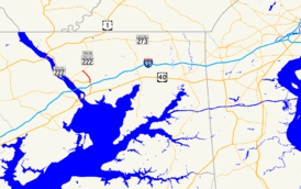
Maryland Route 275 (MD 275) is a state highway in the U.S. state of Maryland. Known as Perrylawn Drive, the highway runs 2.22 miles (3.57 km) from MD 222 and MD 824 in Perryville north to MD 276 in Woodlawn in western Cecil County. MD 275 provides an eastern bypass of Port Deposit and is signed as part of MD 222 Truck. The state highway also serves to connect Rising Sun (via MD 276) and Interstate 95 (I-95). MD 275 was constructed along a new alignment in the mid-1960s.
Route description
MD 275 begins at a four-legged intersection with MD 222 and MD 824 (Blythedale Road) in the town of Perryville. MD 222 heads west toward Port Deposit as Bainbridge Road and south as Perryville Road toward an interchange with I-95 (John F. Kennedy Memorial Highway) and the center of Perryville. MD 275 heads north as Perrylawn Drive, a controlled-access two-lane highway. The highway heads north along a long, sweeping curve that passes to the east of the limits of Port Deposit. MD 275 parallels Mill Creek and crosses the stream twice along its course. The state highway reaches its northern terminus at MD 276 (Jacob Tome Memorial Highway) in the community of Woodlawn.[1][3]
MD 275 is a part of the National Highway System as a principal arterial for its entire length.[1][4]
History
MD 275 was constructed along a new alignment between July 1965 and October 1967.[5][2]
Junction list
The entire route is in Cecil County.
| Location | mi[1] | km | Destinations | Notes | |
|---|---|---|---|---|---|
| Perryville | 0.00 | 0.00 | Southern terminus of MD 275 and MD 222 Truck | ||
| Woodlawn | 2.22 | 3.57 | Northern terminus; MD 222 Truck continues on northbound MD 276 | ||
| 1.000 mi = 1.609 km; 1.000 km = 0.621 mi | |||||
See also
 Maryland Roads portal
References
- 1 2 3 4 Highway Information Services Division (December 31, 2014). Highway Location Reference. Maryland State Highway Administration. Retrieved March 16, 2016.
- Cecil County (PDF)
- 1 2 Maryland State Roads Commission (1967). Maryland: Official Highway Map (Map). Baltimore: Maryland State Roads Commission.
- ↑ Maryland State Highway Administration (2015). Maryland General Highway Statewide Grid Map (PDF) (Map). 1:12,000. Baltimore: Maryland State Highway Administration. §§ B14B, A14D, A15C, A15A. Retrieved March 16, 2016.
- ↑ National Highway System: Maryland (PDF) (Map). Federal Highway Administration. October 1, 2012. Retrieved 2015-02-09.
- ↑ Maryland Road Construction Progress Log (PDF). Baltimore: Maryland State Highway Administration. Contract Number: CE-387-4-241 (June 16, 1965). Retrieved March 16, 2016 – via Maryland State Archives.
External links
- MDRoads: MD 275
- MD 222 Truck signed along MD 275