Maryland Route 588
| ||||
|---|---|---|---|---|
|
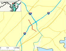
Maryland Route 588 highlighted in red | ||||
| Route information | ||||
| Maintained by MDSHA | ||||
| Length: | 1.94 mi[1] (3.12 km) | |||
| Existed: | 1935 – present | |||
| Major junctions | ||||
| South end: |
| |||
| North end: | End of state maintenance in Overlea | |||
| Location | ||||
| Counties: | Baltimore | |||
| Highway system | ||||
| ||||

Maryland Route 588 (MD 588) is a state highway in the U.S. state of Maryland. The state highway runs 1.94 miles (3.12 km) from MD 7 in Rosedale north to the end of state maintenance in Overlea. MD 588 was constructed in the mid-1930s.
Route description
MD 588 begins at an intersection with MD 7 (Philadelphia Road) just west of Interstate 695 (I-695) (Baltimore Beltway) in Rosedale. Golden Ring Road continues south as a county highway toward U.S. Route 40 on the south side of the intersection. MD 588 heads north through residential subdivisions. At Kenwood Avenue, MD 588 leaves Golden Ring Road and continues north on Kenwood Avenue. The state highway passes through a commercial area before crossing I-95 with no access. MD 588 continues north through a residential area of Overlea, passing Overlea High School before reaching its northern terminus just beyond the intersection with Brookwood Avenue.[1][2]
History
MD 588 was brought into the state highway system when the existing county highway was widened with concrete shoulders and resurfaced with macadam in 1935.[3][4] The state highway has changed little since then.
Junction list
The entire route is in Baltimore County.
| Location | mi[1] | km | Destinations | Notes | |
|---|---|---|---|---|---|
| Rosedale | 0.00 | 0.00 | Southern terminus | ||
| 0.58 | 0.93 | Golden Ring Road north / Kenwood Road south | MD 588 turns north onto Kenwood Road | ||
| Overlea | 1.94 | 3.12 | Kenwood Road north | Northern terminus; end of state maintenance | |
| 1.000 mi = 1.609 km; 1.000 km = 0.621 mi | |||||
See also
 Maryland Roads portal
References
- 1 2 3 Highway Information Services Division (December 31, 2013). Highway Location Reference. Maryland State Highway Administration. Retrieved 2011-05-31.
- Baltimore County (PDF)
- ↑ Google (2010-06-10). "Maryland Route 588" (Map). Google Maps. Google. Retrieved 2010-06-10.
- ↑ Byron, William D.; Lacy, Robert (December 28, 1934). Report of the State Roads Commission of Maryland (1931–1934 ed.). Baltimore: Maryland State Roads Commission. p. 321. Retrieved 2011-05-31.
- ↑ Maryland Geological Survey (1935). Map of Maryland Showing State Road System: State Aid Roads and Improved County Road Connections (Map). Baltimore: Maryland Geological Survey.