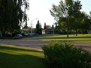
Meadowlark Park, Edmonton
| Meadowlark Park | |
|---|---|
| Neighbourhood | |
 Meadowlark Park Location of Meadowlark Park in Edmonton | |
| Coordinates: 53°31′30″N 113°35′56″W / 53.525°N 113.599°W | |
| Country |
|
| Province |
|
| City | Edmonton |
| Quadrant[1] | NW |
| Ward[1] | 1 |
| Sector[2] | Mature area |
| Area[3][4] | Jasper Place |
| Government[5] | |
| • Administrative body | Edmonton City Council |
| • Councillor | Linda Sloan |
| Area[6] | |
| • Total | 1.11 km2 (0.43 sq mi) |
| Elevation | 675 m (2,215 ft) |
| Population (2012)[7] | |
| • Total | 2,608 |
| • Density | 2,349.5/km2 (6,085/sq mi) |
| • Change (2009–12) |
|
| • Dwellings | 1,211 |
Meadowlark Park is a residential neighbourhood in west Edmonton, Alberta, Canada. Bounded by 95 Avenue to the north, 156 Street to the east, 87 Avenue to the south, and 163 Street to the west, the neighbourhood was originally part of the Town of Jasper Place. It became part of Edmonton in 1964 when Jasper Place amalgamated with the city.
Demographics
In the City of Edmonton's 2012 municipal census, Meadowlark Park had a population of 2,608 living in 1,211 dwellings,[7] a -3.1% change from its 2009 population of 2,691.[8] With a land area of 1.11 km2 (0.43 sq mi),[6] it had a population density of 2,349.5 people/km2 in 2012.[6][7]
Residential development

Nine out of ten residences in the neighbourhood are owner occupied, with the most common type of dwelling being single detached houses. There are also a number of walk up apartment buildings in the neighbourhood. Roughly eight out of ten residences were constructed between the end of the Second World War and the 1970s. I
Schools
There is a single school in the neighbourhood, Meadowlark Elementary School, operated by the Edmonton Public School System.
Shopping and services
Meadowlark Health and Shopping Centre is located at the south east corner of the neighbourhood at the intersection of 156 Street and 87 Avenue. The Jasper Place branch of the Edmonton Public Library is located close to the shopping centre as is a fire station. The Edmonton Transit System's Meadowlark Transit Centre is located on the north side of the shopping centre.
West Edmonton Mall is located to the west of the neighbourhood along 87 Avenue.
Surrounding neighbourhoods
Surrounding neigbhborhoods are Lynnwood and Elmwood to the south, Sherwood and Jasper Park to the east, West Jasper Place to the northeast, Glenwood to the north and northwest, and West Meadowlark Park to the west.
 |
Glenwood | Glenwood | West Jasper Place |  |
| West Meadowlark Park | |
Jasper Park, Sherwood | ||
| ||||
| | ||||
| Elmwood | Elmwood, Lynnwood | Lynnwood |
External links
References
- 1 2 "City of Edmonton Wards & Standard Neighbourhoods" (PDF). City of Edmonton. Retrieved February 13, 2013.
- ↑ "Edmonton Developing and Planned Neighbourhoods, 2011" (PDF). City of Edmonton. Retrieved February 13, 2013.
- ↑ "The Way We Grow: Municipal Development Plan Bylaw 15100" (PDF). City of Edmonton. 2010-05-26. Retrieved February 13, 2013.
- ↑ "City of Edmonton Plans in Effect" (PDF). City of Edmonton. November 2011. Retrieved February 13, 2013.
- ↑ "City Councillors". City of Edmonton. Retrieved February 13, 2013.
- 1 2 3 "Neighbourhoods (data plus kml file)". City of Edmonton. Retrieved February 22, 2013.
- 1 2 3 "Municipal Census Results – Edmonton 2012 Census". City of Edmonton. Retrieved February 22, 2013.
- ↑ "2009 Municipal Census Results". City of Edmonton. Retrieved February 22, 2013.