Summerlea, Edmonton
| Summerlea | |
|---|---|
| Neighbourhood | |
|
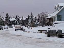
Residential sidestreet in Summerlea | |
|
Summerlea Location of Summerlea in Edmonton | |
| Coordinates: 53°31′30″N 113°37′26″W / 53.525°N 113.624°W | |
| Country |
|
| Province |
|
| City | Edmonton |
| Quadrant[1] | NW |
| Ward[1] | 1 |
| Sector[2] | West |
| Area[3][4] | West Jasper Place |
| Government[5] | |
| • Administrative body | Edmonton City Council |
| • Councillor | Linda Sloan |
| Area[6] | |
| • Total | 1.1 km2 (0.4 sq mi) |
| Elevation | 678 m (2,224 ft) |
| Population (2012)[7] | |
| • Total | 2,058 |
| • Density | 1,870.9/km2 (4,846/sq mi) |
| • Change (2009–12) |
|
| • Dwellings | 1,008 |
Summerlea is a neighbourhood located in west Edmonton, Alberta, Canada. It is bounded by 170 Street to the east, 178 Street to the west, 95 Avenue to the north and 87 Avenue to the south. Summerlea is home to West Edmonton Mall, one of Edmonton's best known tourist destinations. The mall occupies almost the entire southern half of the neighbourhood.
Demographics
In the City of Edmonton's 2012 municipal census, Summerlea had a population of 2,058 living in 1,008 dwellings,[7] a -0.7% change from its 2009 population of 2,072.[8] With a land area of 1.1 km2 (0.42 sq mi),[6] it had a population density of 1,870.9 people/km2 in 2012.[6][7]
Summerlea is an ethnically diverse neighbourhood with no identifiable ethnic group accounting for more than 10% of the population. Almost two out of three respondents in the 2001 federal census indicated affiliation with multiple ethnic groups.[9]
Crime
With the largest mall in North America in the neighbourhood and a booming Alberta economy, Summerlea has some challenges with crime. Between 2000 and 2003, the number of property crimes tripled, before leveling off in 2004 and declining in 2005. "Property crime involves unlawful acts with the intent of gaining property. It includes actual and attempted break and enter, actual and attempted motor vehicle theft, ‘other’ theft (i.e. theft from vehicle, shoplifting, theft of bicycle, and other thefts), possession of stolen property, and fraud."[10]
Surrounding neighbourhoods
Surrounding neighbourhoods are Terra Losa to the north, Glenwood to the north east, West Meadowlark Park to the east, Elmwood to the south east, Thorncliff to the south, Aldergrove to the south west, Belmead to the west, and La Perle to the north west.
 |
La Perle | Terra Losa | Glenwood | |
| Belmead | |
West Meadowlark Park | ||
| ||||
| | ||||
| Aldergrove | Thorncliff | Elmwood |
References
- 1 2 "City of Edmonton Wards & Standard Neighbourhoods" (PDF). City of Edmonton. Retrieved February 13, 2013.
- ↑ "Edmonton Developing and Planned Neighbourhoods, 2011" (PDF). City of Edmonton. Retrieved February 13, 2013.
- ↑ "The Way We Grow: Municipal Development Plan Bylaw 15100" (PDF). City of Edmonton. 2010-05-26. Retrieved February 13, 2013.
- ↑ "City of Edmonton Plans in Effect" (PDF). City of Edmonton. November 2011. Retrieved February 13, 2013.
- ↑ "City Councillors". City of Edmonton. Retrieved February 13, 2013.
- 1 2 3 "Neighbourhoods (data plus kml file)". City of Edmonton. Retrieved February 13, 2013.
- 1 2 3 "Municipal Census Results – Edmonton 2012 Census". City of Edmonton. Retrieved February 22, 2013.
- ↑ "2009 Municipal Census Results". City of Edmonton. Retrieved February 22, 2013.
- ↑ http://censusdocs.edmonton.ca/DD13/FEDERAL%202001/Neighbourhood/SUMMERLEA.pdf
- ↑ http://censusdocs.edmonton.ca/DD33/EDMONTON%20POLICE%20SERVICE%202005/Neighbourhood/SUMMERLEA.pdf