Meringur
| Meringur Victoria | |||||||||||||
|---|---|---|---|---|---|---|---|---|---|---|---|---|---|
|
St John the Evangelist's Lutheran church, built in a style similar to those in South Australia | |||||||||||||
 Meringur | |||||||||||||
| Coordinates | 34°23′S 141°21′E / 34.383°S 141.350°ECoordinates: 34°23′S 141°21′E / 34.383°S 141.350°E | ||||||||||||
| Population | 128 (2011 census)[1] | ||||||||||||
| Postcode(s) | 3496 | ||||||||||||
| Location | |||||||||||||
| LGA(s) | Rural City of Mildura | ||||||||||||
| State electorate(s) | Mildura | ||||||||||||
| Federal Division(s) | Mallee | ||||||||||||
| |||||||||||||
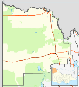
Meringur is a farming settlement to the west of Mildura in northwestern Victoria, Australia. At the 2011 census, Meringur and the surrounding area had a population of 128.[1] It is located in the Millewa region at the end of the Red Cliffs-Meringur Road towards the South Australian border.
The Post Office opened on 2 February 1926.[2] The railway opened in 1925, and the station had facilities to handle passengers, sheep and grain. The line was extended to Morkalla in 1931, but the extension closed in 1965. The entire line was closed by 1988.[3]
The Millewa Pioneer Forest and Historical Village open-air museum is in Meringur.[4]
Meringur had an Australian Rules football team competing in the Millewa Football League, although in recent years the team was based in Mildura, It went into recess in 2011 due to lack of players but has since reformed.
References
- 1 2 Australian Bureau of Statistics (31 October 2012). "Meringur (State Suburb)". 2011 Census QuickStats. Retrieved 4 January 2015.
- ↑ Premier Postal History, Post Office List, retrieved 11 April 2008
- ↑ Andrew Waugh (March 2003). "Redcliffs - Meringur" (PDF). Victorian Signalling Histories No 58, Version 1.0. p. 6. Retrieved 24 June 2014.
- ↑ "The Millewa Pioneer Forest and Historical Society INC.". Retrieved 24 June 2014.
External links
![]() Media related to Meringur at Wikimedia Commons
Media related to Meringur at Wikimedia Commons