Metekel Zone
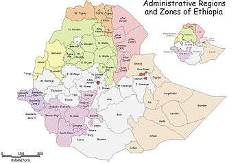
Metekel is one of the three Zones in the Benishangul-Gumuz Region of Ethiopia, named after the former Metekkel province. It is bordered on the south and southwest by Kamashi, on the west by Sudan, and on the north and east by the Amhara Region. The Abay River defines the Zone's boundaries with Kamashi, while the Dinder River defines part of its boundary with the Amhara Region.
The administrative center of Metekel Zone is Gilgil Beles; other towns include Manbuk. The highest point is Mount Belaya (3,131 meters), which is part of the Dangur range.
MIDROC Gold reported in 2009 that it was exploring the Zone for gold deposits.[1]
Demographics
Based on the 2007 Census conducted by the Central Statistical Agency of Ethiopia (CSA), this Zone has a total population of 276,367, of whom 139,119 are men and 137,248 women. 37,615 or 13.61% of population are urban inhabitants. A total of 58,515 households were counted in this Zone, which results in an average of 4.72 persons to a household, and 56,734 housing units. The five largest ethnic groups reported in the Metekel Zone were the Gumuz (36.78%), the Shinasha (21.6%), the Amhara (17.39%), the Awi (11.33%), a subgroup of the Agew, and the Oromo (11.09%); all other ethnic groups made up 1.81% of the population. Main languages are the Gumuz (36.31%), Oromo (19.89%), Amharic (18.21%), Shinasha (12.81%) and Awngi (10.91%). The majority of the inhabitants practiced Ethiopian Orthodox Christianity, with 54.49% of the population reporting that they held that belief, while 20.31% were Muslim, 17.65% observed traditional religions, and 6.36% were Protestant.[2]
Based on figures from the Central Statistical Agency in 2005, this zone has an estimated total population of 225,284, of whom 111,986 were males and 113,299 were females; 24,147 or 10.72% of its population are urban dwellers. With an estimated area of 26,272.38 square kilometers, Metekel has an estimated population density of 8.57 people per square kilometer.[3]
The 1994 national census reported a total population for this Zone of 201,521 in 45,114 households, of whom 101,134 were males and 100,387 were females; 19,607 or 7.82% of its population were urban dwellers. The five largest ethnic groups reported in the Metekel Zone were the Gumuz (33%), the Amhara (24%), the Oromo (13.4%), the Shinasha (16%), and the Awi (7.6%), a subgroup of the Agew. Amhara is spoken as a first language by 24% and as a second language by another 10%. The majority of the inhabitants practiced Ethiopian Orthodox Christianity, with 53.5% of the population reporting that they held that belief, while 21% observed traditional religions, 18.6% were Muslim, and 4.4% were either Protestant or Catholic.[4]
According to a May 24, 2004 World Bank memorandum, 8% of the inhabitants of Metekel have access to electricity, this zone has a road density of 28.4 kilometers per 1000 square kilometers, the average rural household has 1.4 hectare of land (compared to the national average of 1.01 hectare of land and an average of 2.25 for pastoral Regions)[5] and the equivalent of 0.6 heads of livestock. 10% of the population is in non-farm related jobs, compared to the national average of 25% and an average of 28% for pastoral Regions. 93% of all eligible children are enrolled in primary school, and 25% in secondary schools. 68% of the zone is exposed to malaria, and 100% to Tsetse fly. The memorandum gave this zone a drought risk rating of 433.[6]
Notes
- ↑ Minassie Teshome, "Ethiopia: Midroc Signs Up for Second Gold Mine", Addis Fortune 29 November 2009 (accessed 29 April 2010)
- ↑ Census 2007 Tables: Benishangul-Gumuz Region, Tables 2.1, 2.4, 2.5, 3.1, 3.2 and 3.4.
- ↑ CSA 2005 National Statistics, Table B.3
- ↑ 1994 Population and Housing Census of Ethiopia: Results for Benishangul-Gumuz Region, Vol. 1 Tables 2.1, 2.4, 2.7, 2.11, 2.12, 2.14, 2.15, 2.19 (accessed 30 December 2008). The Census takers included the numbers for Pawe special woreda in the totals for the Metekel Zone.
- ↑ Comparative national and regional figures comes from the World Bank publication, Klaus Deininger et al. "Tenure Security and Land Related Investment", WP-2991 (accessed 23 March 2006). This publication defines Benishangul-Gumaz, Afar and Somali as "pastoral Regions".
- ↑ World Bank, Four Ethiopias: A Regional Characterization (accessed 23 March 2006).
Coordinates: 11°00′N 35°45′E / 11.000°N 35.750°E
Woredas of the Benishangul-Gumuz Region | ||
|---|---|---|
| Asosa Zone | ||
| Kamashi Zone | ||
| Metekel Zone | ||
| Special woredas | ||